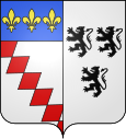
Longué jumelles
| Longué jumelles | ||
|---|---|---|

|
|
|
| region | Pays de la Loire | |
| Department | Maine-et-Loire | |
| Arrondissement | Saumur | |
| Canton | Longué jumelles | |
| Community association | Saumur Val de Loire | |
| Coordinates | 47 ° 23 ′ N , 0 ° 6 ′ W | |
| height | 20-78 m | |
| surface | 96.20 km 2 | |
| Residents | 6,794 (January 1, 2017) | |
| Population density | 71 inhabitants / km 2 | |
| Post Code | 49160 | |
| INSEE code | 49180 | |
| Website | www.villedelonguejumelles.fr | |
Longué-Jumelles is a French municipality with 6794 inhabitants (at January 1, 2017) in the department of Maine-et-Loire in the region of Pays de la Loire .
geography
Longué-Jumelles is a canton capital in the northeast of the Maine-et-Loire department. The Lathan flows through the church. The municipality is part of the Loire-Anjou-Touraine Regional Nature Park .
The next larger city is Saumur , 15 kilometers south.
The much larger district is Longué, Jumelles, four kilometers to the north, has only a few hundred inhabitants.
traffic
Longué-Jumelles is crossed by the E 60 , which runs here on the N 147 national road. There is an exit from the A 85 to the north of the municipality .
Town twinning
- Sinsheim , Germany (Baden-Württemberg), since 1976
See also
literature
- Le Patrimoine des Communes de Maine-et-Loire . Flohic Editions, Volume 2, Paris 2001, ISBN 2-84234-117-1 , pp. 746-760.
Web links
Commons : Longué-Jumelles - Collection of images, videos and audio files
