
Matzerath
| coat of arms | Germany map | |
|---|---|---|

|
Coordinates: 50 ° 9 ' N , 6 ° 23' E |
|
| Basic data | ||
| State : | Rhineland-Palatinate | |
| County : | Eifel district Bitburg-Prüm | |
| Association municipality : | Prüm | |
| Height : | 440 m above sea level NHN | |
| Area : | 4.31 km 2 | |
| Residents: | 51 (Dec. 31, 2019) | |
| Population density : | 12 inhabitants per km 2 | |
| Postal code : | 54597 | |
| Area code : | 06556 | |
| License plate : | BIT, PRÜ | |
| Community key : | 07 2 32 266 | |
| Association administration address: | Tiergartenstrasse 54 54595 Prüm |
|
| Website : | ||
| Local Mayor : | Roland Puetz | |
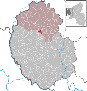
| Location of the local community Matzerath in the Eifelkreis Bitburg-Prüm | ||
  |
||


Matzerath is a municipality in the Eifelkreis Bitburg-Prüm in Rhineland-Palatinate . It belongs to the community of Prüm .
geography
Matzerath is in the West Eifel . The eastern part of the hamlet of Dürsittert also belongs to the municipality.
history
Graves from Celtic times have been found near the place. The present-day community was created during the medieval clearing phase. It belonged to the Pronsfeld condominium . In 1794 the place became French, in 1815 it came to Prussia and was assigned to the Prüm district . In the middle of the 20th century there were still over 100 inhabitants in Matzerath, since then the number of inhabitants has been declining. The municipality Prüm heard Matzerath since 1,971th
- Statistics on population development
The development of the population of Matzerath, the values from 1871 to 1987 are based on censuses:
|
|
Municipal council
The municipal council in Matzerath consists of six council members who were elected by a majority vote in the local elections on May 26, 2019 , and the honorary local mayor as chairman.
Attractions
There is an old oak tree in the village as a natural monument. The village fountain is also worth seeing. Matzerath has a small chapel.
economy
The place is characterized by agriculture. The dairy industry is still dominant today. Today there are still eight full-time farms with around 300 dairy cows (as of 2010).
Web links
- To search for cultural assets of the local community Matzerath in the database of cultural assets in the Trier region .
Individual evidence
- ↑ State Statistical Office of Rhineland-Palatinate - population status 2019, districts, communities, association communities ( help on this ).
- ↑ State Statistical Office Rhineland-Palatinate (ed.): Official directory of the municipalities and parts of the municipality. Status: January 2018 [ Version 2020 is available. ] . S. 65 (PDF; 2.2 MB).
- ↑ a b State Statistical Office Rhineland-Palatinate - regional data
- ^ The Regional Returning Officer Rhineland-Palatinate: Local elections 2019, city and municipal council elections

Auw at Prüm | Lead alf | Brandscheid | Buchet | Büdesheim | Dingdorf | Fire divider | Fleringen | Giesdorf | Gondeboard | Großlangenfeld | Habscheid | Heckhuscheid | Heisdorf | Hersdorf | Kleinlangenfeld | Lasel | Masthorn | Matzerath | Mützenich | Neuendorf | Niederlauch | Nimshuscheid | Nimsreuland | Upper flap oath | Upper garlic | Olzheim | Orlenbach | Pittenbach | Pronsfeld | Prüm | Rommersheim | Roth near Prüm | Schönecken | Schwirzheim | Seiwerath | Celery | Wallersheim | Watzerath | Wawern | Weinsheim | Winringen | Winterscheid | Winterspelt