
Giesdorf
| coat of arms | Germany map | |
|---|---|---|

|
Coordinates: 50 ° 11 ′ N , 6 ° 27 ′ E |
|
| Basic data | ||
| State : | Rhineland-Palatinate | |
| County : | Eifel district Bitburg-Prüm | |
| Association municipality : | Prüm | |
| Height : | 421 m above sea level NHN | |
| Area : | 3.55 km 2 | |
| Residents: | 136 (Dec. 31, 2019) | |
| Population density : | 38 inhabitants per km 2 | |
| Postal code : | 54614 | |
| Primaries : | 06551, 06553 | |
| License plate : | BIT, PRÜ | |
| Community key : | 07 2 32 224 | |
| Association administration address: | Tiergartenstrasse 54 54595 Prüm |
|
| Website : | ||
| Local Mayor : | Hubert Hockertz | |
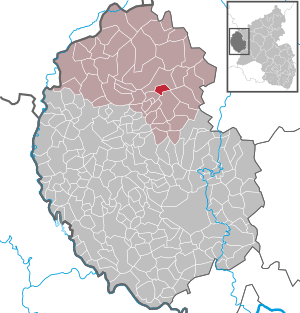
| Location of the local community of Giesdorf in the Eifel district of Bitburg-Prüm | ||
  |
||

Giesdorf is a municipality in the Eifelkreis Bitburg-Prüm in Rhineland-Palatinate . It belongs to the community of Prüm .

geography
The Rattenberg residential area also belongs to Giesdorf .
history
In 1016 the place consisted of a house and a mill and belonged to the Marienstift in Prüm . Wonderfully country belonged to the village by the end of the 18th century to the Electorate of Trier and shelter as part of the dairy Dingdorf the management of the Office Schönecken in Oberamt Prüm. In 1792 it had 32 inhabitants.
- Population development
The development of the population of Giesdorf, the values from 1871 to 1987 are based on censuses:
|
|
Municipal council
The municipal council in Giesdorf consists of six council members, who were elected by a majority vote in the local elections on May 26, 2019 , and the honorary local mayor as chairman.
See also
Web links
- Local community Giesdorf on the website of the Association of Prüm
- To search for cultural assets of the local community Giesdorf in the database of cultural assets in the Trier region .
Individual evidence
- ↑ a b State Statistical Office of Rhineland-Palatinate - population status 2019, districts, municipalities, association communities ( help on this ).
- ↑ State Statistical Office Rhineland-Palatinate (ed.): Official directory of the municipalities and parts of the municipality. Status: January 2018 [ Version 2020 is available. ] . S. 65 (PDF; 2.2 MB).
- ^ Wilhelm Fabricius : Explanations of the historical atlas of the Rhine province, Volume 2: The map of 1789. Bonn 1898, p. 125.
- ↑ ( page no longer available , search in web archives: Statistisches Landesamt Rheinland-Pfalz - regional data )
- ^ The Regional Returning Officer Rhineland-Palatinate: Local elections 2019, city and municipal council elections

Auw at Prüm | Lead alf | Brandscheid | Buchet | Büdesheim | Dingdorf | Fire divider | Fleringen | Giesdorf | Gondeboard | Großlangenfeld | Habscheid | Heckhuscheid | Heisdorf | Hersdorf | Kleinlangenfeld | Lasel | Masthorn | Matzerath | Mützenich | Neuendorf | Niederlauch | Nimshuscheid | Nimsreuland | Upper flap oath | Upper garlic | Olzheim | Orlenbach | Pittenbach | Pronsfeld | Prüm | Rommersheim | Roth near Prüm | Schönecken | Schwirzheim | Seiwerath | Celery | Wallersheim | Watzerath | Wawern | Weinsheim | Winringen | Winterscheid | Winterspelt