
Masthorn
| coat of arms | Germany map | |
|---|---|---|

|
Coordinates: 50 ° 9 ′ N , 6 ° 18 ′ E |
|
| Basic data | ||
| State : | Rhineland-Palatinate | |
| County : | Eifel district Bitburg-Prüm | |
| Association municipality : | Prüm | |
| Height : | 459 m above sea level NHN | |
| Area : | 4.54 km 2 | |
| Residents: | 52 (Dec. 31, 2019) | |
| Population density : | 11 inhabitants per km 2 | |
| Postal code : | 54597 | |
| Area code : | 06556 | |
| License plate : | BIT, PRÜ | |
| Community key : | 07 2 32 265 | |
| Association administration address: | Tiergartenstrasse 54 54595 Prüm |
|
| Website : | ||
| Local Mayor : | Gerhard Lenz | |
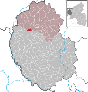
| Location of the local community Masthorn in the Eifelkreis Bitburg-Prüm | ||
  |
||

Masthorn is a municipality in the Eifelkreis Bitburg-Prüm in Rhineland-Palatinate . It belongs to the community of Prüm .
geography
Masthorn is located three kilometers southwest of Pronsfeld and ten kilometers southwest of the city of Prüm on an area sloping east to the Bierbach , a tributary of the Prüm and south to the Waldbierbach . The village covers altitudes between 450 m above sea level. NHN and 480 m above sea level NHN , to the west rises Burgplatz ( 491 m above sea level ). Geographically, the wooded half and in which is Westeifel municipality preferred three parts: the southern portion of the main place can the Arzfelder high surface attribute, the Northeast the Southern Schneifelvorland and a North Western part of the Leiden Hochfläche . On the eastern edge it also includes part of the Bierbachtal nature reserve between Hollnich and Masthorn . The village is crossed by the district road 118 between Kesfeld and Lünebach . Masthorn includes the Masthornermühle (Waldmühle) and Rothenbüsch residential areas .
Masthorn borders (clockwise) on the local communities Habscheid , Pronsfeld , Lünebach, Euscheid and Üttfeld .
population
The development of the population of Masthorn, the values from 1871 to 1987 are based on censuses:
|
|
politics
Municipal council
The council in Masthorn consists of six council members, who in the local elections on May 26, 2019 in a majority vote were elected, and the honorary mayor as chairman.
Attractions
- Chapel from the 16th century with a late Gothic ribbed vault and a wooden columned altar
See also: List of cultural monuments in Masthorn
Web links
- Local community Masthorn on the website of the Association of Prüm
- To search for cultural goods of the local community Masthorn in the database of cultural goods in the Trier region .
Individual evidence
- ↑ State Statistical Office of Rhineland-Palatinate - population status 2019, districts, communities, association communities ( help on this ).
- ^ A b State Statistical Office Rhineland-Palatinate: My village, my city. Retrieved April 28, 2020 .
- ↑ State Statistical Office Rhineland-Palatinate (ed.): Official directory of the municipalities and parts of the municipality. Status: January 2019 [ Version 2020 is available. ] . S. 103 (PDF; 3 MB).
- ^ The Regional Returning Officer Rhineland-Palatinate: Local elections 2019, city and municipal council elections.

Auw at Prüm | Lead alf | Brandscheid | Buchet | Büdesheim | Dingdorf | Fire divider | Fleringen | Giesdorf | Gondeboard | Großlangenfeld | Habscheid | Heckhuscheid | Heisdorf | Hersdorf | Kleinlangenfeld | Lasel | Masthorn | Matzerath | Mützenich | Neuendorf | Niederlauch | Nimshuscheid | Nimsreuland | Upper flap oath | Upper garlic | Olzheim | Orlenbach | Pittenbach | Pronsfeld | Prüm | Rommersheim | Roth near Prüm | Schönecken | Schwirzheim | Seiwerath | Celery | Wallersheim | Watzerath | Wawern | Weinsheim | Winringen | Winterscheid | Winterspelt