
Weinsheim (Eifel)
| coat of arms | Germany map | |
|---|---|---|

|
Coordinates: 50 ° 14 ' N , 6 ° 28' E |
|
| Basic data | ||
| State : | Rhineland-Palatinate | |
| County : | Eifel district Bitburg-Prüm | |
| Association municipality : | Prüm | |
| Height : | 545 m above sea level NHN | |
| Area : | 24.03 km 2 | |
| Residents: | 1002 (Dec. 31, 2019) | |
| Population density : | 42 inhabitants per km 2 | |
| Postal code : | 54595 | |
| Primaries : | 06551, 06558 | |
| License plate : | BIT, PRÜ | |
| Community key : | 07 2 32 226 | |
| Community structure: | 4 districts | |
| Association administration address: | Tiergartenstrasse 54 54595 Prüm |
|
| Website : | ||
| Local Mayor : | Peter Meyer | |
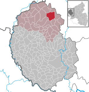
| Location of the local community of Weinsheim in the Eifel district of Bitburg-Prüm | ||
  |
||

Weinsheim is a municipality in the Eifelkreis Bitburg-Prüm in Rhineland-Palatinate . It belongs to the community of Prüm .
geography
Weinsheim is in the West Eifel , on the northwest edge of the Prüm Kalkmulde .
The community is divided into four districts (population as of 2014):
| District | Residents |
|---|---|
| Gondola home | 223 |
| Hermespand | 177 |
| Weinheim | 532 |
| Willwerath | 158 |
The Gondelsheim district also includes the Gondelsheim station, hunting lodge and Schwirzheim-Gondelsheim residential areas , Willwerath station and Hermespand station and Hubertusblick hunting and farmhouse and Brühlborn Weinsheim.
history
To the northeast of Weinsheim, on a hill, there is a ring wall protected by watercourses, 150 by 75 meters in size, which is probably of prehistoric origin.
Weinsheim was first mentioned in a document in 1335 when Hartart von Schönecken gave his court to "Winzheim" to the Elector Baldwin of Trier as a fief. After another notarization of the place in 1343 as "Winsheim", the name "Wyntzem" appeared in 1570.
At that time, Weinsheim belonged to the Electorate of Trier and had been merged with Gondelsheim to form a dairy (estate or administrative area) since the 14th century . In 1720, the ownership structure in Weinsheim was recorded in a so-called stock book.
After the French revolutionary troops marched in in 1794, the region was amalgamated in the Saar Department and after the Congress of Vienna the place belonged to the Prüm district from 1815 .
After the end of the First World War , the village was under American occupation until 1919. At the end of the Second World War , American troops first occupied the severely destroyed place in 1945, then Weinsheim belonged to the French occupation zone and since 1946 to the then newly formed state of Rhineland-Palatinate .
- Incorporation
On January 1, 1971, the previously independent municipalities of Gondelsheim (then 140 inhabitants), Hermespand (114 inhabitants), Weinsheim (295 inhabitants) and Willwerath (92 inhabitants) were merged into a new municipality, whose name was Gondelsheim by drawing lots was determined. On May 1, 1980, the local community was renamed Weinsheim.
- Population development
The development of the population of Weinsheim in relation to today's municipal area; the values from 1871 to 1987 are based on censuses:
|
|
Municipal council
The municipal council in Weinsheim consists of 16 council members, who were elected in a personalized proportional representation in the local elections on May 26, 2019 , and the honorary local mayor as chairman. The 16 seats in the local council are divided between four groups of voters .
economy
Weinsheim is a regionally important industrial location. The prefabricated house manufacturer Streif GmbH produces here in the local industrial area . Other local companies are the Prüm door factory and the magnesium die-casting factory of Andreas Stihl AG as well as a factory of the Westeifel Werke.
Attractions

- The Catholic parish church of St. Willibrord was first mentioned around 1330. After the tower was renovated in 1703, the nave was also rebuilt in 1706. The furnishings date from the time it was built, including a stone relief of the Last Supper.
- The former pilgrimage church of St. Fides in the Gondelsheim district has largely been preserved in its 16th century construction. The reticulated vault of the late Gothic monument had to be restored after being destroyed in the war, which was done in a simplified form.
- The Ehrenfriedhof in Gondelsheim is the final resting place for around 450 fallen soldiers of the Second World War.
_07.jpg)
See also: List of cultural monuments in Weinsheim
Web links
- Local community Weinsheim on the website of the community association Prüm
- To search for cultural assets of the local community Weinsheim in the database of cultural assets in the Trier region .
- Information on Weinsheim from the Trier Region Initiative
Individual evidence
- ↑ State Statistical Office of Rhineland-Palatinate - population status 2019, districts, communities, association communities ( help on this ).
- ^ Local community Weinsheim - population data. Verbandsgemeinde Prüm, archived from the original on April 5, 2017 ; accessed on July 1, 2019 (as of June 1, 2014).
- ↑ State Statistical Office Rhineland-Palatinate (ed.): Official directory of the municipalities and parts of the municipality. Status: January 2019 [ Version 2020 is available. ] . S. 102 (PDF; 3 MB).
- ↑ Official municipality directory 2006 ( Memento from December 22, 2017 in the Internet Archive ) (= State Statistical Office Rhineland-Palatinate [Hrsg.]: Statistical volumes . Volume 393 ). Bad Ems March 2006, p. 199 (PDF; 2.6 MB). Info: An up-to-date directory ( 2016 ) is available, but in the section "Territorial changes - Territorial administrative reform" it does not give any population figures.
- ↑ Official municipality directory (= State Statistical Office of Rhineland-Palatinate [Hrsg.]: Statistical volumes . Volume 407 ). Bad Ems February 2016, p. 187 (PDF; 2.8 MB).
- ↑ State Statistical Office Rhineland-Palatinate: Regional data.
- ^ The Regional Returning Officer Rhineland-Palatinate: Local elections 2019, city and municipal council elections

Auw at Prüm | Lead alf | Brandscheid | Buchet | Büdesheim | Dingdorf | Fire divider | Fleringen | Giesdorf | Gondeboard | Großlangenfeld | Habscheid | Heckhuscheid | Heisdorf | Hersdorf | Kleinlangenfeld | Lasel | Masthorn | Matzerath | Mützenich | Neuendorf | Niederlauch | Nimshuscheid | Nimsreuland | Upper flap oath | Upper garlic | Olzheim | Orlenbach | Pittenbach | Pronsfeld | Prüm | Rommersheim | Roth near Prüm | Schönecken | Schwirzheim | Seiwerath | Celery | Wallersheim | Watzerath | Wawern | Weinsheim | Winringen | Winterscheid | Winterspelt