
Pronsfeld
| coat of arms | Germany map | |
|---|---|---|

|
Coordinates: 50 ° 10 ′ N , 6 ° 20 ′ E |
|
| Basic data | ||
| State : | Rhineland-Palatinate | |
| County : | Eifel district Bitburg-Prüm | |
| Association municipality : | Prüm | |
| Height : | 380 m above sea level NHN | |
| Area : | 15.37 km 2 | |
| Residents: | 921 (Dec. 31, 2019) | |
| Population density : | 60 inhabitants per km 2 | |
| Postal code : | 54597 | |
| Area code : | 06556 | |
| License plate : | BIT, PRÜ | |
| Community key : | 07 2 32 295 | |
| LOCODE : | DE PXD | |
| Association administration address: | Tiergartenstrasse 54 54595 Prüm |
|
| Website : | ||
| Local Mayor : | Harald Urfels | |
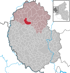
| Location of the local community Pronsfeld in the Eifelkreis Bitburg-Prüm | ||
  |
||


Pronsfeld is a municipality in the Eifelkreis Bitburg-Prüm in Rhineland-Palatinate . It belongs to the community of Prüm .
geography
The place is in the Eifel in the triangle of Germany , Belgium and Luxembourg .
The residential areas Finkendell, In der Lünebach and the western part of Schloßheck also belong to Pronsfeld .
history
The current municipality of Pronsfeld was already settled in Roman times , as finds of bricks and walls from a Roman country villa in the area of the Schlossheck district show.
The place is probably in the Franconian clearing period in the 9th / 10th. Century originated. The place name, called Prumizveld in the Middle Ages , is explained by the location and probably means “field on the Prüm”. The oldest mention of the place name Pronsfeld ( Prumizuelt or Prumizvelt ) can be found in a document from Archbishop Poppo of Trier from the year 1045 or 1046. In this document, Count Cadelo and his wife Irmingard received an earlier transfer of their property to "Prumizuelt" to the Trier Church approved.
From 1794, when French revolutionary troops marched into the Eifel, Pronsfeld also came to the French Republic and was part of the forest department and the canton of Arzfeld for 20 years . In 1798 the lace war led numerous farmers into a hopeless uprising against French rule. After 1815 Pronsfeld came to Prussia .
Located on the Westeifelbahn from 1886 , Pronsfeld became a railway junction after construction in 1907 with the opening of additional routes. The railway connection gave it a considerable boost, but it also suffered considerable damage and losses towards the end of the Second World War .
Pronsfeld condominium
Pronsfeld gave its name to an administrative and judicial district known as "Hof" or " Meierei ", to which a total of 22 localities belonged. It was a condominium that was under the joint sovereignty of the Electorate of Trier and the Duchy of Luxembourg . The Pronsfeld farm included the villages of Dackscheid , Eilscheid , Euscheid , Habscheid , Hargarten , Hollnich , Kinzenburg , Lambertsberg , Lascheid , Lichtenborn , Lierfeld , Lünebach , Masthorn , Matzerath , Merlscheid , Oberüttfeld , Orlenbach , Pittenbach , Pronsfeld, Stalbach , Strickscheid and Watzerath .
Population development
The development of the population of Pronsfeld, the values from 1871 to 1987 are based on censuses:
|
|
politics
Municipal council
The council in Pronsfeld consists of twelve council members, who in the local elections on May 26, 2019 in a majority vote were elected, and the honorary mayor as chairman.
Municipal institutions
- Volunteer firefighter
- primary school
- kindergarten
- sports ground
- RV park
coat of arms
The left half of the coat of arms , the Trier Cross , points to the Electorate of Trier . The right half shows the “Luxembourg Lion”, symbolizing Luxembourg rule.
Culture and sights
Cultural monuments
_(09).jpg)
- The old St. Remigius Church with the choir and remains of the tower from the construction period around 1498 is listed as a historical monument in 1983 .
- The New Parish Church of St. Remigius from 1889 and 1921,
- Numerous preserved crosses , the oldest from 1603, are distributed over the municipality.
- The open-air railway museum is a reminder of the former importance of the station.
- St. Remigius in Pronsfeld

Right side altar

High altar

Sanctuary
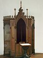
confessional

Figure Joseph and the child

Figure Maria and the child

pulpit

organ


See also: List of cultural monuments in Pronsfeld
Economy and Infrastructure
Companies
- Pronsfeld is the headquarters of MUH Arla , the largest UHT milk producer in Europe.
- The Mais-Glandien dealership sells the Audi and VW brands.
- The forest garden and small appliances GMBH oversees all relevant brands.
There is also a car parts dealer, a tire shop, a master painter & floor layer, a carpenter's workshop and funeral home, a garden center, a printing shop, a law firm, the Raiffeisen bank, a pedagogical learning center, a hairdresser, a bakery and two veterinarians.
Leisure and traffic


The federal road 410 leads through Pronsfeld ; the A 60 and the B 51 can be reached within a short time. Before it was downgraded to a state road in 1993 in favor of the A 60, the B 409 led from Pronsfeld via Habscheid to the Belgian border at Winterspelt .
In 1886 Pronsfeld was connected to the Westeifelbahn and in 1907 it became a junction with the opening of the branch lines to Waxweiler and Neuerburg . In the years 1967 to 1969, the lines leading from Pronsfeld were closed for passenger traffic, and in 1972 the section between Prüm and Pronsfeld followed. 1987 to 1989 this affected the entire traffic from Pronsfeld and 2001 the entire Westeifelbahn. In the following years the track systems were dismantled. Today an open-air railway museum reminds of the earlier importance of Pronsfeld as a hub station.
The four railway lines starting from Pronsfeld were upgraded to paved bike paths . The area around Pronsfeld offers numerous hiking opportunities, including the Bieber area in the Alfbachtal.
Pronsfeld has several playgrounds and a shelter and barbecue hut.
The neighboring Eifel Zoo is west of the Bierbach Valley Viaduct.
Web links
- Internet presence of the local community Pronsfeld
- Local community Pronsfeld on the website of the Association of Prüm
- To search for cultural goods of the local community Pronsfeld in the database of cultural goods in the Trier region .
Individual evidence
- ↑ a b State Statistical Office of Rhineland-Palatinate - population status 2019, districts, municipalities, association communities ( help on this ).
- ↑ State Statistical Office Rhineland-Palatinate (ed.): Official directory of the municipalities and parts of the municipality. Status: January 2018 [ Version 2020 is available. ] . S. 65 f . (PDF; 2.2 MB).
- ^ Heinrich Beyer : Mittelrheinisches Urkundenbuch , Volume I, Coblenz: Hölscher, 1860, p. 378, document 324 ( dilibri.de )
- ^ Johann Friedrich Schannat , Georg Bärsch : Eiflia illustrata or geographical and historical description of the Eifel , Volume 3, Issue 2, Part 1, Mayer, 1854, p. 318 ( Google Books )
- ^ Wilhelm Fabricius : Explanations of the historical atlas of the Rhine province, Volume 2: The map of 1789. Bonn, Hermann Behrend, 1898, p. 586
- ↑ State Statistical Office Rhineland-Palatinate - regional data
- ^ The Regional Returning Officer Rhineland-Palatinate: Local elections 2019, city and municipal council elections

Auw at Prüm | Lead alf | Brandscheid | Buchet | Büdesheim | Dingdorf | Fire divider | Fleringen | Giesdorf | Gondeboard | Großlangenfeld | Habscheid | Heckhuscheid | Heisdorf | Hersdorf | Kleinlangenfeld | Lasel | Masthorn | Matzerath | Mützenich | Neuendorf | Niederlauch | Nimshuscheid | Nimsreuland | Upper flap oath | Upper garlic | Olzheim | Orlenbach | Pittenbach | Pronsfeld | Prüm | Rommersheim | Roth near Prüm | Schönecken | Schwirzheim | Seiwerath | Celery | Wallersheim | Watzerath | Wawern | Weinsheim | Winringen | Winterscheid | Winterspelt