
Dackscheid
| coat of arms | Germany map | |
|---|---|---|

|
Coordinates: 50 ° 7 ' N , 6 ° 23' E |
|
| Basic data | ||
| State : | Rhineland-Palatinate | |
| County : | Eifel district Bitburg-Prüm | |
| Association municipality : | Arzfeld | |
| Height : | 503 m above sea level NHN | |
| Area : | 5.09 km 2 | |
| Residents: | 106 (Dec. 31, 2019) | |
| Population density : | 21 inhabitants per km 2 | |
| Postal code : | 54649 | |
| Area code : | 06554 | |
| License plate : | BIT, PRÜ | |
| Community key : | 07 2 32 211 | |
| Association administration address: | Luxemburger Strasse 6 54687 Arzfeld |
|
| Website : | ||
| Local Mayor : | Matthias Knauf | |
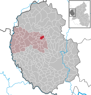
| Location of the local community Dackscheid in the Eifelkreis Bitburg-Prüm | ||
  |
||

Dackscheid is a municipality in the Eifelkreis Bitburg-Prüm in Rhineland-Palatinate . It belongs to the community of Arzfeld .
geography
Dackscheid is located between Lünebach in the north-west and Waxweiler in the south-west, a few kilometers east of the B 410 . The Coumontshof residential area also belongs to the community . Around 60% of the community is agricultural land and around 30% is forest.
history
Grave and coin finds indicate a Roman settlement east of today's location in the 2nd and 3rd centuries. The name ending "-scheid" is typical for a town founded in the clearing phase of the 12th / 13th. Century.
Until the end of the 18th century, the place belonged to the Pronsfeld condominium , which was under the joint sovereignty of the Electorate of Trier and the Duchy of Luxembourg . After the region was annexed by French revolutionary troops , Dackscheid was assigned to the canton of Arzfeld in the department of forests in 1795. Due to the resolutions at the Congress of Vienna , the area and thus also Dackscheid were assigned to the Kingdom of Prussia in 1815. Under the Prussian administration, the municipality of Dackscheid came to the newly established district of Prüm in the administrative district of Trier in 1816 . It belonged to the mayor's office of Lünebach and later to the Waxweiler office .
Population development
The development of the population of Dackscheid, the values from 1871 to 1987 are based on censuses:
|
|
politics
Municipal council
The municipal council in Dackscheid consists of six council members, who were elected by a majority vote in the local elections on May 26, 2019 , and the honorary local mayor as chairman.
coat of arms
In red, silver bell, pine cones and single, rising foal (2: 1).
See also
Web links
- Internet presence of the local community Dackscheid
- Local community Dackscheid on the webpage of the association community Arzfeld
- To search for cultural assets of the local community Dackscheid in the database of cultural assets in the Trier region .
- Short portrait with a film about Dackscheid on SWR television
Individual evidence
- ↑ a b State Statistical Office of Rhineland-Palatinate - population status 2019, districts, municipalities, association communities ( help on this ).
- ↑ State Statistical Office Rhineland-Palatinate (ed.): Official directory of the municipalities and parts of the municipality. Status: January 2018 [ Version 2020 is available. ] . S. 60 (PDF; 2.2 MB).
- ↑ a b State Statistical Office Rhineland-Palatinate - regional data
- ^ Wilhelm Fabricius : Explanations of the historical atlas of the Rhine province, Volume 2: The map of 1789. Bonn, Hermann Behrend, 1898, p. 586.
- ^ Georg Bärsch : Description of the government district of Trier , Volume 2, Trier, Lintz, 1846, p. 68 ( Google Books )
- ↑ District administration of the Eifelkreis Bitburg-Prüm: Administrative affiliation of the individual communities ( online PDF )
- ^ The Regional Returning Officer Rhineland-Palatinate: Local elections 2019, city and municipal council elections
Arzfeld | Dackscheid | Dahnen | Daleiden | Dasburg | Eilscheid | Eschfeld | Euscheid | Großkampenberg | Hargarten | Harpelt | Herzfeld | Irrhausen | Itching | Kesfeld | Kickeshausen | Kinzenburg | Krautscheid | Lambertsberg | Lash oath | Lauperath | Leidenborn | Lichtenborn | Lierfeld | Lünebach | Lützkampen | Manderscheid | Mauel | Merlscheid | Niederpierscheid | Oberpierscheid | Olmscheid | Pintesfeld | Plütscheid | Price oath | Reiff | Reipeldingen | Roscheid | Sengerich | Sevenig (Our) | Strickscheid | Üttfeld | Waxweiler