
Niederpierscheid
| coat of arms | Germany map | |
|---|---|---|

|
Coordinates: 50 ° 5 ' N , 6 ° 22' E |
|
| Basic data | ||
| State : | Rhineland-Palatinate | |
| County : | Eifel district Bitburg-Prüm | |
| Association municipality : | Arzfeld | |
| Height : | 369 m above sea level NHN | |
| Area : | 1.64 km 2 | |
| Residents: | 37 (Dec. 31, 2019) | |
| Population density : | 23 inhabitants per km 2 | |
| Postal code : | 54649 | |
| Area code : | 06554 | |
| License plate : | BIT, PRÜ | |
| Community key : | 07 2 32 277 | |
| Association administration address: | Luxemburger Strasse 6 54687 Arzfeld |
|
| Website : | ||
| Local Mayor : | Matthias Schares | |
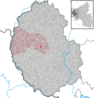
| Location of the local community Niederpierscheid in the Eifelkreis Bitburg-Prüm | ||
  |
||

Niederpierscheid is a municipality in the Eifelkreis Bitburg-Prüm in Rhineland-Palatinate . It belongs to the community of Arzfeld .
geography
Niederpierscheid is located south of Waxweiler on the Prüm . The residential areas Hof Arelt and Niederpierscheidermühle also belong to Niederpierscheid.
history
Niederpierscheid was created during the medieval clearing phase. The place is first mentioned in 1505 as Nyderpirscheid . It belonged to the Luxembourg rule of Neuerburg and in Prussian times first to the mayor's office Ringhuscheid , later to the mayor's office of Waxweiler .
Statistics on population development
The development of the population of Niederpierscheid, the values from 1871 to 1987 are based on censuses:
|
|
Municipal council
The municipal council in Niederpierscheid consists of six council members, who were elected by a majority vote in the local elections on May 26, 2019 , and the honorary local mayor as chairman.
Culture and sights
Buildings
- Skylight portal with lozenge doubled door wing from 1774, Dorfstraße 7
See also: List of cultural monuments in Niederpierscheid
Green spaces and recreation
- Hiking routes in and around Niederpierscheid
Regular events
- Annual fair or parish fair
- Hut burning on the first weekend after Ash Wednesday (so-called Scheef Sunday)
Economy and Infrastructure
The community is still predominantly agricultural today. Niederpierscheid is accessed via the K 123 district road.
Web links
- Internet presence of the local community Niederpierscheid
- Local municipality Niederpierscheid on the website of the association municipality Arzfeld
- To search for cultural assets of the Niederpierscheid local community in the database of cultural assets in the Trier region .
Individual evidence
- ↑ State Statistical Office of Rhineland-Palatinate - population status 2019, districts, communities, association communities ( help on this ).
- ↑ State Statistical Office Rhineland-Palatinate (ed.): Official directory of the municipalities and parts of the municipality. Status: January 1, 2017 [ Version 2020 is available. ] . S. 61 (PDF; 1.9 MB).
- ↑ State Statistical Office Rhineland-Palatinate - regional data
- ^ The Regional Returning Officer Rhineland-Palatinate: Local elections 2019, city and municipal council elections
- ↑ Hiking route Panoramaweg. Retrieved February 5, 2018 .
- ↑ NaturWanderPark delux: Devon path. Retrieved February 5, 2018 .
- ↑ Hüttenbrennen in the Eifel. Retrieved May 1, 2016 .
- ↑ Hut Sunday in the Eifel. Retrieved August 10, 2017 .
Arzfeld | Dackscheid | Dahnen | Daleiden | Dasburg | Eilscheid | Eschfeld | Euscheid | Großkampenberg | Hargarten | Harpelt | Herzfeld | Irrhausen | Itching | Kesfeld | Kickeshausen | Kinzenburg | Krautscheid | Lambertsberg | Lash oath | Lauperath | Leidenborn | Lichtenborn | Lierfeld | Lünebach | Lützkampen | Manderscheid | Mauel | Merlscheid | Niederpierscheid | Oberpierscheid | Olmscheid | Pintesfeld | Plütscheid | Price oath | Reiff | Reipeldingen | Roscheid | Sengerich | Sevenig (Our) | Strickscheid | Üttfeld | Waxweiler