
Reipeldingen
| coat of arms | Germany map | |
|---|---|---|

|
Coordinates: 50 ° 5 ' N , 6 ° 11' E |
|
| Basic data | ||
| State : | Rhineland-Palatinate | |
| County : | Eifel district Bitburg-Prüm | |
| Association municipality : | Arzfeld | |
| Height : | 490 m above sea level NHN | |
| Area : | 4.76 km 2 | |
| Residents: | 74 (Dec. 31, 2019) | |
| Population density : | 16 inhabitants per km 2 | |
| Postal code : | 54689 | |
| Area code : | 06550 | |
| License plate : | BIT, PRÜ | |
| Community key : | 07 2 32 298 | |
| Association administration address: | Luxemburger Strasse 6 54687 Arzfeld |
|
| Website : | ||
| Local Mayor : | not occupied / welfare officer: Andreas Kruppert | |
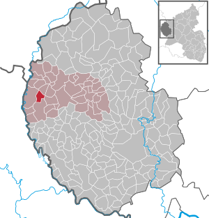
| Location of the local community Reipeldingen in the Eifelkreis Bitburg-Prüm | ||
  |
||

.jpg)
Reipeldingen is a municipality in the western Eifel district of Bitburg-Prüm in Rhineland-Palatinate . It belongs to the community of Arzfeld .
geography
Geographical location
The place is located in the South Eifel nature park in a valley north of Daleiden , 5 km east of the state border between Germany and the Grand Duchy of Luxembourg .
Reipeldingen also includes the Auf den Kaulen and Haustrich residential areas .
56.6% of the municipal area is used for agriculture, 39.2% consists of forest (as of 2011).
Neighboring communities
Reipeldingen borders Eschfeld in the north, Irrhausen in the east, Daleiden in the south and Dahnen in the west .
history
The place was first mentioned in a document in 1326. In 1624 "Ripendingen" had six houses.
The village recovered comparatively well from the time of the plague , after which only six Vogt estates were still inhabited.
Population development
The development of the population of Reipeldingen, the values from 1871 to 1987 are based on censuses:
|
|
Municipal council
The council in Reipeldingen consists of six council members, who in the local elections on May 26, 2019 in a majority vote were elected, and the honorary mayor as chairman.
religion
96% of the residents of Reipeldingen are Catholics. They belong to the parish of St. Matthew , based in Daleiden , which in turn belongs to the parish community of Arzfeld in the deanery of St. Willibrord Westeifel in the diocese of Trier .
In Reipeldingen the parish has a branch church of St. Maria , in which, however, there are no regular services.
Culture and sights
The church, built in the 19th century and first mentioned in a document in 1832, is a baroque hall with a gable roof. The altar erected in it from 1611 comes from the church in Waxweiler . The church is a listed building.
See also: List of cultural monuments in Reipeldingen
Economy and Infrastructure
Today Reipeldingen is an agricultural community . Since 1971, when 19 farms were still counted, the agricultural area increased from 234 hectares to 285 hectares (2010), which were managed by only three farms.
The Luxembourg national road 7 runs about 10 km west of the municipality .
literature
- Ernst Wackenroder (edit.): The art monuments of the Prüm district (= Paul Clemen [Hrsg.]: The art monuments of the Rhine province . Volume 12 / II ). Trier 1983, ISBN 3-88915-006-3 , p. 55, 57 (222 p., With 12 plates and 227 illus. In the text. Reprinted by the Schwann edition, Düsseldorf 1927).
Web links
- Reipeldingen parish
- Reipeldingen local community on the webpage of the Arzfeld community community
- To search for cultural assets of the Reipeldingen community in the database of cultural assets in the Trier region .
Individual evidence
- ↑ State Statistical Office of Rhineland-Palatinate - population status 2019, districts, communities, association communities ( help on this ).
- ↑ State Statistical Office Rhineland-Palatinate (ed.): Official directory of the municipalities and parts of the municipality. Status: January 2018 [ Version 2020 is available. ] . S. 61 (PDF; 2.2 MB).
- ^ A b c State Statistical Office Rhineland-Palatinate - regional data
- ^ Johann Friedrich Schannat : Eiflia illustrata or geographical and historical description of the Eifel . tape 4 , 1854, p. 227 ( limited preview in Google Book search).
- ^ The Regional Returning Officer Rhineland-Palatinate: Local elections 2019, city and municipal council elections
- ↑ census database
- ↑ Entry on Immaculate Conception in the database of cultural assets in the Trier region ; accessed on September 30, 2015.
- ^ Hans-Hermann Reck, Andrea Rumpf (arrangement): Bitburg-Prüm district. Verbandsgemeinden Arzfeld, Neuerburg and Prüm (= cultural monuments in Rhineland-Palatinate. Monument topography Federal Republic of Germany . Volume 9.3 ). Wernersche Verlagsgesellschaft, Worms 2000, ISBN 3-88462-170-X .
- ^ General Directorate for Cultural Heritage Rhineland-Palatinate (ed.): Informational directory of cultural monuments - Eifelkreis Bitburg-Prüm. Mainz 2018, p. 103 (PDF; 4.4 MB).
Arzfeld | Dackscheid | Dahnen | Daleiden | Dasburg | Eilscheid | Eschfeld | Euscheid | Großkampenberg | Hargarten | Harpelt | Herzfeld | Irrhausen | Itching | Kesfeld | Kickeshausen | Kinzenburg | Krautscheid | Lambertsberg | Lash oath | Lauperath | Leidenborn | Lichtenborn | Lierfeld | Lünebach | Lützkampen | Manderscheid | Mauel | Merlscheid | Niederpierscheid | Oberpierscheid | Olmscheid | Pintesfeld | Plütscheid | Price oath | Reiff | Reipeldingen | Roscheid | Sengerich | Sevenig (Our) | Strickscheid | Üttfeld | Waxweiler