
Plutscheid
| coat of arms | Germany map | |
|---|---|---|

|
Coordinates: 50 ° 5 ' N , 6 ° 26' E |
|
| Basic data | ||
| State : | Rhineland-Palatinate | |
| County : | Eifel district Bitburg-Prüm | |
| Association municipality : | Arzfeld | |
| Height : | 456 m above sea level NHN | |
| Area : | 12.68 km 2 | |
| Residents: | 303 (Dec. 31, 2019) | |
| Population density : | 24 inhabitants per km 2 | |
| Postal code : | 54597 | |
| Area code : | 06554 | |
| License plate : | BIT, PRÜ | |
| Community key : | 07 2 32 293 | |
| Association administration address: | Luxemburger Strasse 6 54687 Arzfeld |
|
| Website : | ||
| Local Mayor : | Johann Heltemes | |
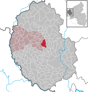
| Location of the local community Plütscheid in the Eifel district Bitburg-Prüm | ||
  |
||

;_Panoramablick_Pl%C3%BCtscheid_a.jpg)

Plütscheid is a municipality in the Eifelkreis Bitburg-Prüm in Rhineland-Palatinate . It belongs to the community of Arzfeld .
geography
Plütscheid is located in the western Eifel , only a few kilometers east of the state border with Luxembourg . 38.6% of the municipal area is used for agriculture, with 50.3% the largest part is forest (as of 2011). The Ehlenzbach flows through Plütscheid .
Part of the hamlet of Gesotz and the residential areas Atzseifen, Geweberhof, Hasenknopp and Mauelermühle also belong to the community.
Neighboring communities are Hargarten in the north, Feuerscheid in the east, Oberweiler in the south and Lambertsberg and Mauel in the west.
history
Celtic ramparts on the Plütscheid district indicate a very early settlement. The name "Plütscheid" is derived from the word Plotiacum , which also refers to a first settlement in the Celtic-Roman period. On the "Hardberg" finds were uncovered that confirm Roman settlement activity.
The first documentary mention as "Pluzei" took place in 1220 in the Maximiner Urbar . Until the end of the 18th century the village belonged to the Electoral Trier office of Schönecken . Plütscheid was the main town of a dairy , which also included the towns of Greimelscheid and Staudenhof and the Maueler Mühle.
In 1794 French revolutionary troops occupied the left bank of the Rhine . Under French administration , from 1798 Plütscheid was assigned to the canton and arrondissement of Prüm in the Saardepartement . During the Prussian period, the town was administered by the mayor of Dingdorf from 1816 .
Statistics on population development
The development of the population of Plütscheid, the values from 1871 to 1987 are based on censuses:
|
|
politics
Municipal council
The municipal council in Plütscheid consists of eight council members, who were elected by a majority vote in the local elections on May 26, 2019 , and the honorary local mayor as chairman.
coat of arms
|
|
Blazon : "In silver (white) over a red Antonius cross, a two-leaved green oak branch with five stemmed acorns."
The coat of arms designed by Christian Credner in collaboration with the citizens of Plütscheider was approved on November 21, 2007 by the local authority of the Eifelkreis Bitburg-Prüm. |
| Justification of the coat of arms: The colors red and silver indicate the former rule of Schönecken and the Electorate of Trier , to which Plütscheid belonged earlier; the Antonius Cross is a reference to the local patron Antonius the Hermit ; The acorns symbolize the five districts of Plütscheid, Atzseifen, Gesotz, Geweberhof and Mauler Mühle; the oak branch indicates the abundance of forests in the community. |
Economy and Infrastructure
;_Solarpark_Pl%C3%BCtscheid_a.jpg)
Plütscheid is an agricultural community . Since 1971, when 53 farms were still counted, the agricultural area has decreased from 405 ha to 307 ha (2010), which were cultivated by eleven farms.
Plütscheid has a restaurant with a guesthouse in the middle of the village, which is run as a family business.
The municipality is located to the west of the Waxweiler / Schönecken junction of federal motorway 60 . The village itself is crossed by the state road 33 in an east-west direction, which connects it with Waxweiler , among other places .
The establishment of an “inter-communal industrial area Plütscheid / Feuerscheid” was planned, which lies on both sides of the associations of Arzfeld and Prüm ( ⊙ ). In 2015, a ten megawatt solar park was built in the Plütscheid-Feuerscheid industrial park in Rhineland-Palatinate. The solar park is the first joint project between WIRSOL and the non-profit Bürgerservice GmbH Trier
In 1998 a wind turbine of the type Enercon E-66 / 15.66 was installed in the Krummenacker corridor ( ⊙ ). In 1999 the Krummenacker wind farm was enlarged by two more Enercon E-40 / 5.40 wind turbines. The total output of the systems is 2.5 megawatts.
See also: List of wind turbines in Rhineland-Palatinate
Culture and sights
;_kath._Filialkirche_St._Antonius_a.jpg)
- Catholic parish church of St. Anthony the Hermit from 1929
- Annual fair or parish fair is celebrated on the weekend after September 17th.
- Burning castles on the first Sunday of Lent (so-called Scheef Sunday)
- A few - partly old - crossroads are distributed over the municipality .
- Baroque house from 1758 in Hauptstrasse 8
- Hiking routes in and around Plütscheid
See also: List of cultural monuments in Plütscheid
See also: List of natural monuments in Plütscheid
Web links
- Website of the local community Plütscheid
- To search for cultural assets of the local community Plütscheid in the database of cultural assets in the Trier region .
- SWR TV report from Plütscheid
Individual evidence
- ↑ State Statistical Office of Rhineland-Palatinate - population status 2019, districts, communities, association communities ( help on this ).
- ^ A b c State Statistical Office Rhineland-Palatinate - regional data
- ↑ State Statistical Office Rhineland-Palatinate (ed.): Official directory of the municipalities and parts of the municipality. Status: January 2018 [ Version 2020 is available. ] . S. 61 (PDF; 2.2 MB).
- ^ Johann Friedrich Schannat , Georg Bärsch : Eiflia illustrata , Volume 3, Edition 2, Part 1, Verlag Mayer, 1854, p. 243 ( Google Books )
- ^ The Regional Returning Officer Rhineland-Palatinate: Local elections 2019, city and municipal council elections
- ↑ Description of coat of arms / justification. Plütscheid parish, accessed on September 28, 2015 .
- ↑ Plütscheid-Feuerscheid solar park. Retrieved July 8, 2017 .
- ↑ 10 megawatt solar park Plütscheid-Feuerscheid. Retrieved July 8, 2017 .
- ↑ Plütscheid wind farm. Retrieved July 8, 2017 .
- ↑ Plütscheid wind farm. Retrieved July 8, 2017 .
- ↑ Hüttenbrennen in the Eifel. Retrieved May 1, 2016 .
- ↑ Plütscheid circular hike. Retrieved July 8, 2017 .
- ↑ Hiking to and from Plütscheid. Retrieved July 8, 2017 .
Arzfeld | Dackscheid | Dahnen | Daleiden | Dasburg | Eilscheid | Eschfeld | Euscheid | Großkampenberg | Hargarten | Harpelt | Herzfeld | Irrhausen | Itching | Kesfeld | Kickeshausen | Kinzenburg | Krautscheid | Lambertsberg | Lash oath | Lauperath | Leidenborn | Lichtenborn | Lierfeld | Lünebach | Lützkampen | Manderscheid | Mauel | Merlscheid | Niederpierscheid | Oberpierscheid | Olmscheid | Pintesfeld | Plütscheid | Price oath | Reiff | Reipeldingen | Roscheid | Sengerich | Sevenig (Our) | Strickscheid | Üttfeld | Waxweiler