
Daleids
| coat of arms | Germany map | |
|---|---|---|

|
Coordinates: 50 ° 4 ′ N , 6 ° 11 ′ E |
|
| Basic data | ||
| State : | Rhineland-Palatinate | |
| County : | Eifel district Bitburg-Prüm | |
| Association municipality : | Arzfeld | |
| Height : | 452 m above sea level NHN | |
| Area : | 15.59 km 2 | |
| Residents: | 859 (Dec. 31, 2019) | |
| Population density : | 55 inhabitants per km 2 | |
| Postal code : | 54689 | |
| Area code : | 06550 | |
| License plate : | BIT, PRÜ | |
| Community key : | 07 2 32 213 | |
| LOCODE : | DE DNL | |
| Association administration address: | Luxemburger Strasse 6 54687 Arzfeld |
|
| Website : | ||
| Local Mayor : | Herbert Maus | |
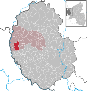
| Location of the local community Daleiden in the Eifelkreis Bitburg-Prüm | ||
  |
||

Daleiden is a municipality in the Eifelkreis Bitburg-Prüm in Rhineland-Palatinate . It belongs to the community of Arzfeld . Daleiden is a state-approved resort and designated as a basic center according to state planning .
geography
Daleiden is located in the Islek in close proximity (6.6 km) to the Luxembourg border. The highest point is on the high Hardt ( 505 m ).
The community also includes the hamlets and residential areas Bermichthof, Bommert, Burtdell, Falkenauel, Feder, Kalenbornerhof, Laarberg, Neuhof, Schwabert, Vor der Höh, Zingent and Zinglersseif.
history
Daleiden was first mentioned in a document in 1222 as belonging to the Prüm Abbey . Several memorial crosses from this time commemorate the outbreak of the plague in 1636 and the loss of life that it caused.
Until 1794 the place belonged to the dairy Eschfeld - Arzfeld in the Dasburg rule , which was part of the Duchy of Luxembourg . After the annexation of the Austrian Netherlands , to which the Duchy of Luxembourg belonged, by French revolutionary troops , the municipality of Daleiden was assigned to the canton of Arzfeld in the department of forests in 1795. Due to the resolutions at the Congress of Vienna in 1815, the former Luxembourg area east of the Sauer and Our rivers was assigned to the Kingdom of Prussia . Under the Prussian administration, Daleiden came to the newly established district of Prüm in the Trier administrative district in 1816 and became the seat of the Daleiden mayor . In 1843 Daleiden consisted of 106 houses with 645 inhabitants. All residents were Catholic.
During the Second World War , the place was evacuated and heavily devastated during fighting.
Population development
The development of the population of Daleiden, the values from 1871 to 1987 are based on censuses:
|
|
politics
Municipal council
The municipal council in Daleiden consists of twelve council members, who were elected in a personalized proportional representation in the local elections on May 26, 2019 , and the honorary local mayor as chairman.
The distribution of seats in the municipal council:
| choice | SPD | CDU | FWL | total |
|---|---|---|---|---|
| 2019 | 1 | 4th | 7th | 12 seats |
| 2014 | - | 5 | 7th | 12 seats |
| 2009 | - | 5 | 7th | 12 seats |
| 2004 | 3 | 5 | 4th | 12 seats |
- FWL = Free Voters List Daleiden e. V.
coat of arms
|
|
Blazon : "In shields divided nine times by silver and blue, topped with a gold-crowned, double-tailed, red lion, a silver shield base with a sloping, red bishop's staff bent downwards, over silver waves."
The coat of arms was given by the mayor of Unkel a. D. Decku designed. The local community of Daleiden was granted permission to use a community coat of arms on October 4, 1967 by the Ministry of the Interior of Rhineland-Palatinate. |
| Justification of the coat of arms: The former sovereignty over Daleiden was the Duchy of Luxembourg, hence its coat of arms up here. The base of the shield shows an attribute of the parish priest, St. Willibrordus (source under a stick). |
Attractions


- Due to the landscape and many hiking trails, Daleiden is very popular with tourists, especially the older generation.
- Nature reserve "Valley of 1000 Butterflies".
- In the ISLEK house , a converted typical Eifel quarter house, historical, geological and geographical information is displayed with the help of a 3D terrain model of the region illuminated by a projector . The house, which has been restored inside, also houses a small library and a small museum. The house is open to visitors and school classes after consultation with the mayor.
- On the outskirts of Daleiden there is the Daleiden cemetery of honor for over 3000 soldiers who died in World War II. It is the largest cemetery of its kind in Rhineland-Palatinate. From there you can see the whole village.
- The parish church with tower from 1331. On the church square: Pest cross (1623) and Trinitarian cross.
- At the old cemetery: tomb of pastor Michael Bormann (1795–1860), author of the first history of the lace war .
- The Willbrordus Chapel (18th century) with a nearby spring is associated with Saint Willibrord because of its alleged healing power against a skin disease called "wild fire"
- The Aloysius Chapel
See also: List of cultural monuments in Daleiden
natural reserve
- On July 24, 1987 the nature reserve "Ginsterheiden im Irsental bei Daleiden" was designated with the number NSG-7232-003.
See also: List of nature reserves in the Eifelkreis Bitburg-Prüm
Born in Daleiden
- Alwin Michael Schronen (* 1965), composer
Web links
- Internet presence of the local community Daleiden
- Local community Daleiden on the webpage of the association community Arzfeld
- To search for cultural assets of the local community Daleiden in the database of cultural assets in the Trier region .
Individual evidence
- ↑ State Statistical Office of Rhineland-Palatinate - population status 2019, districts, communities, association communities ( help on this ).
- ↑ a b State Statistical Office Rhineland-Palatinate - regional data
- ↑ State Statistical Office Rhineland-Palatinate (ed.): Official directory of the municipalities and parts of the municipality. Status: January 2019 [ Version 2020 is available. ] . S. 94 f . (PDF; 3 MB).
- ^ Wilhelm Fabricius : Explanations of the historical atlas of the Rhine province, Volume 2: The map of 1789. Bonn, Hermann Behrend, 1898, p. 36
- ^ Georg Bärsch : Description of the government district of Trier , Volume 2, Trier, Lintz, 1846, p. 63 ( Google Books )
- ^ The Regional Returning Officer Rhineland-Palatinate: Local elections 2019, city and municipal council elections
- ↑ Declaration of the coat of arms. (PDF) Retrieved September 28, 2016 .
- ↑ cf. Bormann, Michael, 1842. Contribution to the history of the Ardennes, Theil 2. F. Lintz, Trier.
- ^ Ordinance on the nature reserve "Ginsterheiden im Irsental bei Daleiden". (PDF) Retrieved March 28, 2019 .
Arzfeld | Dackscheid | Dahnen | Daleiden | Dasburg | Eilscheid | Eschfeld | Euscheid | Großkampenberg | Hargarten | Harpelt | Herzfeld | Irrhausen | Itching | Kesfeld | Kickeshausen | Kinzenburg | Krautscheid | Lambertsberg | Lash oath | Lauperath | Leidenborn | Lichtenborn | Lierfeld | Lünebach | Lützkampen | Manderscheid | Mauel | Merlscheid | Niederpierscheid | Oberpierscheid | Olmscheid | Pintesfeld | Plütscheid | Price oath | Reiff | Reipeldingen | Roscheid | Sengerich | Sevenig (Our) | Strickscheid | Üttfeld | Waxweiler