
Mauel
| coat of arms | Germany map | |
|---|---|---|

|
Coordinates: 50 ° 4 ′ N , 6 ° 24 ′ E |
|
| Basic data | ||
| State : | Rhineland-Palatinate | |
| County : | Eifel district Bitburg-Prüm | |
| Association municipality : | Arzfeld | |
| Height : | 396 m above sea level NHN | |
| Area : | 5.33 km 2 | |
| Residents: | 58 (Dec. 31, 2019) | |
| Population density : | 11 inhabitants per km 2 | |
| Postal code : | 54649 | |
| Area code : | 06554 | |
| License plate : | BIT, PRÜ | |
| Community key : | 07 2 32 267 | |
| Association administration address: | Luxemburger Strasse 6 54687 Arzfeld |
|
| Website : | ||
| Local Mayor : | Walter Fuchs | |
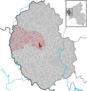
| Location of the local community Mauel in the Eifelkreis Bitburg-Prüm | ||
  |
||

Mauel is a municipality in the Eifelkreis Bitburg-Prüm in Rhineland-Palatinate . It belongs to the community of Arzfeld .
geography

Mauel is located in a valley in the west of the Eifel , only a few kilometers east of the state borders with Luxembourg and Belgium . The place is drained by the Prüm , which runs north of the town center.
The Hubertushof, Staudenhof and Urmauel residential areas also belong to Mauel .
With 37.5%, a comparatively small part of the municipality is used for agriculture, 57.5% are forest (as of 2011).
Neighboring communities are Lambertsberg in the north, Plütscheid in the east, Oberpierscheid in the south and west, Niederpierscheid in the north-west and Waxweiler in the north.
history
The place probably formed in the area of today's primeval wall in the early Middle Ages and has relocated due to the risk of flooding. It was first mentioned in a document in 1345 as "Mauwel".
Before 1794 Mauel belonged to the Krautscheid dairy in the Neuerburg rulership , which was part of the Duchy of Luxembourg . Under French administration (1795 to 1814) he came to the canton of Arzfeld in the Forêts department . Under Prussia , the village first belonged to the Ringhuscheid mayor , and later to the Waxweiler mayor .
On July 1, 1967, the previously independent community of Staudenhof, at that time one of the smallest communities in Germany with six inhabitants, was incorporated.
Statistics on population development
The development of the population of Mauel in relation to today's municipal area; the values from 1871 to 1987 are based on censuses:
|
|
politics
Municipal council
The municipal council in Mauel consists of six council members, who were elected by a majority vote in the local elections on May 26, 2019 , and the honorary local mayor as chairman.
coat of arms
The coat of arms was designed by the heraldist Christian Credner from Lambertsberg.
Regular events
A fair takes place on the Sunday after September 18th.
Economy and Infrastructure
Today Mauel is an agricultural community . Since 1971, when 19 farms were counted, the area used for agriculture has rapidly decreased from 223 hectares to 35 hectares (2007), which were managed by only four farms.
The Waxweiler / Schönecken junction of federal motorway 60 is about 5 km away.
Public facilities
The local community is the location of a volunteer fire brigade with 12 members.
See also
Web links
- Local community Mauel on the website of the Verbandsgemeinde Arzfeld
- To search for cultural goods of the local community Mauel in the database of cultural goods in the Trier region .
Individual evidence
- ↑ State Statistical Office of Rhineland-Palatinate - population status 2019, districts, communities, association communities ( help on this ).
- ↑ State Statistical Office Rhineland-Palatinate (ed.): Official directory of the municipalities and parts of the municipality. Status: January 2019 [ Version 2020 is available. ] . S. 96 (PDF; 3 MB).
- ^ A b c State Statistical Office Rhineland-Palatinate - regional data
- ↑ Official municipality directory 2006 ( Memento from December 22, 2017 in the Internet Archive ) (= State Statistical Office Rhineland-Palatinate [Hrsg.]: Statistical volumes . Volume 393 ). Bad Ems March 2006, p. 186 (PDF; 2.6 MB). Info: An up-to-date directory ( 2016 ) is available, but in the section "Territorial changes - Territorial administrative reform" it does not give any population figures.
- ^ The Regional Returning Officer Rhineland-Palatinate: Local elections 2019, city and municipal council elections
Arzfeld | Dackscheid | Dahnen | Daleiden | Dasburg | Eilscheid | Eschfeld | Euscheid | Großkampenberg | Hargarten | Harpelt | Herzfeld | Irrhausen | Itching | Kesfeld | Kickeshausen | Kinzenburg | Krautscheid | Lambertsberg | Lash oath | Lauperath | Leidenborn | Lichtenborn | Lierfeld | Lünebach | Lützkampen | Manderscheid | Mauel | Merlscheid | Niederpierscheid | Oberpierscheid | Olmscheid | Pintesfeld | Plütscheid | Price oath | Reiff | Reipeldingen | Roscheid | Sengerich | Sevenig (Our) | Strickscheid | Üttfeld | Waxweiler