
Arzfeld
| coat of arms | Germany map | |
|---|---|---|

|
Coordinates: 50 ° 5 ' N , 6 ° 17' E |
|
| Basic data | ||
| State : | Rhineland-Palatinate | |
| County : | Eifel district Bitburg-Prüm | |
| Association municipality : | Arzfeld | |
| Height : | 490 m above sea level NHN | |
| Area : | 19.38 km 2 | |
| Residents: | 1383 (December 31, 2019) | |
| Population density : | 71 inhabitants per km 2 | |
| Postal code : | 54687 | |
| Area code : | 06550 | |
| License plate : | BIT, PRÜ | |
| Community key : | 07 2 32 201 | |
| LOCODE : | DE 3AX | |
| Community structure: | 5 districts | |
| Association administration address: | Luxemburger Strasse 6 54687 Arzfeld |
|
| Website : | ||
| Local Mayor : | Walter Heinisch | |
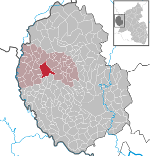
| Location of the local community of Arzfeld in the Eifel district of Bitburg-Prüm | ||
  |
||

Arzfeld is a municipality in the Eifelkreis Bitburg-Prüm in Rhineland-Palatinate . It is the administrative seat of the association of the same name , to which it also belongs. Arzfeld is designated as a basic center according to state planning .
geography
Arzfeld is located on the Islek plateau in the South Eifel nature park .
The community is divided into the districts of Arzfeld, Halenbach , Hickeshausen , Hölzchen and Neurath . The Arzfeld district also includes the residential areas Am Zechenbüsch, Arzfelderhöhe, Arzfeldermühle, Auf der Kehr, Auf der Sonne, Dreis and Prümerbach; Langenfeld belongs to Hölzchen.
history
The place was first mentioned in a document from 1344 as Artsu (v) elt.
The entire current municipal area belonged to the Duchy of Luxembourg until the end of the 18th century . Arzfeld, Halenbach and Hickeshausen belonged to the Dasburg rule , Hölzchen and Neurath to the Neuerburg rule . After the annexation of the Austrian Netherlands , to which the Duchy of Luxembourg belonged, by French revolutionary troops , the five communities were assigned to the canton of Arzfeld in the department of forests in 1795. Due to the resolutions at the Congress of Vienna in 1815, the former Luxembourg area east of the Sauer and Our rivers was assigned to the Kingdom of Prussia . Under the Prussian administration, the places came in 1816 to the newly established district of Prüm in the Trier administrative district . Arzfeld became the seat of a mayor's office , to which Neurath and Irrhausen also belonged. Halenbach belonged to the Lichtenborn mayor , Hickeshausen to the Eschfeld mayor and Hölzchen to the Ringhuscheid mayor .
On July 1, 1971, the previously independent municipality of Hickeshausen (18 inhabitants) was incorporated into Arzfeld, while Halenbach (58 inhabitants), Hölzchen (95) and Neurath (103) were incorporated on June 1, 1972.
Parish of Arzfeld
As a parish, Arzfeld belonged to the deanery of Stablo in the diocese of Liège until 1801 , to the diocese of Metz until 1817 and since then to the diocese of Trier .
;_Luftbildaufnahme_a.jpg)
Arzfeld post office
By 1522 at the latest, there was a post office in Arzfeld on the Dutch postal route from Brussels via Augsburg to Innsbruck , South Tyrol and Italy. This post office was also mentioned in documents in 1537 and often later. It was only in the course of the route shift in the late 17th century, including the cities of Luxembourg and Trier , that it was closed in 1680/81, with the son of the last Arzfeld postman being transferred to Steinfort .
Population development
The development of the population of Arzfeld in relation to today's municipal area; the values from 1871 to 1987 are based on censuses:
;_Bev%C3%B6lkerungsentwicklung_aa.jpg)
|
|
Municipal council
;_Dorfgemeinschaftshaus_%26_Touristeninformation_a.jpg)
The local council in Arzfeld consists of 16 council members, who were elected in the local elections on May 26, 2019 in a personalized proportional representation, and the honorary local mayor as chairman.
The distribution of seats in the municipal council:
| choice | SPD | CDU | FWG | total |
|---|---|---|---|---|
| 2019 | 4th | 8th | 4th | 16 seats |
| 2014 | 4th | 7th | 5 | 16 seats |
| 2009 | 4th | 7th | 5 | 16 seats |
| 2004 | 6th | 10 | 0 | 16 seats |
- FWG = FWG Arzfeld e. V.
coat of arms
|
|
Blazon : “In shields divided nine times by silver and blue, a red can of ointment with
golden cross and golden ornamental bars. " |
| Foundation of the coat of arms: Arzfeld was formerly part of the duchy of Luxembourg, so the Luxembourg colors were up for grabs. The ointment box is an attribute of the parish patroness of Arzfeld, Sankt Maria Magdalena. |
The coat of arms was given by the mayor a. D. Decku from St. Wendel designed. On January 17, 1968, the local community of Arzfeld was granted permission to have its own coat of arms by the Ministry of the Interior of Rhineland-Palatinate.
partnership
;_Dorfplatz_b.jpg)
Arzfeld has a partnership with the Willofs district of the Bavarian municipality of Obergünzburg in the Allgäu . The village square at the church is dedicated to the 20-year friendship between the villages of Arzfeld and Willofs.
Culture and sights
;_katholische_Kirche_St._Maria_Magdalena_1.jpg)

Buildings
- Catholic parish church of St. Maria Magdalena from the 15th or 16th century
- Catholic branch church St. Luzia from the 15th century in the district of Hölzchen
- Stalingrad Chapel on the B 410, built by an Arzfelder on the basis of a promise made during World War II in Russia. The figure of Mary was carved out of the wave tree of a mill.
- Arzfeld railway station from 1907
- Wegekapelle from 1899 in Hauptstrasse
- About the municipality several are roadside crosses distributed
See also: List of cultural monuments in Arzfeld
Green spaces and recreation
- Memorial to the memory of the lace war of 1795
- Hiking routes in and around Arzfeld
- Premium hiking trails in the Südeifel Nature Park
- Two children's playgrounds
- Reservoir
- Railway cycle path
Regular events
- The annual fair or parish fair is celebrated on the weekend after June 22nd (Maria Magdalena)
- Traditional rattling or rattling on Good Friday and Holy Saturday
- Castle burning on the first weekend after Ash Wednesday (so-called Scheef Sunday)
Economy and Infrastructure
Institutions and companies
In Arzfeld there is a DRK rescue station and a road maintenance department, a Caritas welfare station, a kindergarten, a primary school with a gym and an artificial turf sports field. The fire brigade's staff consists of 36 trained and operational firefighters. There is a general practitioner and a pharmacy as well as a senior citizens' residence with assisted living.
Arzfeld has a hardware store, supermarket, butcher and baker, accommodation and refreshment facilities as well as a car dealer with a workshop and an electrical engineering company.
The construction of a photovoltaic open space system in Arzfeld was started in 2010 by the company F&S Solar, the commissioning by the operator ISLEK Energie AöR took place on September 30, 2011. A total of around 420 households can be supplied with the system. The system consists of 6268 modules of the type CSG (Crystalline Silicon on Glass) Solar CSG 235 Wp poly on 538 tables of eleven modules each. It has an annual production of around 1,399,778 kWh (950 kWh / kWp).
See also: List of solar power plants in Germany
traffic
The place is crossed by the federal highway 410 . District road 58 leads south from Arzfeld . Arzfeld and its train station were on the dismantled Pronsfeld – Neuerburg railway line . The former railway line has been expanded to become a railway cycle path and is part of the Enztal cycle path .
literature
- Ernst Wackenroder (edit.): The art monuments of the Prüm district (= Paul Clemen [Hrsg.]: The art monuments of the Rhine province . Volume 12 / II ). Trier 1983, ISBN 3-88915-006-3 , p. 19–22 (222 p., With 9 plates and 185 ills. In the text. Reprinted by the Schwann edition, Düsseldorf 1927).
- Literature about Arzfeld in the catalog of the German National Library
- Literature about Arzfeld in the Rhineland-Palatinate State Bibliography
Web links
- Internet presence of the municipality of Arzfeld
- Local community Arzfeld on the web site of the community community Arzfeld
- To search for cultural assets of the local community Arzfeld in the database of cultural assets in the Trier region .
Individual evidence
- ↑ a b State Statistical Office of Rhineland-Palatinate - population status 2019, districts, municipalities, association communities ( help on this ).
- ↑ a b State Statistical Office Rhineland-Palatinate - regional data
- ↑ State Statistical Office Rhineland-Palatinate (ed.): Official directory of the municipalities and parts of the municipality. Status: January 2018 [ Version 2020 is available. ] . S. 60 (PDF; 2.2 MB).
- ^ Wilhelm Fabricius : Explanations of the historical atlas of the Rhine province, Volume 2: The map of 1789. Bonn, Hermann Behrend, 1898, pp. 36, 37
- ^ Georg Bärsch : Description of the government district of Trier , Volume 2, Trier, Lintz, 1846, pp. 60, 65, 67, 72 ( Google Books )
- ↑ Official municipality directory 2006 ( Memento from December 22, 2017 in the Internet Archive ) (= State Statistical Office Rhineland-Palatinate [Hrsg.]: Statistical volumes . Volume 393 ). Bad Ems March 2006, p. 168 (PDF; 2.6 MB). Info: An up-to-date directory ( 2016 ) is available, but in the section "Territorial changes - Territorial administrative reform" it does not give any population figures.
- ^ Philipp de Lorenzi: Contributions to the history of all parishes of the Diocese of Trier. Episcopal General Vicariate, Trier 1887, p. 622 ( dilibri.de )
- ^ Archives of the Katharinenspital zu Regensburg, estate of the diplomat Johann Maria Warschitz, archive number VI / 2 No.4, folder undated documents, see also the verification, postal rate from 1522 .
- ↑ Hermann-Josef Becker: The post course Brussels - Innsbruck in the Eifel, Moselle and Hunsrück area , in: Postgeschichtliche Blätter Saarbrücken 1962/1, pp. 13-14.
- ^ Ernst-Otto Simon: The postal course from Rheinhausen to Brussels over the centuries , in: Archive for German Postal History 1/1990, p. 28.
- ^ Leon Bodé: The relocation of the Italian-Dutch postal course in the Hunsrück, Eifel and Ardennes area , in: Archive for German Postal History (AfdPg) 1/1994, p. 11 and p. 16.
- ^ The Regional Returning Officer Rhineland-Palatinate: Local elections 2019, city and municipal council elections
- ↑ Coat of arms of the local community of Arzfeld
- ↑ Hiking in Arzfeld. Retrieved June 6, 2018 .
- ↑ Hiking trail no. 15 in the Südeifel nature park. Retrieved June 6, 2018 .
- ↑ Hüttenbrennen in the Eifel. Retrieved May 1, 2016 .
- ↑ Hut Sunday in the Eifel. Retrieved August 10, 2017 .
- ↑ Hut Sunday in the Eifel. Retrieved August 10, 2017 .
- ↑ Description of the place
- ↑ Solar Park Arzfeld, project 11,021th Accessed June 6, 2018 .
Arzfeld | Dackscheid | Dahnen | Daleiden | Dasburg | Eilscheid | Eschfeld | Euscheid | Großkampenberg | Hargarten | Harpelt | Herzfeld | Irrhausen | Itching | Kesfeld | Kickeshausen | Kinzenburg | Krautscheid | Lambertsberg | Lash oath | Lauperath | Leidenborn | Lichtenborn | Lierfeld | Lünebach | Lützkampen | Manderscheid | Mauel | Merlscheid | Niederpierscheid | Oberpierscheid | Olmscheid | Pintesfeld | Plütscheid | Price oath | Reiff | Reipeldingen | Roscheid | Sengerich | Sevenig (Our) | Strickscheid | Üttfeld | Waxweiler