
Herzfeld (Eifel)
| coat of arms | Germany map | |
|---|---|---|

|
Coordinates: 50 ° 8 ' N , 6 ° 13' E |
|
| Basic data | ||
| State : | Rhineland-Palatinate | |
| County : | Eifel district Bitburg-Prüm | |
| Association municipality : | Arzfeld | |
| Height : | 499 m above sea level NHN | |
| Area : | 2.67 km 2 | |
| Residents: | 37 (Dec. 31, 2019) | |
| Population density : | 14 inhabitants per km 2 | |
| Postal code : | 54619 | |
| Area code : | 06559 | |
| License plate : | BIT, PRÜ | |
| Community key : | 07 2 32 240 | |
| Association administration address: | Luxemburger Strasse 6 54687 Arzfeld |
|
| Website : | ||
| Local Mayor : | Klaus Dingels | |
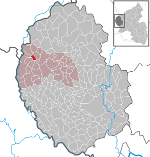
| Location of the local community of Herzfeld in the Eifel district of Bitburg-Prüm | ||
  |
||

Herzfeld is a municipality in the Eifelkreis Bitburg-Prüm in Rhineland-Palatinate . It belongs to the community of Arzfeld .
geography
The local community is located in the western Eifel , immediately south of the community of Leidenborn , around 5 km from the border triangle between Germany, Luxembourg and Belgium . Neighboring communities are Leidenborn in the east, Sengerich in the southeast, Eschfeld in the south, Harspelt in the west and Lützkampen in the northwest. Almost three quarters of the community is used for agriculture, over 20 percent is forest.
history

Until the end of the 18th century, Herzfeld was a hamlet that belonged to the Harspelt dairy and then to the Leidenborn dairy in the Dasburg estate . Around 1800 four households (fireplaces) with 30 inhabitants were counted. The two farms "Locherhof" and "Hof Neuesberg" with a total of 8 residents belonged to Herzfeld.
In connection with the Napoleonic Wars , the region came under French administration in 1794 and from 1798 belonged to the Mairie Leidenborn in the canton of Prüm in the Saar department . Herzfeld became an independent municipality. Ecclesiastically Herzfeld belonged to the parish Großkampen , which belonged to the deanery of Stablo in the diocese of Liège . After the Rhineland came to the Kingdom of Prussia in 1815 on the basis of the treaties of the Congress of Vienna , Herzfeld belonged to the mayor's office of Leidenborn in the newly created district of Prüm in 1816 .
Population development
The development of the population of Herzfeld, the values from 1871 to 1987 are based on censuses:
|
|
politics
The local council in Herzfeld consists of six council members, who were elected by a majority vote in the local elections on May 26, 2019 , and the honorary local mayor as chairman.
Cultural monuments
Worth seeing is a house built around 1830 with a knee-high floor ; the five-axis residential part with adjoining bakery shows late classicist motifs.
Economy and Infrastructure
Today, Herzfeld is an agricultural community. The largest employer in the municipality is a carpenter's shop. Since 1971, when 8 farms were still counted, the utilized agricultural area has increased from 198 ha to 264 ha (2005), which were cultivated by 4 farms.
Web links
- Website of the local parish of Herzfeld
- Local community Herzfeld on the webpage of the Verbandsgemeinde Arzfeld
- To search for cultural assets of the local community Herzfeld (Eifel) in the database of cultural assets in the Trier region .
Individual evidence
- ↑ a b State Statistical Office of Rhineland-Palatinate - population status 2019, districts, municipalities, association communities ( help on this ).
- ^ A b Johann Friedrich Schannat : Eiflia illustrata or geographical and historical description of the Eifel , Volume 4, 1854, p. 267 ( Google Books )
- ^ Friedrich von Restorff : Topographical-Statistical Description of the Royal Prussian Rhine Province , Nicolai, Berlin and Stettin 1830, p. 882 ( Google Books )
- ↑ regional data . State Statistical Office of Rhineland-Palatinate
- ^ The Regional Returning Officer Rhineland-Palatinate: Local elections 2019, city and municipal council elections
- ^ General Directorate for Cultural Heritage Rhineland-Palatinate (ed.): Informational directory of cultural monuments - Eifelkreis Bitburg-Prüm. Mainz 2018, p. 52 (PDF; 4.4 MB).
Arzfeld | Dackscheid | Dahnen | Daleiden | Dasburg | Eilscheid | Eschfeld | Euscheid | Großkampenberg | Hargarten | Harpelt | Herzfeld | Irrhausen | Itching | Kesfeld | Kickeshausen | Kinzenburg | Krautscheid | Lambertsberg | Lash oath | Lauperath | Leidenborn | Lichtenborn | Lierfeld | Lünebach | Lützkampen | Manderscheid | Mauel | Merlscheid | Niederpierscheid | Oberpierscheid | Olmscheid | Pintesfeld | Plütscheid | Price oath | Reiff | Reipeldingen | Roscheid | Sengerich | Sevenig (Our) | Strickscheid | Üttfeld | Waxweiler