
Lambertsberg
| coat of arms | Germany map | |
|---|---|---|

|
Coordinates: 50 ° 5 ' N , 6 ° 23' E |
|
| Basic data | ||
| State : | Rhineland-Palatinate | |
| County : | Eifel district Bitburg-Prüm | |
| Association municipality : | Arzfeld | |
| Height : | 480 m above sea level NHN | |
| Area : | 3.66 km 2 | |
| Residents: | 366 (Dec. 31, 2019) | |
| Population density : | 100 inhabitants per km 2 | |
| Postal code : | 54649 | |
| Area code : | 06554 | |
| License plate : | BIT, PRÜ | |
| Community key : | 07 2 32 254 | |
| Community structure: | 2 districts | |
| Association administration address: | Luxemburger Strasse 6 54687 Arzfeld |
|
| Website : | ||
| Local Mayor : | Jochen Schoden | |
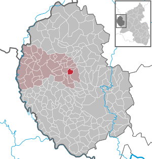
| Location of the local community Lambertsberg in the Eifelkreis Bitburg-Prüm | ||
  |
||


Lambertsberg is a municipality in the Eifelkreis Bitburg-Prüm in Rhineland-Palatinate . It belongs to the community of Arzfeld .
geography
The place is in the southern Eifel , on the edge of the German-Luxembourg nature park . Lambertsberg consists of the districts Lambertsberg and Greimelscheid. The residential area “Im next Busch” also belongs to the hamlet of Lambertsberg .
55% of the municipal area is used for agriculture, 33% consists of forest (as of 2018).
In the northwest, Lambertsberg borders on Hargarten , in the east on Plütscheid , in the south on Mauel and in the west on Waxweiler .
history
Before 1794 Lambertsberg belonged to the Pronsfeld condominium , while Greimelscheid belonged to the Electorate of Trier . The administrative division of the two places remained even after French revolutionary troops took the Left Bank of the Rhine in 1794 . Until 1814, Lambertsberg belonged to Mairie Waxweiler in the forest department , Greimelscheid to Mairie Dingdorf in the Saar department . Also in the Prussian time after 1815: Lambertsberg belonged from 1816 to the mayor Waxweiler , Greimelscheid for mayor Dingdorf , both belonged to the circle of Prüm in Trier .
Lambertsberg and today's district Greimelscheid were united in the parish of Lambertsberg in the diocese of Trier . Greimelscheid was first mentioned in a document in 1288. Lambertsberg emerged from Obergreimelscheid, which was first mentioned in 1408 and was renamed in the 16th century. Lambertsberg and Greimelscheid were only separated by today's Landstrasse, which, however, also formed the state and church boundary line for the various institutions.
The current local community was formed on January 1, 1968 from the previously independent communities Greimelscheid (then 143 inhabitants) and Lambertsberg (206 inhabitants).
Statistics on population development
The development of the population of Lambertsberg in relation to today's municipal area; the values from 1871 to 1987 are based on censuses:
|
|
politics
Municipal council
The local council in Lambertsberg consists of eight council members, who were elected in the local elections on May 26, 2019 in a majority vote, and the honorary local mayor as chairman.
coat of arms
|
|
Blazon : "A silver göpel in red, in front a silver bishop's staff and a silver lance, behind four silver four-pointed stars, each staggered in two at an angle." |
Culture and sights
Buildings


The pilgrimage church of St. Lambertus from the 15th century with an outside pulpit from 1618 and a former market cross from 1623 on the church forecourt are worth seeing .
Events
- Carnival : The Lambertsberg night parade was considered to be one of the largest carnival parades in the southern Eifel and the Bitburg-Prüm district. The parade traditionally took place on Carnival Friday in the evening. Due to lack of space, the move is no longer organized today.
- 1st Sunday in August: antique and flea market at the parish hall.
Economy and Infrastructure
Business
Lambertsberg is today an agricultural community , which has a higher economic power compared to the surrounding communities.
Since 1971, when 30 farms were still counted, the agricultural area has decreased from 260 ha to 180 ha (2010), which were managed by 6 farms.
traffic
The village is crossed by the state road 12 , which connects it with Waxweiler and the Waxweiler / Schönecken junction 3 km to the east of the federal motorway 60 .
Web links
- Website of the local community Lambertsberg
- Lambertsberg on the website of the Arzfeld association
- To search for cultural assets of the local community Lambertsberg in the database of cultural assets in the Trier region .
Individual evidence
- ↑ State Statistical Office of Rhineland-Palatinate - population status 2019, districts, communities, association communities ( help on this ).
- ↑ State Statistical Office Rhineland-Palatinate (ed.): Official directory of the municipalities and parts of the municipality. Status: January 2019 [ Version 2020 is available. ] . S. 95 (PDF; 3 MB).
- ↑ a b c State Statistical Office Rhineland-Palatinate: My village, my city. Retrieved February 28, 2020 .
- ↑ Administrative affiliation of the individual municipalities. (PDF) District administration of the Eifelkreis Bitburg-Prüm, accessed on February 28, 2020 .
- ↑ Official municipality directory 2006 ( Memento from December 22, 2017 in the Internet Archive ) (= State Statistical Office Rhineland-Palatinate [Hrsg.]: Statistical volumes . Volume 393 ). Bad Ems March 2006, p. 184 (PDF; 2.6 MB). Info: An up-to-date directory ( 2016 ) is available, but in the section "Territorial changes - Territorial administrative reform" it does not give any population figures.
- ^ The Regional Returning Officer Rhineland-Palatinate: Local elections 2019, city and municipal council elections.
- ↑ Description of coat of arms / justification. Lambertsberg parish, accessed on September 24, 2015 .
Arzfeld | Dackscheid | Dahnen | Daleiden | Dasburg | Eilscheid | Eschfeld | Euscheid | Großkampenberg | Hargarten | Harpelt | Herzfeld | Irrhausen | Itching | Kesfeld | Kickeshausen | Kinzenburg | Krautscheid | Lambertsberg | Lash oath | Lauperath | Leidenborn | Lichtenborn | Lierfeld | Lünebach | Lützkampen | Manderscheid | Mauel | Merlscheid | Niederpierscheid | Oberpierscheid | Olmscheid | Pintesfeld | Plütscheid | Price oath | Reiff | Reipeldingen | Roscheid | Sengerich | Sevenig (Our) | Strickscheid | Üttfeld | Waxweiler