
Mickten (statistical district)
 with Trachau-Süd, Übigau and Kaditz-Süd Statistical district No. 22 of Dresden |
|
|---|---|
  |
|
| Coordinates | 51 ° 4 '28 " N , 13 ° 41' 55" E |
| height | 105- 110 u m. NN |
| surface | 4.24 km² |
| Residents | 12,786 (Dec. 31, 2017) |
| Population density | 3016 inhabitants / km² |
| Incorporation | 1903 |
| Post Code | 01139 |
| prefix | 0351 |
| Website | www.dresden.de (PDF; 354 kB) |
| Borough | Pieschen |
| Transport links | |
| Highway |
|
| Train | S1 |
| tram | 4, 9, 13 |
| bus | 64, 70, 72, 79, 80 |
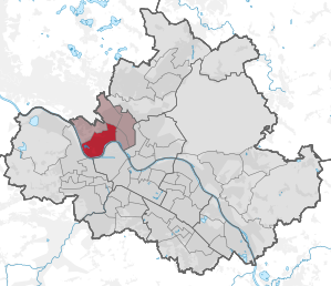
Mickten with Trachau-Süd, Übigau and Kaditz-Süd is a statistical district in the Dresden district of Pieschen . It is located northwest of the city center on the Neustadt side of the Elbe.
location
The statistical district Mickten is surrounded in the north by Kaditz and Trachau , in the east by Pieschen-Nord / Trachenberge and Pieschen-Süd , in the south by Friedrichstadt and Cotta and in the west by Briesnitz .
The boundaries of the district are formed by the Autobahn 4 at the Dresden-Neustadt junction, sections of the Lommatzscher and Leipziger Strasse , the Leipzig-Dresden railway line and the Elbe . Mickten is therefore completely in the Elbe valley .
structure
The statistical district includes the districts Mickten and Übigau as well as the southern parts of the districts Trachau (Alttrachau) and Kaditz . It is divided into the following seven statistical districts :
- 221 Trachau-Süd ( Alttrachau )
- 222 Trachau-Süd (Bunsenstrasse)
- 223 Mickten (Dreyzigerplatz)
- 224 Mickten (Lommatzscher Str.)
- 225 Mickten (Sternstrasse)
- 226 Mickten ( Altmickten )
- 227 Übigau
traffic
The most important streets in the district are Leipziger Strasse ( S 82 ), an entry and exit road used by tram line 4 in the direction of Radebeul ( Meißner Strasse there ), Washingtonstrasse , which is part of the western inner city bypass, and Lommatzscher Strasse, a connection between both. Tram lines 9 and 13 also run in Mickten. Five city buses and other regional bus routes run through the district, which has a total of 12 tram and 22 bus stops. Immediately north of the district boundary is the Trachau S-Bahn station , which is connected to the S1 line.
Web links
Statistical districts: Äußere Neustadt (Antonstadt) | Albertstadt | Bubble joke | Briesnitz | Bühlau / White Deer | Coschütz / Gittersee | Cossebaude / Mobschatz / Oberwartha | Cotta | Airport / industrial area Klotzsche | Friedrichstadt | Gönnsdorf / Pappritz | Gompitz / Old Franconia | Gorbitz-Nord / Neuomsewitz | Gorbitz-East | Gorbitz-Süd | Großzschachwitz | Gruna | Dresden Heath | Hellerau / Wilschdorf | Hellerberge | Hosterwitz / Pillnitz | Inner old town | Inner New Town | Johannstadt-North | Johannstadt-Süd | Kaditz | Kleinpestitz / Mockritz | Kleinzschachwitz | Klotzsche | Langebrück / Schönborn | Leaf guest | Leipzig suburb | Leuben | Leubnitz-Neuostra | Lockwitz | Löbtau-Nord | Löbtau-Süd | Loschwitz / Wachwitz | Mickten | Naußlitz | Niedersedlitz | Pieschen-Nord / Trachenberge | Pieschen-Süd | Pirnaische Vorstadt | Plauen | Prohlis-North | Prohlis-South | Radeberger Vorstadt | Räcknitz / Zschertnitz | Reick | Schönfeld / Schullwitz | Seervorstadt-Ost / Great Garden | Seidnitz / Dobritz | Chasing | Striesen-Ost | Striesen-Süd | Striesen-West | Südvorstadt-Ost | Südvorstadt-West | Tolkewitz / Seidnitz-Nord | Trachau | Weixdorf | Whitish | Wilsdruffer Vorstadt / Seevorstadt-West