Johannstadt
|
Johannstadt -Nord and -Süd district and statistical districts No. 06 and 07 of Dresden |
|
|---|---|
| Coordinates | 51 ° 3 '10 " N , 13 ° 46' 8" E |
| height | 111 m above sea level NN |
| surface | 3.51 km² |
| Residents | 24,037 (Dec. 31, 2013) |
| Population density | 6848 inhabitants / km² |
| Post Code | 01307 |
| prefix | 0351 |
| Website | www.dresden.de |
| Borough | Old town |
| Transport links | |
| tram | 1, 2, 4, 6, 10, 12, 13 |
| bus | 62, 64 |
The Johannstadt is one of the suburbs of Dresden . It is located east of the old town and on the Elbe and belongs to the Altstadt district , where it is part of the Altstadt II district . It is divided into the two statistical districts Johannstadt-Nord and -Süd, which border one another along the Gerokstrasse / Blasewitzer Strasse.
The district is named after King Johann (1801–1873) of Saxony . Historically, Johann city especially from 1877 began to develop when she by the Albert Bridge to the New Town was connected.
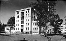
With the foundation of the 1954 Medical Academy Dresden incurred University Hospital Carl Gustav Carus is the largest hospital in Dresden Johannstadt. The St. Joseph-Stift hospital is also located in the south of the district.
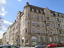
In the district area, prefabricated buildings from the GDR era predominate, most of which were renovated after the fall of the Wall . In the eastern Johannstadt, however, there are many Wilhelminian-style buildings. In the east borders Blasewitz on, southeast is Striesen , south Seevorstadt-Ost / Grosser Garten and west of the Pirnaische suburbs . In the north is the Elbe.
Neighboring districts
| Inner New Town | Radeberger Vorstadt | |
| Pirnaische suburb |

|
Blowjoke |
| Seervorstadt-Ost / large garden | Striesen |
history


General
In the area of today's Johannstadt was the village of Ranvoltitz (German / Slavic: people of Ramfalt ) at the intersection of Striesener Straße and Hans-Grundig-Straße . The settlement, which was probably founded by a German colonist by the name of Ramfalt, was first mentioned in 1310 in a document from Margrave Friedrich von Dresden . In the fortified city , the Rampische Gasse, named after the village, ran to the east, and from 1530 the Rampische Tor existed at its exit as one of the city gates of the Dresden fortifications .
The inhabitants were Elbe fishermen or arable farmers. Part of it lived from the mining of the clay, which can be found in the area of a former Elbar between Dürerstrasse and Holbeinstrasse. There was a brick factory at the site of Sachsenplatz . A gallows was inaugurated on Tatzberg in 1735.
On the initiative of King Friedrich August I , a 4.3 meter wide circular path was laid out between the customs stations of the Dresden Akzisering (toll ring) in 1823. This is the forerunner of the 26th Ring , which runs over Güntzstraße and Sachsenplatz on the western edge of Johannstadt.
After the construction, the area between the ring and the city center was referred to as the Pirnaische Vorstadt , the area outside the ring as the Äußere Pirnaische Vorstadt, from which the Johannstadt later developed. While the Pirnaische Vorstadt was heavily developed from 1813 onwards, building restrictions applied to the areas further to the east in order to prevent excessive development, especially in the area around the Great Garden . The building ban was not lifted until 1874.
The Central Bank for Land Acquisition and Buildings, founded in 1872, bought a large part of the area between Großer Garten and Blasewitzer Strasse in order to later make profits on land sales. Due to the poor development, especially the lack of a paved road, it was not successful. The building association Johannstadt took over the parcels of the insolvent bank in 1878. The inauguration of Grunaer Straße as a connection to the city center in 1880 finally triggered a building boom.
From 1891 to 1893 the Trinity Church was built for the Trinity Congregation with 10,000 members.
The air raids on Dresden in 1945 left the largest contiguous area of rubble in the city in Johannstadt, and many of the historicism and art nouveau houses were destroyed. After the war, only around 4,000 people lived in Johannstadt. At the end of the 1950s, the reconstruction of Johannstadt began south of Striesener Strasse. From the beginning of the 1970s, large prefabricated buildings (most of the IW 67 type ) were built in many places in Johannstadt .
Sea airfield
On Johannstadt bank one was at the Elbausschiffungsplatz for a few months water airfield . On August 10, 1925, Junkers Luftverkehrs A. G. opened Germany's first seaplane route: it connected the then independent city of Altona with Dresden with F-13 aircraft until winter of that year and ran along the Elbe via Magdeburg to the water airport in Altona-Neumühlen. Each day - except on Sundays - there was one flight to Johannstadt and Altona, the travel time was around four hours with a twenty-minute stopover in Magdeburg. As early as 1926, at the beginning of the season, the line was no longer in operation, instead the Dresden-Kaditz airfield took over the flights to Hamburg.
Infrastructure

Important streets and squares in Johannstadt are: Pfotenhauerstraße , Käthe-Kollwitz-Ufer , Gerokstraße, Trinitatisplatz, Blasewitzer Straße , Striesener Straße , Güntzplatz, Sachsenplatz , Straßburger Platz .
Tramlines of DVB in the Johannstadt are the 4, 6, 10 and 12. The lines 1, 2 and 13 affect the Johannstadt in the south or the west. In addition, bus line 62 traverses Johannstadt in an east-west direction to the university hospital and, since the Waldschlößchenbrücke was opened , line 64 in a north-south direction.
One of the largest cemeteries in Dresden is the Johannstadt Trinitatisfriedhof , where the painter Caspar David Friedrich, among others, found his final resting place. To the east of the Trinitatisfriedhof is the New Jewish Cemetery , whose mortuary hall was rededicated as a synagogue from 1950 to 2002 .
Educational institutions are the adult education center, the Bertolt-Brecht-Gymnasium and the 101st Oberschule . The St. Benno-Gymnasium can also be found on the border with the Pirnaische Vorstadt .
In the western part of Johannstadt, the university faculty of computer science has been located on the site of the former engineering college in Dresden since its incorporation into the Technical University of Dresden in 1986, until it moved to a new building on the university campus in the southern suburb in 2006. The Johannstadt campus then became the seat of the Staatliche Studienakademie Dresden (BA) and the Evangelical University of Dresden (EHS), and some institutes of the Technical University are still in its vicinity. Directly to the west of the BA and EHS, the Dresden University of Fine Arts (HfBK) has its second location in the building complex of the former School of Applied Arts ; further studios are located north of the university clinic. The Max Planck Institute for Molecular Cell Biology and Genetics is located on the site of the Pfotenhauerstraße tram station, which was closed in 1998 .
Development
Buildings under monument protection
In addition to a large number of residential buildings (including in Pfotenhauerstraße and its side streets), various other buildings in Johannstadt are under monument protection:
- Artus Court
- Clara-Zetkin-Heim (Pfotenhauer- / Fetscherstrasse) at the University Hospital
- Comeniusstrasse 32
- Former social security institution
- Sparkassenhaus Dresden
- synagogue
Remaining development
The Johannstadt-Süd residential complex (the area between Pillnitzer Strasse and Gerokstrasse) was built from 1969 to 1971 under the urban planning direction of the architect Udo Fehrmann and the complex architects Horst Linge and Siegmar Schreiber. Some of the new buildings were erected between Striesener, Gerok, Holbein and Dürerstraße, abandoning the old street system of the residential buildings destroyed in World War II. The building complex consists of ten-story high-rise buildings and five-story residential buildings. The buildings provide 2523 apartments.
The Johannstadt-Nord residential complex between Gerokstrasse and Käthe-Kollwitz-Ufer was built from 1972 to 1975 under the urban planning direction of the architect Kurt Röthig and the complex architects Horst Linge and Siegmar Schreiber . The new building was necessary after the 90 percent destruction of the mixed area between Gerokstrasse, Käthe-Kollwitz-Ufer, Sachsenplatz and Arnoldstrasse during the air raids on Dresden . The building complex consists of 15-storey high-rise buildings and ten-storey residential buildings, with which the north-eastern development of Sachsenplatz was also carried out. The buildings provide 3800 apartments.
From 2002 to 2007 there was an open-air museum on industrial modular construction on the former site of the only stationary panel factory in Dresden .
literature
- Arno Scheer: Dresden-Johannstadt - The world before the brickbreak . Verlag von C. Heinrich, Dresden 1930 (Geschichtliche Wanderfahrten, Booklet No. 3; Ed. Dr. Artur Brabant).
Web links
- Johannstadt on dresdner-stadtteile.de
- dresden.de: Statistics Johannstadt-Nord (PDF; 356 kB)
- dresden.de: Statistics Johannstadt-Süd (PDF; 361 kB)
- Travel guide Dresden-Johannstadt
- JohannStadtArchive
Individual evidence
- ↑ johannstaedter.de: Images from the water aerodrome Johannstadt
- ^ Andreas Kieselbach: Dresden-Johannstadt - The water airport on the Elbe. In: Flieger Revue 6/1993. P. 46/47.


