
Ocher joke
|
Ocher joke
District of the state capital Dresden
Coordinates: 51 ° 3 ′ 21 ″ N , 13 ° 38 ′ 30 ″ E
|
|
|---|---|
| Height : | 175–265 m above sea level NN |
| Area : | 1.47 km² |
| Incorporation : | April 1, 1993 |
| Incorporated into: | Gompitz |
| Postal code : | 01156 |
| Area code : | 0351 |
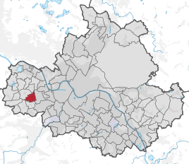  Location of the Ockerwitz district in Dresden
|
|
Ockerwitz is a district in the west of the Saxon capital Dresden . It is located in the district of the same name and belongs to the village of Gompitz .
geography

Ockerwitz located 7 km west of Dresden city center, the interior of the old town , on the left bank, Meissner highlands called Lösshochfläche . The location is at a height of about 200 to 250 m above sea level. NN and clearly exceeds the valley floor of the Elbe . The terrain slopes down to the east towards the Elbe valley basin . To the north, Ockerwitz is bounded by the Zschonergrund . The subsoil is determined by the plan here . The village character of the Ockerwitz district changed in favor of a residential suburb; the west and south of the corridors are undeveloped and used for agriculture . The old village center is on the Ockerwitz village street . Several three and four-sided courtyards have been preserved in their external appearance from the 19th century . Here is also the village linden tree, designated as a natural monument ND 81 since 1958, with a trunk circumference of more than 3.5 m, whose age is estimated at 250 years. Also, another Linde in the district, which also share of the conservation area Zschonergrund has is protected (ND 104) .
The other districts of Dresden are Gompitz in the south and Pennrich in the west. The neighboring districts of Podemus and Merbitz to the north-west and north already belong to the Dresden town of Mobschatz . East of Ockerwitz is Omsewitz , which is part of the Cotta district . Ockerwitz belongs to the statistical district Gompitz / Altfranken , within which the district forms the statistical district 992 Ockerwitz. The district is connected to Omsewitz and Gompitz by the Ockerwitzer Allee , and there are another 15 named streets in Ockerwitz . The bus route 92 of the Dresdner Verkehrsbetriebe has one of its endpoints in Ockerwiz.
history

The Rundling Ockerwitz, equipped with a corridor and a block corridor, was probably founded in the 12th century or earlier and possibly first mentioned around 1140 under the name Oicice . A forged document for the Meißner Bishop Benno confirmed that Oicice belonged to Burgward Woz , which, according to recent research, was in Niederwartha . This would make Ockerwitz one of the earliest mentioned villages of the then Gaus Nisan or today's Dresden region. However, the connection between Ockerwitz and Oicice , who is closer to Eutschütz , is very controversial; The case of Roitzsch's first mention is similar . What is certain is that Ogkranwicz, mentioned in 1378, is Ockerwitz.
The place name is of Sorbian origin. However, there are various theories about its derivation. One of the approaches says that it is a combination of Okoran , the name of a Slavic locator , and novice (from nova vice ), a Slavic word for new village (cf. origin of the name of the Dresden districts ). According to another explanation, it is associated with the Slavic word okraj , which means on the edge and refers to the location of the village on the slope of the Zschonergrund. The place name developed in the 15th and 16th centuries via Ockernwicz , Ogkerwitz , Ockruwicz , Ockerwicz and Ockericz . The current spelling appears for the first time in 1791.
During the period of German expansion to the east , an early German fortification was built on a mountain ledge on the Zschonergrund, which presumably served to protect the old connection route from Meißen to Briesnitz . Her to the intensive agricultural use only few remains in the form of a small castle Walls make 1937 an archaeological monument . At the September 30, 1408 several members of the Dresdner councilor family were Busmann by the Margrave Wilhelm II. With Ockerwitz invested . As early as 1445 it belonged to the Scharfenberg manor , whose owners, the Lords of Miltitz , exercised the manorial rule . To ocher Witzer hall at that time, parts of the east of listed Cotta located Wüstung Wernten that after the establishment of Ostravorwerks but to the Saxon electors fell.
On September 29, 1580, Elector August acquired the village from Martin von Miltitz and paid a total of 5,424 guilders for Ockerwitz, Coschütz , Pesterwitz and four other villages. From then on, Ockerwitz was subordinate to the Dresden office as an administrative village . The neighboring Zschonergrund was at that time a popular hunting ground for the Wettins who tried to curb the ongoing clearing . From 1611, when Elector Johann Georg I had relinquished the service rights resulting from his possessions, the farmers in Ockerwitz had to perform labor services for the lords of the Nöthnitz manor . In a village fire in 1762, Ockerwitz was partially destroyed, but then rebuilt. Besides arable farming , fruit growing was of increasing importance. In the 19th century they also operated gardening shops and dismantled plans in quarries . At that time Ockerwitz was also on Kohlweg (today's Ockerwitzer Allee ), via which the coal mined in the Zauckeroder Revier was brought into the Elbe Valley.

In the middle of the 19th century, Ockerwitz received the status of an independent rural community , whose corridors covered an area of 147 hectares in 1900. The village of Briesnitz was and is parish . In Leutewitz , the school building of a school community stood from 1876 onwards, in which Ockerwitz and Omsewitz and Burgstädtel were also involved. Administratively, the place belonged to the administrative authority of Dresden at this time . In 1904 he had his own waterworks built. With the incorporation of Omsewitz in 1930, Dresden had advanced to the Ockerwitz field boundary. This meant that settlement activity increased in the village and the first new homes were built in the 1930s .
In contrast to the surrounding villages, which were all incorporated into Mobschatz or Gompitz in 1950, Ockerwitz did not lose its independence during the GDR era . In the 1950s, agriculture was forcibly collectivized and an LPG was founded. Only after the fall of the Wall , on April 1, 1993, was Ockerwitz incorporated into Gompitz. Due to the dissolution of the Dresden-Land district on January 1, 1996, Ockerwitz was incorporated into the Meißen district as part of Gompitz and finally incorporated into Dresden on January 1, 1999 .
Population development

| year | Residents |
|---|---|
| 1547/51 | 5 possessed men , 2 residents |
| 1764 | 7 possessed men, 1 cottage owner |
| 1834 | 95 |
| 1871 | 131 |
| 1890 | 109 |
| 1910 | 254 |
| 1925 | 242 |
| 1939 | 340 |
| 1946 | 426 |
| 1950 | 408 |
| 1964 | 333 |
| 1990 | 235 |
| 2001 | 568 |
See also
Web links
Individual evidence
- ↑ Ockerwitz. In: ortschaft-gompitz.de. Retrieved September 1, 2016 .
- ↑ Protected areas according to the Nature Conservation Act. (PDF; 331 kB) In: Environmental Atlas of the City of Dresden. Environmental Office of the City of Dresden, June 2014, pp. 3, 7 , accessed on September 1, 2016 .
- ↑ District catalog 2013. (PDF, 26 MB) (No longer available online.) In: dresden.de. Municipal statistics office Dresden, archived from the original on February 19, 2016 ; accessed on September 1, 2016 . Info: The archive link was inserted automatically and has not yet been checked. Please check the original and archive link according to the instructions and then remove this notice.
- ↑ Line overview. Dresdner Verkehrsbetriebe, accessed on September 1, 2016 .
- ↑ CDS II 1, No. 32, p. 37 : Haec Benno decimus Misinensis ecclesiae episcopus scripsit et sigilli sui impressione signatum corroboravit. Ista sunt nomina villarum, quas Bor et filii eius in concambium dederunt Wighardus et Liuthegerus Misinensis ecclesiae sine werra et omni contradictione: Gozebudi, Oicice, Grodice, Cinici, Luderuwice. This document was made out by two scribes, No. 32 A and No. 32 B. Both documents have double additions, added by two other hands, the form of the document is that of a protocol, the type of writing was not until the 12th century originated while the forgery itself was terminated to 1071, when Henry IV was staying in Meissen.
- ↑ CDS IA 1 No. 142
- ^ Gerhard Billig : The Burgward organization in the Upper Saxon-Meissnian area. Archaeological-archival comparative studies (= publications of the State Museum for Prehistory Dresden. Vol. 20). Deutscher Verlag der Wissenschaften, Berlin (East) 1989, ISBN 3-326-00489-3 , p. 71ff.
- ↑ en.wiktionary.org
- ↑ a b Ockerwitz in the Digital Historical Directory of Saxony
- ↑ Ockerwitzer Allee. Streets and squares in Gompitz. In: dresdner-stadtteile.de. Retrieved September 1, 2016 .
- ^ History. 75th primary school Dresden-Leutewitz, accessed on September 1, 2016 .
- ↑ History of the villages of Gompitz and Altfranken. State capital Dresden, accessed on September 1, 2016 .
Districts in districts
Albertstadt |
Outer New Town |
Bubble joke |
Briesnitz |
Bühlau |
Coschütz |
Cotta |
Dobritz |
Dolzschen |
Dresden Heath |
Friedrichstadt |
Grid lake |
Gorbitz |
Gostritz |
Großzschachwitz |
Gruna |
Hellerau |
Hellerberge |
Hosterwitz |
Inner old town |
Inner New Town |
Johannstadt |
Kaditz |
Kaitz |
Kauscha |
Kemnitz |
Small plague |
Kleinzschachwitz |
Klotzsche |
Leaf guest |
Leipzig suburb |
Leuben |
Leubnitz-Neuostra |
Leutewitz |
Lockwitz |
Löbtau |
Loschwitz |
Luga |
Meusslitz |
Mickten |
Mockritz |
Naußlitz |
Nod |
Niederpoyritz |
Niedersedlitz |
Oberpoyritz |
Omsewitz |
Pieschen |
Pillnitz |
Pirnaische Vorstadt |
Plauen |
Prohlis |
Räcknitz |
Radeberger Vorstadt |
Reick |
Rochwitz |
Roßthal |
Seervorstadt |
Seidnitz |
Other |
Sporbitz |
Stetzsch |
Chasing |
Striesen |
Südvorstadt |
Tolkewitz |
Torna |
Trachau |
Trachenberg |
Übigau |
Wachwitz |
White deer |
Wilschdorf |
Wilsdruffer suburb |
Wölfnitz |
Zschertnitz |
Zschieren
Districts in localities
Altfranken |
Alt-Leuteritz |
Borsberg |
Brabuetz |
Cossebaude |
Cunnersdorf |
Eichbusch |
Eschdorf |
Friedersdorf |
Gönnsdorf |
Gohlis |
Gomlitz |
Gompitz |
Helfenberg |
Krieschendorf |
Langebrück |
Lausa |
Malschendorf |
Marsdorf |
Merbitz |
Mob treasure |
Neu-Leuteritz |
Niederwartha |
Oberwartha |
Ocher joke |
Cardboard box |
Pennrich |
Podemus |
Reitzendorf |
Rennersdorf |
Rockau |
Roitzsch |
Rossendorf |
Schönborn |
Schönfeld |
Schullwitz |
Steinbach |
Unkersdorf |
Whitish |
Weixdorf |
Zaschendorf |
Tariff