
Gompitz (district)
|
Gompitz
District of the state capital Dresden
Coordinates: 51 ° 2 ′ 39 ″ N , 13 ° 38 ′ 25 ″ E
|
|
|---|---|
| Height : | 263 (200-280) m |
| Area : | 1.35 km² |
| Incorporation : | January 1, 1999 |
| Postal code : | 01156 |
| Area code : | 0351 |
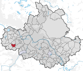  Location of the Gompitz district in Dresden
|
|
Gompitz is a district in the west of the Saxon capital Dresden . Since the seat of the community Gompitz was located here in earlier times, today's village of Gompitz is named after him, to which the districts Ockerwitz , Pennrich , Roitzsch , Steinbach , Unkersdorf and Zöllmen also belong. The local authority is now in Pennrich.
geography

Gompitz located 6 km west of Dresden city center, the interior of the old town , on the left bank, Meissner highlands called Lösshochfläche . The location is at a height of about 260 m above sea level. NN and clearly exceeds the valley floor of the Elbe . The terrain slopes slowly to the east towards the Elbe valley . The north-western tip of the Gompitzer Flur is in the Zschonergrund . Gompitz now has the character of a residential suburb, the village elements faded into the background. Several farms have been preserved in the village center of Altgompitz . Neighboring districts are the other Dresden districts Ockerwitz in the north, Pennrich in the west and Altfranken in the south. In the east, the districts of Omsewitz and Gorbitz border, both of which, however, already belong to the Cotta district . Gompitz belongs to the statistical district Gompitz / Altfranken , within which the district forms the statistical district 991 Gompitz.
The most important street in Gompitz is Kesselsdorfer Strasse , which runs as the B 173 from downtown Dresden in the direction of Chemnitz and also provides a connection to the nearby A 17 . The Altnossener Straße branches off the B 173 and connects Gompitz with the other parts of the village. The Ockerwitzer Allee runs to Ockerwitz. There are ten more named streets in Gompitz. Public transport in Gompitz is the tram line 7, the bus lines 70 and 90 of the Dresdner Verkehrsbetriebe as well as 330 ( Satra Eberhardt ) and 333 ( regional traffic Sächsische Schweiz-Osterzgebirge ).
history
Surname

The Rundling Gompitz, equipped with a block corridor and a strip similar to a win and later expanded , was first mentioned in 1206 as part of the personal name Hildebrandus de Gonpitz , who was mentioned as a witness of a court hearing about the razing of Thorun Castle . The same document also mentions the place Dresdene for the first time (cf. Dresden ). From the name Hildebrand von Gompitz it can be assumed that he was the landlord of Gompitz, which then had a manor house. The "difficult to explain" place name is of Sorbian origin, but there are different approaches to deriving it. The derivation from the Old Sorbian goba (sponge) is problematic, a German-Slavic mixed name (settlement of the people of a Gundbald) is possible. Since hemp was still grown in Gompitz in the 14th century, the place name is also associated with konop , the Slavic name for industrial hemp , which is originally related to the name cannabis . However, a connection with the Old Sorbian terms humpac (German: bittern ) or gonoti (German: hunt, hunt) is also possible. In 1350 and 1378 the village is known as Gumpicz . The place name hardly developed any further in the 16th century via Gompicz and Gumpicz . The current spelling of the district appears again in 1791.
Development up to the early modern period

Already in prehistoric times, around 200 BC BC, the area was populated. Among other things, the remains of a craftsmen's settlement east of today's location testify to this; During the construction of Coventrystrasse in 1995 and 1996, building fragments, ceramic parts and cast copper crucibles were discovered there. Slavic settlers probably founded the village of Gompitz in the 11th century . Around 1400 the village belonged to the extensive possessions of the Dresden councilor Lorenz Busmann , who in 1404 gave part of it to the Altzella monastery. Gompitz burned down in the Hussite Wars . In 1500 the monastery also acquired the rest of the village, which from then on belonged to the Leubnitz monastery estate . After the Reformation , the Prokuraturamt in Leubnitz became the administrator of the previous property of the Catholic Church in the 1530s and remained so for several centuries.
The main source of income for the Gompitz residents was agriculture , but there were repeated damage. One of the reasons for this is a severe mouse plague in 1597. In addition, Gompitz was on the old roads to Freiberg ( Frankenstrasse ) and Nossen (Dresden-Nossener Poststrasse). The battle of Kesselsdorf on December 15, 1745, however, had the most devastating effects; the residents fled temporarily. Administratively, Gompitz initially belonged to the castrum and later to the office or the administrative authority of Dresden . It was in the parish of Briesnitz and has been parish in Gorbitz since 1913. After Briesnitz, the children of the village also went to school and in 1790 moved to Pennrich, which had founded a school association with Gompitz that year. In 1902 Gompitz inaugurated his own school building, which also housed the community library and is now used by the 74th elementary school. Around 1840, the six farms and one estate in Gompitz became a rural community closely linked to the neighboring village of Pennrich , in which in the 19th century, in addition to agriculture, fruit and wine growing as well as gardening were carried out. Since then, the municipal area has been 134 hectares. At that time, Gompitz was also located on Kohlweg, on which coal mined in the Zauckeroder district was transported into the Elbe valley . A memorial today commemorates the residents of Gompitz who died in the First World War .
Development in the post-war period

Even after 1945 the place was initially shaped by agriculture; however, Dresden had already expanded to the eastern boundary of the district in 1921, which led to increased settlement activity in Gompitz. On July 1, 1950, Pennrich, with whom Gompitz had grown closer and closer, and Zöllmen were incorporated. The community of Unkersdorf joined Gompitz in 1974 and also brought in its districts Steinbach and Roitzsch; In 1993 Ockerwitz was added. After the fall of the Wall , construction activity skyrocketed. In addition to several new settlements, an industrial area , a hotel and a large riding arena were built . With the dissolution of the Dresden-Land district on January 1, 1996, Gompitz was incorporated into the Meißen district. On January 1, 1999, it was finally incorporated into Dresden . In May 2003 a medieval stone cross was discovered in Gompitz, it was hid and placed in the village. In 2007 and 2008, the B 173 in the Gompitz area was expanded to become an intersection-free motorway feeder . Smaller fossils were recovered from the construction site.
Population development
| year | Residents |
|---|---|
| 1554 | 5 possessed men , 6 residents |
| 1764 | 6 possessed man |
| 1834 | 71 |
| 1871 | 99 |
| 1890 | 310 |
| 1910 | 441 |
| 1925 | 431 |
| 1939 | 406 |
| 1946 | 475 |
| 1950 | see Gompitz (locality) |
See also
literature
- Gompitz . In: Friedrich August Leßke : Contributions to the history and description of the villages of Ober- and Niedergorbitz, Wölfnitz, Pennrich, Naußlitz and Neunimptsch. Self-published, Deuben 1896 ( digitized version ).
Individual evidence
- ↑ District catalog 2013. (PDF, 26 MB) (No longer available online.) In: dresden.de. Municipal statistics office Dresden, archived from the original on February 19, 2016 ; Retrieved February 19, 2016 . Info: The archive link was inserted automatically and has not yet been checked. Please check the original and archive link according to the instructions and then remove this notice.
- ↑ Route network plans of the Dresden transport company
- ↑ a b Ernst Eichler / Hans Walther : Historical book of place names of Saxony. Volume 1, Berlin 2001.
- ↑ a b Gompitz in the Digital Historical Directory of Saxony
- ↑ The history of our school. (No longer available online.) 74th Dresden primary school, archived from the original on March 4, 2016 ; accessed on February 15, 2017 . Info: The archive link was inserted automatically and has not yet been checked. Please check the original and archive link according to the instructions and then remove this notice.
- ^ Dresden-Gompitz, Saxony. In: denkmalprojekt.org. Retrieved February 15, 2017 .
- ↑ History of the villages of Gompitz and Altfranken. State capital Dresden, accessed on August 1, 2020 .
- ^ Districts of Wölfnitz and Naußlitz. In: dresden-und-sachsen.de. Retrieved February 15, 2017 .
- ↑ Gompitz. In: suehnekreuz.de. Retrieved February 15, 2017 .
- ↑ Approval on the B 173. In: dresden.de. State capital Dresden, September 19, 2008, accessed on February 15, 2017 (press release).
- ↑ Dresden-Gompitz / Kesselsdorfer Str. In: kreidefossilien.de. May 2, 2014, accessed February 15, 2017 .
Web links
- Gompitz village
- Village and district of Gompitz
- Gompitz in the Digital Historical Directory of Saxony
- Gompitz district
Districts in districts
Albertstadt |
Outer New Town |
Bubble joke |
Briesnitz |
Bühlau |
Coschütz |
Cotta |
Dobritz |
Dolzschen |
Dresden Heath |
Friedrichstadt |
Grid lake |
Gorbitz |
Gostritz |
Großzschachwitz |
Gruna |
Hellerau |
Hellerberge |
Hosterwitz |
Inner old town |
Inner New Town |
Johannstadt |
Kaditz |
Kaitz |
Kauscha |
Kemnitz |
Small plague |
Kleinzschachwitz |
Klotzsche |
Leaf guest |
Leipzig suburb |
Leuben |
Leubnitz-Neuostra |
Leutewitz |
Lockwitz |
Löbtau |
Loschwitz |
Luga |
Meusslitz |
Mickten |
Mockritz |
Naußlitz |
Nod |
Niederpoyritz |
Niedersedlitz |
Oberpoyritz |
Omsewitz |
Pieschen |
Pillnitz |
Pirnaische Vorstadt |
Plauen |
Prohlis |
Räcknitz |
Radeberger Vorstadt |
Reick |
Rochwitz |
Roßthal |
Seervorstadt |
Seidnitz |
Other |
Sporbitz |
Stetzsch |
Chasing |
Striesen |
Südvorstadt |
Tolkewitz |
Torna |
Trachau |
Trachenberg |
Übigau |
Wachwitz |
White deer |
Wilschdorf |
Wilsdruffer suburb |
Wölfnitz |
Zschertnitz |
Zschieren
Districts in localities
Altfranken |
Alt-Leuteritz |
Borsberg |
Brabuetz |
Cossebaude |
Cunnersdorf |
Eichbusch |
Eschdorf |
Friedersdorf |
Gönnsdorf |
Gohlis |
Gomlitz |
Gompitz |
Helfenberg |
Krieschendorf |
Langebrück |
Lausa |
Malschendorf |
Marsdorf |
Merbitz |
Mob treasure |
Neu-Leuteritz |
Niederwartha |
Oberwartha |
Ocher joke |
Cardboard box |
Pennrich |
Podemus |
Reitzendorf |
Rennersdorf |
Rockau |
Roitzsch |
Rossendorf |
Schönborn |
Schönfeld |
Schullwitz |
Steinbach |
Unkersdorf |
Whitish |
Weixdorf |
Zaschendorf |
Tariff