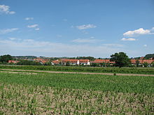
Weißig (Dresden)
|
Weißig district and statistical district No. 45 of Dresden |
|
|---|---|
| Coordinates | 51 ° 3 '39 " N , 13 ° 53' 4" E |
| height | 260 m above sea level NN |
| surface | 7.01 km² |
| Residents | 5734 (December 31, 2017) |
| Population density | 818 inhabitants / km² |
| Incorporation | Jan. 1, 1994 ( Schönfeld-Weißig ) |
| Post Code | 01328 |
| prefix | 0351 |
| Website | www.dresden.de |
| Locality | Schönfeld-Weißig |
| Transport links | |
| Federal road |
|
| bus | 61, 98A, 98B, 229, 261 |
Weißig is a district in the northeast of the city of Dresden in the Schönfeld highlands and belongs to the village of Schönfeld-Weißig .
history
Since the 13th century, the center of the town has been the Kreuzkirche , today the Evangelical Lutheran Church in Weißig. During the Thirty Years' War , a large part of the village was devastated on September 30, 1631 by imperial troops and the leadership of the general Wallenstein . The then village of Weißig was plundered by the Prussians during the Seven Years' War and later by various warring parties during the Napoleonic Wars .
By 1871, the population of Weißig rose to over 1,000 people. With industrialization and the increasing population, the place increasingly began to transform into a residential suburb of the city of Dresden. In 1908 a connection to the rail network was established. Until 1951, Weißig owned a train station on the Dürrröhrsdorf – Weißig railway line . Today the so-called "old railway embankment" is a popular local recreation area for walkers and cyclists.
In addition, in 1908 a tram line was inaugurated with the Bühlauer Außenbahn , which connected the Dresden suburb of Bühlau with Weißig. Tram operations had to be stopped in 1949. The tracks were needed for repairs to inner-city routes that were damaged by acts of war. Since the incorporation there has been regular discussion about building a new tram connection.
The first plans to incorporate Weißig came up in 1913. The negotiations were interrupted by the outbreak of the First World War and were unsuccessful. In 1990 construction activity began in the Schönfeld highlands. The population of Weißig rose to over 5,000. In 1994 the municipality of Weißig merged with the municipality of Schönfeld and other localities in the Schönfeld highlands. In 1999 both were incorporated and have been part of the city of Dresden ever since.
Infrastructure
The Hutberg with its 311 meters is a popular toboggan hill in winter. The Weißiger Dorfbach flows through the village and flows into the Prießnitz on the southern edge of the Dresdner Heide . There is a primary school in the village, the Hutbergschule Weißig, and the Oberschule Weißig.
In terms of traffic, Weißig is connected to the city center by federal road 6 and city bus route 61.
Cultural monuments
→ Main article: List of cultural monuments in Weißig (Dresden)
See also
Web links
- Weißig in the Digital Historical Directory of Saxony
Individual evidence
- ^ Lars Herrmann: Schönfeld-Weißig. Retrieved September 20, 2017 .
- ^ Dresden: village of Schönfeld-Weißig. (No longer available online.) Archived from the original on September 21, 2017 ; accessed on September 20, 2017 . Info: The archive link was inserted automatically and has not yet been checked. Please check the original and archive link according to the instructions and then remove this notice.


