Oswego County
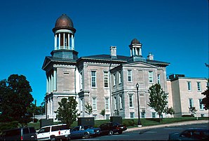
 Oswego County Courthouse |
|
| administration | |
|---|---|
| US state : | new York |
| Administrative headquarters : | Oswego and Pulaski |
| Foundation : | March 1, 1816 |
| Made up from: | Oneida County and Onondaga County |
| Area code : | 315 |
| Demographics | |
| Residents : | 122,109 (2010) |
| Population density : | 49.6 inhabitants / km 2 |
| geography | |
| Total area : | 3,396.8 km² |
| Water surface : | 933.1 km² |
| map | |
Oswego County is a county in the state of New York in the United States . At the 2010 census , Oswego County had 122,109 residents and a population density of 49.6 people per square kilometer. The county has two county seats ; these are Oswego and Pulaski .
geography
Oswego County is located on the south bank of Lake Ontario , which is also the border between the United States and Canada . The shape of the area is shaped by Ice Age influences and is largely flat and only crossed by low elevations. Important rivers are the Oswego River , which has its source in Oneida Lake , has been navigable since 1828 and is connected to the Mohawk River by the Erie Canal , and the Salmon River in the north of the county. The country is crossed by a large number of other small watercourses. The county is primarily used for agriculture and forestry and has an area of 3,396.8 square kilometers, of which 933.1 square kilometers are water, which is primarily part of Lake Ontario.
history

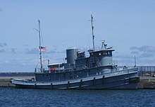
Oswego County was founded in 1816 as the 48th County of New York State. Two locations have National Historic Landmark status , the New York State Barge Canal and the WWII Tugboat Nash . A total of 89 buildings and sites in the county are listed on the National Register of Historic Places (as of February 20, 2018).
Surrounding areas
| Lake Ontario | Jefferson County | Lewis County |
| Lake Ontario |

|
Oneida County |
| Cayuga County | Onondaga County | Madison County |
Population development
| year | 1800 | 1810 | 1820 | 1830 | 1840 | 1850 | 1860 | 1870 | 1880 | 1890 |
|---|---|---|---|---|---|---|---|---|---|---|
| Residents | - | - | 12,374 | 27,119 | 43,619 | 62.198 | 75,958 | 77,941 | 77,911 | 71,883 |
| year | 1900 | 1910 | 1920 | 1930 | 1940 | 1950 | 1960 | 1970 | 1980 | 1990 |
| Residents | 70,881 | 71,664 | 71,045 | 69,645 | 71,275 | 77.181 | 86,118 | 100..897 | 113.901 | 121,771 |
| year | 2000 | 2010 | 2020 | 2030 | 2040 | 2050 | 2060 | 2070 | 2080 | 2090 |
| Residents | 122,377 | 122.109 |
Cities and towns
In addition to the independent communities listed below, there are several villages in Oswego County .
| Locality | status | Population (2010) |
Total area [km²] |
Land area [km²] |
Population density [inhabitants / km²] |
founding | Specialty |
|---|---|---|---|---|---|---|---|
| Albion | town | 2,073 | 123.8 | 122.4 | 16.9 | 24 Mar 1825 | |
| Amboy | town | 1,263 | 97.7 | 95.9 | 13.2 | 25th Mar 1830 | |
| Boylston | town | 549 | 101.4 | 101.4 | 5.4 | Feb. 7, 1828 | |
| Constantia | town | 4,973 | 258.1 | 147.0 | 33.8 | Apr 8, 1808 | |
| Fulton | City | 11,896 | 12.3 | 9.7 | 1,226.4 | Apr 29, 1835 | founded as a village |
| Granby | town | 6,821 | 120.2 | 115.8 | 58.9 | Apr 20, 1818 | |
| Hannibal | town | 4,854 | 116.0 | 115.6 | 42.0 | 28 Feb 1806 | |
| Hastings | town | 9,450 | 119.0 | 118.2 | 79.9 | April 20, 1825 | |
| Mexico | town | 5,197 | 121.6 | 119.8 | 43.4 | Apr 10, 1792 | |
| Minetto | town | 1,659 | 15.6 | 14.9 | 11.3 | Hived off from Oswego Town between 1910 and 1920 according to the footnote in the 1920 Census | |
| New Haven | town | 2,856 | 86.5 | 80.5 | 35.5 | Apr 2, 1812 | |
| Orwell | town | 1,167 | 106.8 | 102.5 | 11.4 | Feb. 28, 1817 | |
| Oswego | City | 18,142 | 29.1 | 19.7 | 920.9 | 14 Mar 1828 | founded as a village ; the City appointed on March 24, 1848 |
| Oswego Town | town | 7,984 | 76.0 | 70.8 | 112.8 | Apr 20, 1818 | |
| Palermo | town | 3,664 | 105.5 | 104.8 | 35.0 | Apr 4, 1832 | |
| Parish | town | 2,558 | 108.6 | 108.0 | 23.7 | 20 Mar 1828 | |
| Redfield | town | 550 | 241.9 | 232.8 | 2.4 | 14 Mar 1800 | |
| Richland | town | 5,718 | 155.5 | 148.2 | 38.6 | Feb 20, 1807 | |
| Sandy Creek | town | 3,939 | 120.2 | 109.5 | 36.0 | 24 Mar 1825 | |
| Schroeppel | town | 8,501 | 111.8 | 109.3 | 77.8 | Apr 4, 1832 | |
| Scriba | town | 6,840 | 113.7 | 105.0 | 65.1 | Apr 5, 1811 | |
| Volney | town | 5,926 | 127.3 | 124.9 | 47.4 | 21 Mar 1806 | founded under the name Fredericksburgh |
| West Monroe | town | 4,252 | 99.9 | 87.4 | 48.6 | 21 Mar 1839 | |
| Williamstown | town | 1,277 | 101.4 | 100.1 | 12.8 | 24 Mar 1804 |
literature
- John Homer French: Gazetteer of the State of New York . RP Smith, Syracuse, NY 1860 (English, archive.org [PDF; 63.8 MB ; accessed on January 1, 2017]).
- Franklin Benjamin Hough: Gazetteer of the State of New York . tape 2 . A. Boyd, Albany, NY 1873, pp. 517 ff . (English, archive.org [PDF; 67.9 MB ; accessed on January 1, 2017]).
Individual evidence
- ↑ Oswego County in the United States Geological Survey's Geographic Names Information System
- ↑ Listing of National Historic Landmarks by State: New York . National Park Service , accessed February 20, 2018.
- ↑ Search mask database in the National Register Information System. National Park Service , accessed February 20, 2018.
- ↑ Population 1820–2010 according to census results
- ↑ Population data from the 2010 US Census in the American Factfinder
- ↑ a b Official data of the United States Board on Geographic Names
- ^ Franklin Benjamin Hough: Gazetteer of the State of New York . tape 2 . A. Boyd, Albany, NY 1873, pp. 520 ff. PDF 67.9 MB, accessed on January 1, 2017 .
Web links
Coordinates: 43 ° 28 ' N , 76 ° 13' W
