Schenectady County
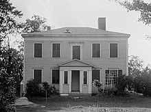
 Schenectady County Courthouse |
|
| administration | |
|---|---|
| US state : | new York |
| Administrative headquarters : | Schenectady |
| Foundation : | March 7, 1809 |
| Made up from: | Albany County |
| Demographics | |
| Residents : | 154,727 (2010) |
| Population density : | 292.1 inhabitants / km 2 |
| geography | |
| Total area : | 542.3 km² |
| Water surface : | 12.6 km² |
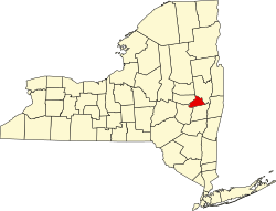
| map | |
| Website : www.schenectadycounty.com | |
Schenectady County [ skəˈnɛktədi ˈkaʊnti ] is a county in the state of New York in the United States . At the 2010 census , Schenectady County had 154,727 residents and a population density of 292.1 people per square kilometer. The county seat is Schenectady .
geography
Schenectady County is located a few kilometers west of the confluence of the Mohawk River in the Hudson River with land on both sides of the Mohawk River. Other notable rivers are the Schoharie Creek and the Norman Kil , which are tributaries to the Mohawk River. Other smaller tributaries from the surrounding hills often fall dry in summer. The surface is largely flat to hilly, with elevations of up to about 100 meters. The county covers an area of 542.3 square kilometers, of which 12.6 square kilometers are water.
Surrounding areas
| Montgomery County |
Montgomery County Saratoga County |
Saratoga County |
| Montgomery County |

|
Saratoga County |
| Schoharie County |
Schoharie County Albany County |
Albany County |
history
Before the arrival of European settlers, the area of Schenectady County was part of the Mohawk settlement area . With the purchase of the plain west of Fort Orange, in which the town of Schenectady stands today, which was agreed with emissaries of the Mohawks in July 1661, the first settlement by Dutch colonists came about in spring 1662. The settlement area of the colonists expanded along the course of the Hudson River to the north and along the Mohawk River to the west into the main settlement areas of the Mohawks. This, together with the military actions of the French from the north, now Canada, and the English in the south, triggered raids by the Mohawks. In the winter of 1679/80 there was massive destruction of settlements in the Mohawk Valley, which advanced from west to east and also destroyed two of the three forts used by British soldiers. On the night of February 8th to 9th, 1680, the main settlement of today's county with around 80 houses was almost completely burned down. There were 36 fatalities among the settlers, 27 people were deported to what is now Canada. Survivors fled to the nearest settlement, Albany.
Despite the militarily unsettled situation - a last major Indian attack is only reported for 1748 - the area was already politically administered. From 1729 until the end of the Revolutionary War , what is now Schenectady County had an MP for the New York General Assembly. On October 23, 1765, the area was declared an independent borough.
During the War of Independence, nearby Albany was an advanced center for British troops. Schenectady's main settlement, today's Schenectady City, was heavily fortified and served as a focal point for settlers and soldiers who were driven from the settlements in the Mohawk Valley during the fighting. When the American revolutionaries prevailed in 1779, the same fortifications were used to protect the Oneida and Tuscerora tribes, who had been driven out by the British and Mohawks; evidently a peaceful coexistence between colonists and displaced indigenous people was possible: the traditional reports show no significant disputes.
With the separation of Schenectady County from Albany County on March 7, 1809, the area became administratively independent. With the construction of the Erie Canal parallel to the Mohawk River and the opening in sections between 1819 and 1825, Schenectady became an important trading and transshipment center. In particular, the opening of the railway line between the economic center of Albany and the Erie Canal in 1831 as well as the construction of further railway lines to economic centers in the area between 1832 and 1864 led to a strong appreciation of the city of Schenectady and the surrounding area: the transport of goods by rail accelerated the processes Considerable because the canal had a large number of locks and bypasses of rapids on the section up to Troy. However, the transport was not cheaper because the transports parallel to the canal were burdened with the exact charges to the canal operator than if they had been transported by ship. It was not until 1851 that this privilege of canal owners was revoked by a resolution of the New York Parliament.
From around 1850, there was a wave of Irish emigrants who fled the area of Schenectady from the famine that raged there between 1845 and 1852 . During the Civil War , Schenectady County provided infantry in the 13th, 18th, 138th, and 144th Infantry Regiments of the NY Volunteers, as well as cavalrymen in the 18th, 91st, and 192nd Infantry Regiments between 1861 and 1864; The county was spared from fighting.
The year 1886 saw the establishment of a large dynamo and electric motor plant, the Edison Machine Works (an evacuation from New York City that became too small to operate). The plant became part of Edison General Electrics from 1889 and, after merging with another large company, of General Electric in 1892 . Schenectady City became the headquarters of General Electric. The economic success of the plant leads to a strong increase in population over the next few decades. The county was barely affected by the economic problems of the 1930s and World War II; The economic success of the local factories and the nearby industrial center of Albany resulted in a strong influx of workers and a strong diversification of suppliers. In 1974 the General Electrics headquarters was relocated to Fairfield, Connecticut ; but the work remained. This saved the place from an economic collapse; To this day, GE is the most important employer in the area and the center of a diverse supply industry.

Four locations have National Historic Landmark status , the New York State Barge Canal , the General Electric Research Laboratory , Irving Langmuir House, and Nott Memorial Hall . A total of 70 buildings and sites in the county are registered on the National Register of Historic Places (as of February 21, 2018).
Population development
| year | 1800 | 1810 | 1820 | 1830 | 1840 | 1850 | 1860 | 1870 | 1880 | 1890 |
|---|---|---|---|---|---|---|---|---|---|---|
| Residents | - | 10,201 | 13,081 | 12,347 | 17,387 | 20,054 | 20.002 | 21,347 | 23,538 | 29,797 |
| year | 1900 | 1910 | 1920 | 1930 | 1940 | 1950 | 1960 | 1970 | 1980 | 1990 |
| Residents | 46,852 | 88,235 | 109,363 | 125.021 | 122,494 | 142,497 | 152.896 | 160,979 | 149.946 | 149.285 |
| year | 2000 | 2010 | 2020 | 2030 | 2040 | 2050 | 2060 | 2070 | 2080 | 2090 |
| Residents | 146,555 | 154,727 |
Cities and towns
In addition to the independent municipalities listed below, there are several villages in Schenectady County .
| Locality | status | Population (2010) |
Total area [km²] |
Land area [km²] |
Population density [inhabitants / km²] |
founding | Specialty |
|---|---|---|---|---|---|---|---|
| Duanesburg | town | 6.122 | 186.6 | 183.3 | 33.4 | 13 Mar 1765 | Establishment by patent; Re-established as a town on March 13, 1765 |
| Glenville | town | 29,480 | 131.3 | 127.4 | 231.4 | Apr 14, 1820 | |
| Niskayuna | town | 21,781 | 39.0 | 36.7 | 593.5 | 7th Mar 1809 | |
| Princetown | town | 2.115 | 62.7 | 62.0 | 14.1 | 2nd Mar 1798 | |
| Rotterdam | town | 29.094 | 94.4 | 92.4 | 314.9 | Apr 14, 1820 | |
| Schenectady | City | 66,135 | 28.4 | 27.9 | 2370.4 | Nov 4, 1684 | Establishment by patent; appointed borough on October 23, 1798, city on March 26, 1798 |
literature
- John Homer French: Gazetteer of the State of New York . RP Smith, Syracuse, NY 1860, pp. 595 ff . (English, archive.org [PDF; 63.8 MB ; accessed on January 1, 2017]).
- Franklin Benjamin Hough: Gazetteer of the State of New York . tape 2 . A. Boyd, Albany, NY 1873, pp. 598 ff . (English, archive.org [PDF; 58.3 MB ; accessed on January 1, 2017]).
Individual evidence
- ↑ Schenectady County in the United States Geological Survey's Geographic Names Information System
- ↑ Listing of National Historic Landmarks by State: New York . National Park Service , accessed February 21, 2018.
- ↑ Search mask database in the National Register Information System. National Park Service , accessed February 21, 2018.
- ↑ Population 1810-2010 according to census results
- ↑ Population data from the 2010 US Census in the American Factfinder
- ^ Franklin Benjamin Hough: Gazetteer of the State of New York . tape 2 . A. Boyd, Albany, NY 1873, pp. 600 ff . (English).
Web links
Coordinates: 42 ° 49 ′ N , 74 ° 3 ′ W


