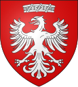
Pihen-lès-Guînes
| Pihen-lès-Guînes | ||
|---|---|---|

|
|
|
| region | Hauts-de-France | |
| Department | Pas-de-Calais | |
| Arrondissement | Calais | |
| Canton | Calais-1 | |
| Community association | Pays d'Opale | |
| Coordinates | 50 ° 52 ' N , 1 ° 47' E | |
| height | 23-121 m | |
| surface | 9.25 km 2 | |
| Residents | 499 (January 1, 2017) | |
| Population density | 54 inhabitants / km 2 | |
| Post Code | 62340 | |
| INSEE code | 62657 | |
| Website | http://www.pihen-les-guines.fr/ | |
 Town hall (Mairie) in Pihen-lès-Guînes |
||
Pihen-lès-Guînes ( Flemish : "Pittem") is a French municipality with 499 inhabitants (as of January 1 2017) in the department of Pas-de-Calais in the region of Hauts-de-France ; it belongs to the Arrondissement of Calais and the canton of Calais-1 (until 2015: canton of Guînes ). The inhabitants are called the Pihenois .
During the Battle of Britain between Pihen and Saint-Inglevert there was an important field airfield of the German Air Force .
geography
Pihen-lès-Guînes is about ten kilometers south-southeast of Calais . Pihen-lès-Guînes is surrounded by the neighboring communities of Bonningues-lès-Calais in the north and north-west, Saint-Tricat in the north-east, Hames-Boucres in the east and south-east, Caffiers and Landrethun-le-Nord in the south and Saint-Inglevert in the west.
Population development
| year | 1962 | 1968 | 1975 | 1982 | 1990 | 1999 | 2006 | 2013 |
|---|---|---|---|---|---|---|---|---|
| Residents | 367 | 349 | 309 | 357 | 413 | 394 | 477 | 467 |
| Source: Cassini and INSEE | ||||||||
Attractions
- Notre-Dame-de-l'Annonciation church from the 13th century
- Alenthun Castle
- La Rocherie Castle
- La Quennevacherie Castle from the 19th century
- Le Beauregard manor house
- Old Mill
Web links
Individual evidence
- ^ De Nederlanden in Frankrijk, Jozef van Overstraeten, 1969

