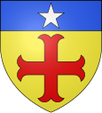
Landrethun-le-Nord
| Landrethun-le-Nord | ||
|---|---|---|

|
|
|
| region | Hauts-de-France | |
| Department | Pas-de-Calais | |
| Arrondissement | Boulogne-sur-Mer | |
| Canton | Desvres | |
| Community association | Terre des Deux Caps | |
| Coordinates | 50 ° 51 ' N , 1 ° 47' E | |
| height | 57-133 m | |
| surface | 7.70 km 2 | |
| Residents | 1,299 (January 1, 2017) | |
| Population density | 169 inhabitants / km 2 | |
| Post Code | 62250 | |
| INSEE code | 62487 | |
 Landrethun-le-Nord |
||
Landrethun-le-Nord (NDL .: Landerten ) is a French municipality with 1,299 inhabitants (at January 1, 2017) in the department of Pas-de-Calais in the region of Hauts-de-France .
Location and transport links
The place is on the D 231 road between Marquise and Guînes . The next motorway exit (E 402) is in the neighboring town of Leubringhen to the west. The municipality is part of the Caps et Marais d'Opale Regional Nature Park .
history
To the west of the village, an underground launching system for V3 shells, the Mimoyecques launching base , was built by the German occupying forces with countless forced laborers in 1943 during World War II .
Web links
Commons : Landrethun-le-Nord - collection of images, videos and audio files
Individual evidence
- ^ De Nederlanden in Frankrijk, Jozef van Overstraeten, 1969
