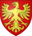
Maninghen hen
| Maninghen hen | ||
|---|---|---|

|
|
|
| region | Hauts-de-France | |
| Department | Pas-de-Calais | |
| Arrondissement | Boulogne-sur-Mer | |
| Canton | Desvres | |
| Community association | Terre des Deux Caps | |
| Coordinates | 50 ° 46 ′ N , 1 ° 40 ′ E | |
| height | 9-115 m | |
| surface | 3.99 km 2 | |
| Residents | 314 (January 1, 2017) | |
| Population density | 79 inhabitants / km 2 | |
| Post Code | 62250 | |
| INSEE code | 62546 | |
Maninghen Hen is a French municipality with 314 inhabitants (as of January 1 2017) in the district of Boulogne-sur-Mer in the department of Pas-de-Calais in the region of Hauts-de-France . Maninghen-Henne belongs to the canton of Desvres (until 2015: canton of Marquise ).
geography
Maninghen-Henne is located about 30 kilometers southwest of Calais and about seven kilometers northeast of Boulogne-sur-Mer near the opal coast of the English Channel ( North Sea ). The municipality is part of the Caps et Marais d'Opale Regional Nature Park .
Maninghen-Henne is surrounded by the neighboring communities of Wacquinghen in the north, Offrethun in the northeast, Wierre-Effroy in the east, Pittefaux in the south and southeast and Wimille in the west and southwest.
| 1962 | 1968 | 1975 | 1982 | 1990 | 1999 | 2006 | 2013 | |
|---|---|---|---|---|---|---|---|---|
| 116 | 123 | 112 | 181 | 211 | 298 | 309 | 350 | |
| Source: Cassini and INSEE | ||||||||
Attractions
- 19th century Saint Martin church
- two mansions from the 17th century
- Windmill

