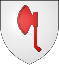
Leulinghen-Bernes
| Leulinghen-Bernes | ||
|---|---|---|

|
|
|
| region | Hauts-de-France | |
| Department | Pas-de-Calais | |
| Arrondissement | Boulogne-sur-Mer | |
| Canton | Desvres | |
| Community association | Terre des Deux Caps | |
| Coordinates | 50 ° 50 ' N , 1 ° 43' E | |
| height | 8-100 m | |
| surface | 6.9 km 2 | |
| Residents | 470 (January 1, 2017) | |
| Population density | 68 inhabitants / km 2 | |
| Post Code | 62250 | |
| INSEE code | 62505 | |
| Website | http://www.ville-leulinghenbernes.fr/ | |
 Town hall (Mairie) of Leulinghen-Bernes |
||
Leulinghen-Bernes ( Flemish : Leulingen ) is a French municipality with 470 inhabitants (as of January 1, 2017) in the district of Boulogne-sur-Mer in the department of Pas-de-Calais in the region of Hauts-de-France . Leulinghen-Bernes belongs to the canton of Desvres (until 2015: canton of Marquise ).
geography
Leulinghen-Bernes is located about 23 kilometers southwest of Calais and about 15 kilometers north-northeast of Boulogne-sur-Mer near the opal coast of the English Channel ( North Sea ). The municipality is part of the Caps et Marais d'Opale Regional Nature Park .
Leulinghen-Bernes is surrounded by the neighboring communities of Audembert in the north and north-west, Leubringhen in the north and north-east, Ferques in the east, Marquise in the south and Bazinghen in the west and south-west.
The A16 autoroute runs through the municipality .
| 1962 | 1968 | 1975 | 1982 | 1990 | 1999 | 2006 | 2013 | |
|---|---|---|---|---|---|---|---|---|
| 243 | 250 | 266 | 266 | 401 | 398 | 412 | 427 | |
| Source: Cassini and INSEE | ||||||||
Attractions
- Saint-Léger church

