Sangatte
| Sangatte | ||
|---|---|---|

|
|
|
| region | Hauts-de-France | |
| Department | Pas-de-Calais | |
| Arrondissement | Calais | |
| Canton | Calais-1 | |
| Community association | Calaisis | |
| Coordinates | 50 ° 57 ′ N , 1 ° 45 ′ E | |
| height | 0-151 m | |
| surface | 14.28 km 2 | |
| Residents | 4,820 (January 1, 2017) | |
| Population density | 338 inhabitants / km 2 | |
| Post Code | 62231 | |
| INSEE code | 62774 | |
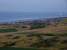
Sangatte ( Dutch Zandgate , dt. About sand hole ) is a French town near Calais with 4,820 inhabitants (at January 1, 2017) in the department of Pas-de-Calais in the region of Hauts-de-France . The name of the city is of Lower Franconian origin.
The submarine section of the Eurotunnel , which connects France with Great Britain , begins under this seaside town .
location
Sangatte is located between Calais in the northeast and Cap Blanc-Nez in the southwest on the English Channel coast . The city is about 250 km from Paris and is part of the Caps et Marais d'Opale Regional Nature Park .
history
Submarine cables
In Sangatte the first - until 1859 - working international submarine cable for telegraphy landed in Sangatte , 25 nautical miles long, coming from St. Margaret's Bay in England .
Blériot plague
The aviation pioneer Louis Blériot took off on July 25, 1909 from the beach in the north and now named after him for the first successful canal overflight to Dover .
Second World War
The so-called Lindemann Battery of the Axis Powers was set up near Sangatte during World War II . The three largest 40.6 cm cannons, which covered the Pas de Calais , secured the passage through the canal and regularly fired Dover , Ramsgate and Folkestone in the British Isles. The threat posed by hellfire corner , as the area around Sangatte was called by the English, remained until September 1944.
Town twinning
- Sandgate , Kent, United Kingdom

