
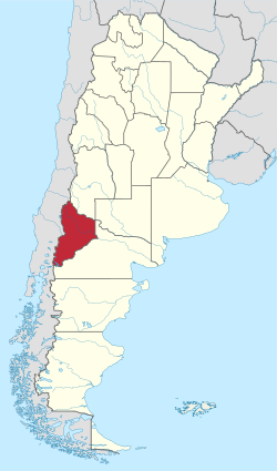
Neuquén Province
| Basic data | |
|---|---|
 ( Details ) |
 ( Details ) |
| Capital: | Neuquén |
| Surface:
- Total |
Rank 13 of 24 94,078 km² |
|
Population :
- Total 2010 |
Rank 16 of 24
551,266 inhabitants |
 .svg) |
|
| ISO 3166-2 code: | AR-Q |
| politics | |
| Region : | Patagonica region |
| Structure: | 16 departments |
| Gobernador: | Omar Gutiérrez |
| Website of the Province of Neuquén | |
Neuquén is a province in western Argentina on the northern edge of Patagonia . The capital of the province is Neuquén of the same name . It was not until July 27, 1955 that the territory was raised to a province.
geography
The province borders on the province of Mendoza in the north, on the province of Río Negro in the southeast, and on Chile in the west. In addition, the province in the northeast has a point of contact with the province of La Pampa .
population
Until the conquest by the troops of General Julio Argentino Roca during the desert campaign in the years 1877–1879, Neuquén was predominantly settled by Mapuche (the name Neuquén is derived from the word Nehuenken , which in their language, Mapudungun , means something like " the ripping one "and originally referred to the Río Neuquén ). Today (2006) there are around 50 Mapuche communities in the province with a total of almost 10,000 inhabitants. An estimated 40% of Neuquén's population have indigenous roots. In February 2006 the Provincial Constituent Assembly granted the Mapuche indigenous status.
More than half of the population (around 360,000 inhabitants) live in the Departamento Confluencia , where the capital Neuquén is located. The population density is around six inhabitants per square kilometer in the entire province and around 50 inhabitants per square kilometer in the Departamento Confluencia.
The population of the province rose from 243,850 (1980) to 551,266 inhabitants in 2010 at 5.86 inhabitants per km². Population growth decreased continuously after 1980 (1980–1990 59.46%, 1990–2000 21.49%, 2000–2010 16.07%).
Important cities
- Neuquén , capital, industrial and commercial center of the province, as an agglomeration about 450,000 inhabitants. The agglomeration also includes the city of Cipolletti in the neighboring province of Río Negro.
- Zapala in the center of the province, characterized by oil production, approx. 32,000 inhabitants
- Cutral-Có in the west of the province, characterized by oil and gas production, approx. 36,000 inhabitants
- San Martín de los Andes in the southwest, located on the lake Lago Lacár , popular holiday destination with around 28,000 inhabitants
politics
The province's governor has been Omar Gutiérrez since December 2015 . His predecessor was Jorge Sapag .
Administrative division
The administrative structure of the province of Neuquén is based on the provisions of the provincial constitution of 1957, which was modified in 1994 and 2006. It is then divided into 16 departments . These in turn are divided into municipalities ( Municipios ), which have been divided into three categories according to their number of inhabitants. In addition, the fourth category is the so-called Comisiones de Fomento , in which the municipalities with up to 500 inhabitants are summarized.
,_departments_and_capital.png)
| Department | Capital | Area in km² | Residents |
|---|---|---|---|
| Aluminé | Aluminé | 4,660 | 8,306 |
| Añelo | Añelo | 11,655 | 10,786 |
| Catan Lil | Las Coloradas | 5,490 | 2,155 |
| Chos Malal | Chos Malal | 4,330 | 15,256 |
| Collón Curá | Piedra del Águila | 5,730 | 4,532 |
| Confluencia | Neuquén | 7,352 | 362.673 |
| Huiliches | Junín de los Andes | 4.012 | 14,725 |
| Lácar | San Martin de Los Andes | 4,930 | 29,748 |
| Loncopué | Loncopué | 5,506 | 6,925 |
| Los Lagos | Villa La Angostura | 4,230 | 11,998 |
| Minas | Andacollo | 6.225 | 7,234 |
| Ñorquín | El Huecú | 5,545 | 4,692 |
| Pehuenches | Rincon de los Sauces | 8,720 | 24,087 |
| Picún Leufú | Picún Leufú | 4,580 | 4,578 |
| Picunches | Las Lajas | 5,913 | 7,022 |
| Zapala | Zapala | 5,200 | 36,549 |
economy
With a per capita gross national product of US $ 8,200, Neuquén is one of the richest provinces in Argentina.
The production of oil and natural gas form the pillar of the province's economy, which together with Chubut makes up most of the extractive industry in Argentina. Furthermore, electricity production by means of three large hydropower plants ( Piedra del Águila with 1.4 GW, El Chocón with 1.34 GW and Alicurá with 1.04 GW) is an important industry. Agriculture is only of regional importance, especially in the valley of the Limay and Neuquén rivers, where fruit is produced in particular. Tourism is concentrated on the towns of San Martín de los Andes and Villa La Angostura as well as on the Copahue thermal baths with the connected winter sports area of Caviahue , all three areas are in the Andean region.
Web links
- Tourist information about the province (Spanish)
- Portal of the city of Neuquén (Spanish)
Individual evidence
- ↑ Source: Argentinisches Tageblatt ( Memento of the original from October 5, 2006 in the Internet Archive ) Info: The archive link was inserted automatically and has not yet been checked. Please check the original and archive link according to the instructions and then remove this notice.
- ↑ Anuario Estadístico del Neuquén 2000 ( Memento of the original from September 14, 2011 in the Internet Archive ) Info: The archive link has been inserted automatically and has not yet been checked. Please check the original and archive link according to the instructions and then remove this notice. , Chap. II, p. 3
- ↑ Results of the 2001 census ( MS Excel ; 28 kB), indec.gov.ar
- ^ Preliminary results of the 2010 census , INDEC
Buenos Aires | Catamarca | Chaco | Chubut | Cordoba | Corrientes | Entre Ríos | Formosa | Jujuy | La Pampa | La Rioja | Mendoza | Misiones | Neuquén | Río Negro | Salta | San Juan | San Luis | Santa Cruz | Santa Fe | Santiago del Estero | Tierra del Fuego | Tucuman
Coordinates: 39 ° 0 ′ S , 70 ° 0 ′ W