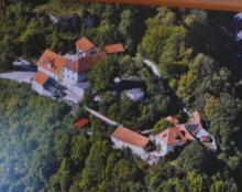
Rieden (Upper Palatinate)
| coat of arms | Germany map | |
|---|---|---|

|
Coordinates: 49 ° 20 ' N , 11 ° 57' E |
|
| Basic data | ||
| State : | Bavaria | |
| Administrative region : | Upper Palatinate | |
| County : | Amberg-Sulzbach | |
| Height : | 365 m above sea level NHN | |
| Area : | 32.29 km 2 | |
| Residents: | 2660 (Dec. 31, 2019) | |
| Population density : | 82 inhabitants per km 2 | |
| Postal code : | 92286 | |
| Area code : | 09624 | |
| License plate : | AS, BUL , ESB , NAB , SUL | |
| Community key : | 09 3 71 146 | |
| Market structure: | 17 districts | |
Market administration address : |
Hirschwalder Str. 27 92286 Rieden |
|
| Website : | ||
| Mayor : | Erwin Geitner ( CSU ) | |
| Location of the Rieden market in the Amberg-Sulzbach district | ||
Rieden is a market in the Upper Palatinate district of Amberg-Sulzbach , consisting of the village of Rieden and the formerly independent municipality of Vilshofen.
geography
Geographical location
Rieden is located in the Upper Palatinate North region on the lower reaches of the northernmost Vils , about 18 km before its confluence with the Naab near Kallmünz . The Hohenfels military training area begins about 1.5 km from the southwestern municipal boundary .
Community structure
Rieden has 17 districts:
|
There are the districts Vilshofen, Rieden, Siegenhofen and Taubenbacher Forst.
history
Until the church is planted
The market vineyards was before 1800 Pflegamt and belonged to Rentamt Amberg of the Electorate of Bavaria. Rieden had market rights with important proprietary rights. In the course of the administrative reforms in Bavaria , the municipality of Rieden was created with the municipal edict of 1818 .
Incorporations
In 1945/46 parts of the Siegenhofen community were incorporated into the Rieden community.
Today's community was created on January 1, 1971 by merging the communities of Vilshofen and Rieden. On September 1, 2015, the municipality-free area of Hirschwald was dissolved . A part was incorporated into the municipality of Rieden.
Population development
Between 1988 and 2018 the market grew from 2,379 to 2,688 by 309 inhabitants or 13%.
- 1970: 2245 inhabitants
- 1987: 2303 inhabitants
- 1991: 2527 inhabitants
- 1995: 2698 inhabitants
- 2000: 2893 inhabitants
- 2005: 2970 inhabitants
- 2010: 2914 inhabitants
- 2015: 2735 inhabitants
politics
Market council
The municipal council has 14 members. Another member and chairman of the market council is the mayor. In the local elections on March 15, 2020, 1,455 of the 2,243 residents entitled to vote in Markt Rieden exercised their right to vote, bringing the turnout to 64.87%.
mayor
In the local elections on March 15, 2020, Erwin Geitner (CSU), who has been in office since May 1, 2014, was re-elected with 77.55% of the vote.
coat of arms
A coat of arms, probably derived from the seal image, has been documented since 1568; it became invalid in 1971. In 1972 the new acceptance took place by resolution of the municipal council and the approval of the government of the Upper Palatinate. The description reads: "In silver, a left-turned, red-tongued black male with a gold collar."
tax income
In 2017, the municipal tax revenue amounted to 2,082,000 euros, of which 358,000 euros were trade tax receipts (net) and 1,321,000 euros were the municipality's share of income tax.
Culture and sights
- Vilshofen
- Parish Church of St. Michael (1781)
- All Souls Chapel on Pfarrberg (1495)
- Wieskirche am Pfarrberg (1751)
- Way of the Cross on the Pfarrberg (1747)
- Vineyards
- Parish Church of the Assumption of Mary (1717)
- St. George Church (15th century)
- Weg Chapel on Kreuther Strasse (1687)
- Chapel on Schloßberg with Stations of the Cross (18th century)
- Prehistoric ring wall
- Rieden-Kreuth
- GOND (big festival)
- Ragnarök 2010 in the Ostbayernhalle
nature
- The Lower Pfistertal nature reserve north of Vilshofen
Economy and Infrastructure
Economy including agriculture and forestry
In 2017 there were 376 jobs subject to social security contributions in the municipality. Of the resident population, 1162 people were in an employment relationship subject to compulsory insurance. This meant that the number of out-commuters was 786 more than that of in-commuters. 53 residents were unemployed. In 2016 there were 22 farms; 1063 hectares of the municipality were used for agriculture.
education
There are the following facilities:
- a day-care center with 75 approved places and 58 children and
- the Rieden elementary school with eight teachers and 167 students.
The district school responsible for middle school students has been in Ensdorf since the beginning of the 2005/2006 school year .
Web links
- Official website of the market town
- Entry on the coat of arms of Rieden (Upper Palatinate) in the database of the House of Bavarian History
Individual evidence
- ↑ "Data 2" sheet, Statistical Report A1200C 202041 Population of the municipalities, districts and administrative districts 1st quarter 2020 (population based on the 2011 census) ( help ).
- ↑ bayerische-landesbibliothek-online.de
- ^ Wilhelm Volkert (ed.): Handbook of Bavarian offices, communities and courts 1799–1980 . CH Beck, Munich 1983, ISBN 3-406-09669-7 , p. 419 .
- ^ Official Journal of the Upper Palatinate , accessed on September 1, 2015
- ↑ Results of local elections 2020. OK.VOTE, March 15, 2020, accessed on May 16, 2020 .
- ↑ Results of local elections 2020. OK.VOTE, March 15, 2020, accessed on May 16, 2020 .
- ↑ Results of local elections 2020. OK.VOTE, March 15, 2020, accessed on May 16, 2020 .
- ↑ AGrundschule vineyards in the school database of the Bavarian State Ministry of Education and Culture , accessed on 31 July 2020th


