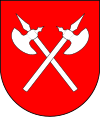
Strážske
| Strážske | ||
|---|---|---|
| coat of arms | map | |

|
|
|
| Basic data | ||
| State : | Slovakia | |
| Kraj : | Košický kraj | |
| Okres : | Michalovce | |
| Region : | Horný Zemplín | |
| Area : | 24.773 km² | |
| Residents : | 4,250 (Dec. 31, 2019) | |
| Population density : | 172 inhabitants per km² | |
| Height : | 135 m nm | |
| Postal code : | 072 22 | |
| Telephone code : | 0 56 | |
| Geographic location : | 48 ° 52 ' N , 21 ° 50' E | |
| License plate : | MI | |
| Kód obce : | 523101 | |
| structure | ||
| Community type : | city | |
| Urban area structure: | 3 districts | |
| Administration (as of November 2018) | ||
| Mayor : | Vladimír Dunajčák | |
| Address: | Mestský úrad Strážske Námestie A. Dubčeka 300 072 22 Strážske |
|
| Website: | www.strazske.sk | |
| Statistics information on statistics.sk | ||
Strážske (until 1927 in Slovak "Stražské"; German rarely Straschke , Hungarian Őrmező ) is a city in eastern Slovakia .
It was mentioned in writing for the first time in 1337 as Evrmezew and is divided into the following parts:
- Krivošťany (incorporated in 1960)
- Plans
- Strážske
The Laborec River flows past the village .
See also
Web links
Commons : Strážske - collection of images, videos and audio files

