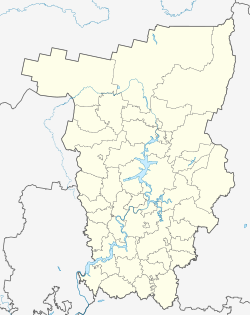
Uralsky (Perm)
| Urban-type settlement
Uralski
Уральский
|
||||||||||||||||||||||||||||||||||||||||
|
||||||||||||||||||||||||||||||||||||||||
|
||||||||||||||||||||||||||||||||||||||||
Uralsky ( Russian Ура́льский ) is an urban-type settlement in the Perm region in Russia with 8014 inhabitants (as of October 14, 2010).
geography
The place is a good 40 km as the crow flies west of the regional administrative center Perm in the western foothills of the Urals . It is located on the right bank of the Kama , which is about a kilometer wide in the upper part of the reservoir area of the Votkinsk reservoir .
Uralsky belongs to the Nytwenski Rajon and is located about 13 km east of its administrative center Nytwa . The settlement is the seat of the municipality of Uralskoye gorodskoje posselenije, which also includes the villages of Prityka, Sukmany and Tjuleni and the settlements at Sukmany and Kasarma train station 27-j km, all about 6 to 7 km to the west. The district of Cheryomushki is located about 2.5 km southwest of the center of Uralsky.
history
In place of the current settlement, an insignificant village called Kamskoje Posselje was first mentioned in 1863. In 1948, in connection with the establishment of a large wood processing company, the construction of today's settlement began. Its name is derived from the name of the mountains and the neighboring Ural region , meaning something like "Ural settlement". The factory started operations in 1956 and is still today (as of 2018, since 2015 as SWESA Uralsky ) one of the largest plywood and chipboard manufacturers in Russia. On September 8, 1961, the place received the status of an urban-type settlement.
Population development
| year | Residents |
|---|---|
| 1970 | 7770 |
| 1979 | 8343 |
| 1989 | 9017 |
| 2002 | 8929 |
| 2010 | 8014 |
Note: census data
traffic
There is a road connection to Nytwa and the neighboring settlement of Novoiljinski , located downstream, as well as via an unpaved road (as of 2018) directly to the Jelabuga - Perm branch of the M7 Volga federal trunk road , which passes just under 10 km northwest .
The nearest train station Sukmany is 6 km west on a branch line from Tchaikovskaya on the Trans-Siberian Railway , which passes a good 20 km north to Nytwa. The wood processing plant has a freight connection line to Sukmany and a small river port on the Kama.
Web links
Individual evidence
- ↑ a b Itogi Vserossijskoj perepisi naselenija 2010 goda. Tom 1. Čislennostʹ i razmeščenie naselenija (Results of the All-Russian Census 2010. Volume 1. Number and distribution of the population). Tables 5 , pp. 12-209; 11 , pp. 312–979 (download from the website of the Federal Service for State Statistics of the Russian Federation)


