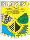
Wylkowe
| Wylkowe | ||
| Вилкове | ||

|
|
|
| Basic data | ||
|---|---|---|
| Oblast : | Odessa Oblast | |
| Rajon : | Kilija district | |
| Height : | no information | |
| Area : | 349.79 km² | |
| Residents : | 9,426 (2004) | |
| Population density : | 27 inhabitants per km² | |
| Postcodes : | 68355 | |
| Area code : | +380 4843 | |
| Geographic location : | 45 ° 24 ' N , 29 ° 35' E | |
| KOATUU : | 5122310300 | |
| Administrative structure : | 1 city, 1 settlement | |
| Mayor : | Mykola Dziadzin | |
| Address: | ву. Кірова 27 68355 м. Вилкове |
|
| Statistical information | ||
|
|
||
Wylkowe ( Ukrainian Вилкове ; Russian Вилково Wilkowo , Romanian Vâlcov ) is a city on the Ukrainian side of the Danube Delta on the Kilija arm . The city is located in the Odessa Oblast in Kilija Raion on the border with Romania and is the last populated point before the mouth of the Danube into the Black Sea .
The administration of the Ukrainian Danube Delta Biosphere Reserve , a UNESCO World Heritage Site, is also located here. Since April 13, 2007, the settlement of Bile on Snake Island east of the city in the Black Sea belongs to Wylkowe.
Origin of name and history
The city is located on an area that includes the three branches of the Danube estuary Kilija , Otschakowskoje and Belgorodnistrovski and forms a fork (Ukrainian “vilka”). The first residents were Lipovans . In the lower part of the Danube Delta, which originally belonged to the Ottoman Empire , fleeing Don Cossacks , Zaporozhian Cossacks and Orthodox Christians ( Lipovans ) who were politically persecuted for religious reasons by the Russian Tsar settled in the middle of the 18th century . The place was founded in 1746, in 1762 it received city rights. It belonged temporarily, for example between 1918 and 1940 and 1941-1944, to Romania. At the end of World War II , Wylkowe became part of the Ukrainian Soviet Republic of the USSR.
City structure and sights
Together with the natural flows of the delta and artificially dug channels for the creation of islands, Wylkowe was built into the uniform water system of the natural Danube trenches. The canals take up up to 45 percent of the city's area, making boats an important means of transport in the city. On average, there are still two boats for every inhabitant. Because of the different water levels, there are also boardwalks on stilts between some properties.
On the main street there is a cinema theater, the town hall and two monuments: a Lenin monument and a fisherman's monument (unveiled in 2004). In total there are three churches in the city, two Nikolaus churches , which were built in honor of the patron saint Nicholas of Myra , and the Church of the Nativity .
To the east of the city is the Bystre Canal . Because of its location on the water, the city is also known as the “Ukrainian Venice ”.
economy
The main food is fishing, so there is a fisherman's memorial on the main street. In addition, the home-growing of fruit and vegetables as well as tourism and boat building now play an important role. The typical Wylkowe boats were first built as replicas of Cossack boats. These were used as combat ships and were equipped with two bows so that they did not have to be turned. The shape was retained and is now used by fishermen under the name herring boat .
Friendship with Furtwangen
In 2017 a delegation from Furtwangen in the Black Forest visited the municipality of Wylkowe at the mouth of the Danube as a representative from the source of the Danube. A "Memorandum of Friendship" was adopted. In 2018 the return visit took place at the source of the Danube in Furtwangen.
Web links
- Danube Biosphere Nature Reserve ( Memento from April 24, 2015 in the Internet Archive )
swell
- ↑ City information website
- ↑ a b Two-page written information during a city tour in August 2010, compiled by the tour guide Chervona Ruta
- ↑ Information on the website of the city of Furtwangen


