Erdősmecske: Difference between revisions
Content deleted Content added
m r2.6.4) (robot Adding: sl:Erdősmecske |
No edit summary |
||
| (18 intermediate revisions by 17 users not shown) | |||
| Line 1: | Line 1: | ||
{{Infobox settlement |
{{Infobox settlement |
||
|official_name =Erdősmecske |
| official_name = Erdősmecske |
||
| |
| native_name = |
||
| |
| other_name = |
||
| |
| settlement_type = Village |
||
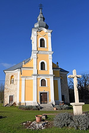
| image_skyline = Erdősmecske, római katolikus templom 2020 01.jpg |
|||
|settlement_type =Village |
|||
| |
| image_caption = Erdősmecske, római katolikus templom |
||
| |
| image_size = 300px |
||
| |
| image_flag = |
||
| |
| image_seal = |
||
| |
| nickname = |
||
| |
| motto = |
||
| |
| image_map = |
||
| |
| map_caption = |
||
| |
| pushpin_map = |
||
| ⚫ | |||
| ⚫ | |||
| ⚫ | |||
| ⚫ | |||
| ⚫ | |||
| ⚫ | |||
| ⚫ | |||
| ⚫ | |||
| ⚫ | |||
|pushpin_mapsize= |
|||
| ⚫ | |||
| ⚫ | |||
| ⚫ | |||
| ⚫ | |||
| subdivision_type2 = |
|||
| ⚫ | |||
| subdivision_name2 = |
|||
| ⚫ | |||
| established_title = |
|||
| ⚫ | |||
| |
| established_date = |
||
| |
| government_type = |
||
| ⚫ | |||
|subdivision_type3 = |
|||
| |
| leader_title = |
||
| ⚫ | |||
| ⚫ | |||
| |
| unit_pref = Imperial |
||
| |
| area_footnotes = |
||
| |
| area_total_km2 = |
||
| |
| area_land_km2 = |
||
| ⚫ | |||
|established_date = |
|||
| |
| elevation_m = |
||
| |
| elevation_ft = |
||
| population_footnotes = |
|||
| ⚫ | |||
| |
| population_total = |
||
| |
| population_as_of = |
||
| ⚫ | |||
|population_as_of = |
|||
| |
| population_note = |
||
| |
| timezone = [[Central European Time|CET]] |
||
| |
| utc_offset = +1 |
||
| ⚫ | |||
| ⚫ | |||
| ⚫ | |||
|timezone=[[Central European Time|CET]] |
|||
| ⚫ | |||
|utc_offset=+1 |
|||
| ⚫ | |||
| ⚫ | |||
| ⚫ | |||
| ⚫ | |||
| ⚫ | |||
|latd=|latm= |lats= |latNS=N |
|||
| ⚫ | |||
|longd=|longm=|longs=|longEW=E |
|||
| ⚫ | |||
|elevation_m = |
|||
|elevation_ft = |
|||
| ⚫ | |||
|postal_code = |
|||
|area_code = |
|||
|blank_name = |
|||
|blank_info = |
|||
|website = |
|||
| ⚫ | |||
}} |
}} |
||
'''Erdősmecske''' (until 1948: '''''Rácmecske'''''; {{lang-de|Ratzmetschke, Metschge}}; {{lang-sr|Српска Мечка}} / ''Srpska Mečka'', Рацмечка / ''Racmečka''; {{lang-hr|Mečka}}) is a village in [[Baranya (county)|Baranya]] county, [[Hungary]]. The residents' majority is Magyar, with minority of [[Serbs]]. Until the end of World War II, the inhabitants were [[Danube Swabians]]. Most of the former German settlers were expelled to Germany and Austria in 1945–1948, following the [[Potsdam Agreement]].<ref>{{Cite web|url=https://ldu-online.de/die-vertreibung|title = Die Vertreibung – Landsmannschaft der Deutschen aus Ungarn}}</ref> |
|||
'''Erdősmecske''' is a village in [[Baranya (county)|Baranya]] county, [[Hungary]]. |
|||
==References== |
|||
{{Reflist}} |
|||
== External links == |
== External links == |
||
* [http://portal.ksh.hu/pls/portal/cp.hnt_telep?NN=18704 Local statistics] {{ |
* [http://portal.ksh.hu/pls/portal/cp.hnt_telep?NN=18704 Local statistics] {{in lang|hu}} |
||
| ⚫ | |||
{{Baranya}} |
{{Baranya}} |
||
{{authority control}} |
|||
| ⚫ | |||
{{DEFAULTSORT:Erdosmecske}} |
|||
[[Category:Populated places in Baranya |
[[Category:Populated places in Baranya County]] |
||
[[Category:Serb communities in Hungary]] |
|||
[[eo:Erdősmecske]] |
|||
| ⚫ | |||
[[fr:Erdősmecske]] |
|||
[[hr:Mečka]] |
|||
[[it:Erdősmecske]] |
|||
[[hu:Erdősmecske]] |
|||
[[nl:Erdősmecske]] |
|||
[[pl:Erdősmecske]] |
|||
[[sk:Erdősmecske]] |
|||
[[sl:Erdősmecske]] |
|||
Latest revision as of 23:22, 10 January 2024
Erdősmecske | |
|---|---|
Village | |
 Erdősmecske, római katolikus templom | |
| Coordinates: 46°11′N 18°31′E / 46.183°N 18.517°E | |
| Country | |
| County | Baranya |
| Time zone | UTC+1 (CET) |
| • Summer (DST) | UTC+2 (CEST) |
Erdősmecske (until 1948: Rácmecske; German: Ratzmetschke, Metschge; Serbian: Српска Мечка / Srpska Mečka, Рацмечка / Racmečka; Croatian: Mečka) is a village in Baranya county, Hungary. The residents' majority is Magyar, with minority of Serbs. Until the end of World War II, the inhabitants were Danube Swabians. Most of the former German settlers were expelled to Germany and Austria in 1945–1948, following the Potsdam Agreement.[1]
References[edit]
External links[edit]
- Local statistics (in Hungarian)


