
San Bernardino, California
City of San Bernardino | |
|---|---|
 | |
| Nickname(s): Gate City; City on the Move; The Friendly City; The Heart of Southern California | |
 Location in the state of California | |
| Country | United States |
| State | California |
| County | San Bernardino |
| Government | |
| • Mayor | Patrick J. Morris (D) |
| Area | |
| • Total | 78.5 sq mi (202.4 km² km2) |
| • Land | 75.8 sq mi (152.3 km² km2) |
| • Water | 0.4 sq mi (1.1 km² km2) |
| Elevation | 1,049−2,900 ft (321 m) |
| Population (2006) | |
| • Total | 205,010 |
| Time zone | UTC-8 (PST) |
| • Summer (DST) | UTC-7 (PDT) |
| ZIP codes | 92401-92408, 92410-92415, 92418, 92420, 92423, 92424, 92427 |
| Area code | 909/951 |
| FIPS code | 06-65000 |
| GNIS feature ID | 1661375 |
| Website | http://sbcity.org/ |
San Bernardino is the county seat of San Bernardino County, California, United States. San Bernardino's estimated population, as of 2006, is 205,010.[1] As of 2006, it was the 18th largest city in California, and the 101st largest city in the United States.[2] San Bernardino is part of the Riverside-San Bernardino-Ontario Metropolitan Area, which is the 14th largest in the nation and which is commonly referred to as the "Inland Empire". Though much of the housing stock is, on average, older than that of the surrounding region, new homes continue to be built in different parts of the City, with the bulk rising in the Verdemont area on the North side of the San Bernardino Valley.
History
The City of San Bernardino, California, occupies much of the San Bernardino Valley, which indigenous tribespeople originally referred to as "The Valley of the Cupped Hand of God." Upon seeing the immense Arrowhead geological monument on the side of the San Bernardino Mountains, they found the life-giving waters of the hot and cold springs to which the rock formation points.
The City of San Bernardino is one of the oldest communities in the State of California. Named for Saint Bernardine of Sienna on May 20, 1810, San Bernardino, in its present-day location, was not largely settled until 1851 when California entered into the Union. The first Anglo-American colony was established by pioneers associated with the Church of Jesus Christ of Latter-Day Saints who would later be recalled in 1857 by Brigham Young. During the interim, the city was officially incorporated in the year 1857. Soon afterward, San Bernardino became an important trading hub in southern California.
According to the Native American legend regarding the landmark Arrowhead, an arrow from heaven burned the formation onto the mountainside in order to show tribes where they could be healed. During the mid-19th Century, “Dr.” David Noble Smith claimed that a saint-like being appeared before him and told of a far-off land with exceptional climate and curative waters, marked by a gigantic arrowhead. Smith’s search for that unique arrowhead formation began in Texas, and eventually ended at Arrowhead Springs in California in 1857. By 1889, word of the springs, along with the hotel on the site (and a belief in the effect of the water from the springs on general health) had grown considerably. Hotel guests often raved about the crystal-clear water from the cold springs, which prompted Seth Marshall to set up a bottling operation in the hotel’s basement. By 1905, water from the cold springs was being shipped to Los Angeles under the newly-created "Arrowhead" trademark.
Indigenous people of the San Bernardino Valley and Mountains were collectively identified by Spanish explorers in the 19th Century as Serrano, a term meaning highlander. Serrano living near what is now Big Bear Lake were called Yuhaviatam, or "People of the Pines". In 1866, to clear the way for settlers and gold miners, state militia conducted a 32-day campaign slaughtering men, women, and children. Yuhaviatam leader Santos Manuel guided his people from their ancient homeland to a village site in the San Bernardino foothills. The United States government in 1891 established it as a tribal reservation and named it after Santos Manuel.
The California Southern Railroad established, through San Bernardino, a rail link between Los Angeles and the rest of the nation in 1883. In 1905, the City of San Bernardino passed its first Charter. World War II brought what would become Norton Air Force Base. The McDonald Brothers founded the McDonald's brand, along with its innovative restaurant concept, in 1948. In 1980, the Panorama Fire destroyed 284 homes. And, in 1994, Norton Air Force Base closed to become the San Bernardino International Airport.

Geography

According to the United States Census Bureau, the city has a total area of 153.5 km² (59.2 mi²), of which 152.3 km² (58.8 mi²) of it is land and 1.1 km² (0.4 mi²), or 0.74%, is water.
The city lies in the San Bernardino foothills and the eastern portion of the San Bernardino Valley, roughly 60 miles east of Los Angeles. Some major geographical features of the city include the San Bernardino Mountains and the San Bernardino National Forest along the northern border; the Cajon Pass adjacent to the northwest border; City Creek, Lytle Creek, San Timoteo Creek, Twin Creek, Warm Creek (as modified through flood control channels) feed the Santa Ana River, which forms part of the city's southern border south of San Bernardino International Airport.
San Bernardino is unique among southern Californian cities because of its wealth of water, which is mostly contained in underground aquifers. A large part of the city is over the Bunker Hill Groundwater Basin, including downtown. This fact accounts for an historically high water table in portions of the city, including at the former Urbita Springs, a lake which no longer exists (It is now the site of the Inland Center Mall.). Seccombe Lake, named after a former mayor, is a man-made lake at Sierra Way and 5th Street. The San Bernardino Valley Municipal Water District ("Muni") has plans to build two more large, multi-acre lakes North and South of the historic downtown in order to reduce groundwater, mitigate the risks of liquefaction in a future earthquake, and sell the valuable water to neighboring agencies.
The city has several notable hills and mountains; among them are: Perris Hill (named after Fred Perris, an early engineer, and the namesake of Perris, California); Kendall Hill (which is near California State University); and, Little Moutain, which rises among Shandin Hills (generally bounded by Sierra Way, 30th Street, Kendall Drive, and Interstate 215).
Freeways act as significant geographical dividers for the City of San Bernardino. Interstate 215 is the major East-West divider, while State Route 210 is the major North-South divider. Interstate 10 is in the southern part of the city. Other major highways include State Route 206 (Kendall Drive and E Street); State Route 66 (which includes the former U.S. 66); State Route 18 (from State Route 210 north on Waterman Avenue to the northern City limits into the mountain communities), and State Route 259, the freeway connector between State Route 210 and I-215.
Neighborhoods and districts

The neighborhoods of San Bernardino are not commonly named. Some reflect geographical regions that existed before annexation, and others originated with specific housing developments. Arrowhead Springs extends from the historic Arrowhead Springs Hotel and Spa in the North to the 210 freeway in the South and from Shandin Hills in the West to East Twin Creek in the East. Del Rosa is the area generally between the foothills and Highland, Mountain and Arden Avenues. Delmann Heights is the area North of Highland Avenue, West of the 215, and East of the unincorporated area of Muscoy, California (which is within the city's sphere of influence for annexation). Some portions of Highland are within the City of San Bernardino, generally consistent with the portions of historical "West Highlands" North of Highland Avenue. The city also contains the post office for Patton, California, the area coextensive with Patton Hospital. Mountain Shadows is the development name for the area between Palm Avenue and Highland Avenue to State Route 330. The "West Side" is used generically to refer to the areas West of the 215 freeway. North Loma Linda is the area West of Mountain View (the border with Redlands), South of the Santa Ana River, North of the 10 freeway, and East of Tippecanoe Avenue. The area north of Northpark Boulevard and Northpark Elementary School is sometimes referred to as "Northpark." The area West of University Parkway, and North of Kendall Avenue to the city limits in Devore is called Verdemont. The "Bench" or "Rialto Bench" refers to the area with Rialto mailing addresses between Foothill Boulevard and Base Line Street.
San Bernardino is divided into several districts. Many of the traditional businesses of the historic downtown have migrated to the Riverfront District, which has effectively become the new downtown and which is generally bounded by the Santa Ana River to the North and the I-10 freeway to the South. To reflect this shift, city leaders have begun referring to the city center as Midtown where government buildings are concentrated. In the foothills of the San Bernardino Mountains lies the University District, which is a commercial area designed to support the California State University with shopping, dining, and medium- and high-density residential space. On the southern side of the 215 freeway and the University District is the Cajon Pass light-industrial district where warehouses are situated to take advantage of this important connection between southern California and the rest of the United States. On the opposite side of the city is the San Bernardino International Gateway, which encompasses the San Bernardino International Airport (SBD) and the AllianceCalifornia logistics campus. Nearby is the Burlington Northern Santa Fe rail hub. The combination of these assets (airport; rail hub; extensive freeway system; and, Cajon Pass) make the city a powerful force in the movement of goods and people between southern California and the rest of the United States, as well as the rest of the world.
The City of San Bernardino is in the process of developing an historic district around the 1918 Santa Fe Depot, which recently underwent a $15.6 million restoration. When completed, this area will connect to the Midtown District with: period light standards and street furniture; historic homes and other structures; a new museum and coffee bar; and, a mercado with an architectural style in keeping with the Mission Revival station.
Zip codes
San Bernardino has zip codes 92401 through 92427.[3] Some parts of the San Bernardino include Loma Linda, Rialto and Highland zip codes.
Parks and recreation
San Bernardino offers several parks and other recreation facilities. Perris Hill Park is the largest with: Roosevelt Bowl, Fiscalini Field, several tennis courts, a Y.M.C.A., a senior center, a shooting range, hiking trails, and a pool. Other notable parks include: Glen Helen Regional Park, operated by the County of San Bernardino, and, in Midtown San Bernardino, Court Street Square where entertainment is regularly-presented on an open-air stage.
Climate

San Bernardino has a Mediterranean climate, which is characterized by wet Winters, with mild to chilly temperatures, and hot and dry Summers. Snow flurries even occur within city limits on occasion. San Bernardino gets a total of 16 inches (41 cm) of rain, hail, or light snow showers each year.
The seasonal Santa Ana winds are felt particularly strongly in the San Bernardino area as warm and dry air is channeled through nearby Cajon Pass at times during the Autumn months. This phenomenon markedly increases the wildfire danger in the foothill, canyon, and mountain communities that the cycle of wet Winters and dry Summers helps create.
| Monthly Normal and Record High and Low Temperatures | |||||||||||||
| Month | Jan | Feb | Mar | Apr | May | Jun | Jul | Aug | Sep | Oct | Nov | Dec | Year |
|---|---|---|---|---|---|---|---|---|---|---|---|---|---|
| Rec High °F | 94 | 93 | 96 | 102 | 112 | 111 | 116 | 116 | 117 | 111 | 98 | 93 | 117 |
| Avg high °F | 45 | 52 | 55 | 67 | 77 | 90 | 100 | 105 | 85 | 67 | 55 | 50 | 71 |
| Avg low °F | 35 | 37 | 39 | 45 | 50 | 60 | 70 | 65 | 60 | 52 | 43 | 39 | 43 |
| Rec Low °F | 17 | 21 | 26 | 20 | 35 | 40 | 44 | 43 | 36 | 29 | 24 | 18 | 17 |
| Precip (in) | 3.5 | 3.7 | 3.28 | 0.93 | 0.41 | 0.09 | 0.04 | 0.22 | 0.41 | 0.71 | 1.20 | 1.94 | 16.43 |
Demographics
As of the 2000 census, there are 185,401 people, 56,330 households, and 41,120 families residing in the city. The population density is 1,217.2/km² (3,152.4/mi²). The population today is higher (2006 estimate: 201, 823)[4], and the Census may have had an undercount. Some areas, particularly north of downtown, have a density beyond design capacity. There are 63,535 housing units at an average density of 417.1/km² (1,080.3/mi²). 47.48% of the population are Hispanic or Latino of any race. 28.23% White, 18.41% African American, 1.40% Native American, 4.19% Asian, 0.37% Pacific Islander, 27.12% from other races, and 5.28% from two or more races.
There are 56,330 households out of which 44.1% have children under the age of 18 living with them, 44.9% are married couples living together, 21.1% have a female householder with no husband present, and 27.0% are non-families. 21.1% of all households are made up of individuals and 7.5% have someone living alone who is 65 years of age or older. The average household size is 3.19 and the average family size is 3.72. As of 2000, 52.4% of housing is owner-occupied, 47.6% is renter-occupied, while 11.6% of all other housing units were vacant.
In the city the population is spread out with 35.2% under the age of 18, 11.0% from 18 to 24, 29.6% from 25 to 44, 16.0% from 45 to 64, and 8.2% who are 65 years of age or older. The median age is 28 years. For every 100 females there are 96.7 males. For every 100 females age 18 and over, there are 92.2 males.
The median income for a household in the city is $31,140, and the median income for a family is $33,357. Males have a median income of $30,847 versus $25,782 for females. The per capita income for the city is $12,925. 48.6% of the population and 23.5% of families are below the poverty line. Out of the total population, 36.2% of those under the age of 18 and 11.4% of those 65 and older are living below the poverty line.
Ethnic diversity
San Bernardino was considered a majority Caucasian or European-American city, which was so homogenous that it had the nickname, "Iowa under Palm Trees," until the 1930's when significant migrations of Mexicans, Black Americans from the southern states, and other immigrants from Europe and Asia occurred. [citation needed]
Parts of western, eastern, and central San Bernardino are now home to a broad mix of ethnic populations, including, most notably, Latino- and African-Americans.
Historically, many Latinos, primarily Mexican-Americans and Mexican nationals, lived on and around Mount Vernon Avenue, while African-Americans were concentrated in the East Base Line area, especially in and around Waterman Gardens.
Government and law
The City of San Bernardino is a charter city, a form of government under California that allows limited home-rule, in that it can pass its own laws not in conflict with state law, such as when state law is silent, or expressly allows municipal regulations of areas of local concern. San Bernardino became a charter city in 1905, the most current charter was passed in 2004.
The City of San Bernardino has what may be a unique form of government, with a strong, full-time, elected mayor, a city manager, an elected City Attorney, City Clerk, and City Treasurer, and seven council positions elected in a ward system. The charter also created the San Bernardino City Unified School District, a legally separate agency, and the Board of Water Commissioners, a semi-autonomous, but legally indistinct commission, and a Board of Library Trustees.
The City Manager is responsible for all department heads, except for the fire and police chiefs. Previously, the San Bernardino Municipal Code recognized a City Administrator. In March 2006, City Administrator Frederick ("Fred") Wilson became the City's first City Manager.
When the City originally adopted a ward system, there were five wards. In the 1960s, the Council was expanded to seven wards. The boundaries are adjusted with each federal census as required by federal constitutional law. The current council is:
First Ward: Esther Estrada; Second Ward: Dennis Baxter; Third Ward: Tobin Brinker; Fourth Ward: Neiland ("Neil") K. Derry; Fifth Ward: Chas (not Charles) Kelley; Sixth Ward: Rikke Van Johnson; Seventh Ward: Wendy McCammack;
The Mayor is Patrick J. Morris;
The City Clerk is Rachel Clark;
The City Treasurer is David Kennedy;
The City Attorney is James "Jim" Frank Penman;
As per California law, all city positions are non-partisan.
San Bernardino's legal community has two centers: downtown and Hospitality Lane. Criminal, family, and government lawyers are centered downtown, while local civil firms and outposts of state and national firms, corporate, and insurance defense firms, are located along Hospitality Lane. The Government of Mexico has a consulate in downtown San Bernardino on the southeast corner of Third Street and "D" Street. Citizens of Mexico can obtain a Matrícula Consular which many governments and businesses use in lieu of U.S. photo identification.
Municipal Code
As a charter city, San Bernardino may make and enforce its own laws not in conflict with the State's laws. These rules have been codified as the San Bernardino Municipal Code. Violations of the San Bernardino Municipal Code, punishable as a misdemeanor or infraction (or both) are prosecuted by the City Attorney's Office in the San Bernardino Superior Court. The City also has two administrative processes for violations of the San Bernardino Municipal Code, including adopted codes such as the Uniform Building Code and the California Fire Code. One is an administrative citation system, similar to a parking ticket, with a pay or contest procedure. The other is an administrative hearing process, generally used for multiple code violations by the Code Enforcement Department.
Joint-power authorities
San Bernardino shares certain powers with other agencies to form legally separate entities known as joint-power authorities under California law. These include Omnitrans, which provides transportation throughout the east and west valleys of San Bernardino County; SANBAG, which coordinates transportation projects throughout the County, and the Inland Valley Development Agency, which is responsible for redevelopment of the areas around the San Bernardino International Airport.
Additionally, the Redevelopment Agency of the City of San Bernardino (which goes by the name "Economic Development Agency of the City of San Bernardino," but never legally changed its name, is a separate legal entity, though the City Council of the City of San Bernardino sits as the Agency Board, and the Mayor is its executive.
County Seat

San Bernardino is the county seat of San Bernardino County. Various state courts, (for civil, criminal and juvenile trials) operate under the auspices of the Superior Court, San Bernardino District (formerly Central Division prior to the unification of the Superior and Municipal Courts in 1998). Currently, the Superior Court of California county courthouse is located at 351 North Arrowhead Avenue. It consists of a four-story building of steel and concrete construction built in 1927. A six-story addition was added in the 1950s. Currently, there are plans to seismically retrofit the 1926 structure, which will cause courtrooms and clerks to be temporarily moved to 303 West Third Street, site of the former State Building. The courthouse, after retrofit, will be transferred to the state's authority.
Juvenile Court and Juvenile Hall are located in a county enclave adjacent to the city on Gilbert Street, near the site of the former County Hospital.
A new courthouse is tentatively planned to be built at the south east corner of Third and Arrowhead, across from both the planned 303 West Third courtrooms, and the current court. Funding for the future court will likely be conditioned upon a statewide bond initiative.
The County's District Attorney and the Public Defender both have their main offices on Mountain View Avenue, directly east of the Courthouse.
The California Court of Appeal Fourth District, Division Two used to be located in San Bernardino, but moved to Riverside in the 1990s. Federal cases (including Bankruptcy) are also heard in Riverside courthouses.

Jails
The San Bernardino Police Department has a holding area, but pre-trial in-custodies are transported to the West Valley Detention Center in Rancho Cucamonga. Sentenced criminals are held at the Glen Helen Rehabilitation Center, just outside the City's limits in the Verdemont area. While the Central Detention Center, located at 630 East Rialto Avenue in San Bernardino, served as the main jail from 1971–1992, today it mostly serves federal prisoners under contract.
Public safety
The 1905 Charter created the San Bernardino Police Department and Chief of Police; before 1905, there was a position of City Marshal. The current Charter places the Chief of Police under the direction of the Mayor.
The San Bernardino City Fire Department was founded in 1878. The Fire Chief is under the direction of the Mayor. It is a completely professional (as opposed to volunteer) fire department.
Charter Section 186 requires that the monthly salaries of police and fire local safety members be the average of like positions at ten comparable cities in California.[5] Thus, if the average goes up in other cities, the compensation of the local safety employees automatically rises.
Over 90 percent of local police officers do not live within the City limits.[6]
Recent police efforts include joint patrols with the San Bernardino County Sheriff's Department and the California Highway Patrol. As of November 2006,[7] Part 1 Crime (Murders, Rape, Robbery, Assault, Burglary and Theft) was down 14.07 percent from 2005. Stricter enforcement caused a rise in both juvenile and adult arrests.[8]
Sister cities
San Bernardino has eleven sister cities, as designated by Sister Cities International[9] and the Mayor's office.[10] of the City of San Bernardino:
Tachikawa is the oldest and strongest of the relationships, and predates Sister Cities International, Inc. It was formed because both San Bernardino and Tachikawa had United States Air Force Bases.
State and Federal
In the state legislature San Bernardino is located in the 31st and 32nd Senate Districts, represented by Republican Robert Dutton and Democrat Gloria Negrete McLeod respectively, and in the 59th, 62nd and 63rd Assembly Districts, represented by Republican Bob Margett, Democrat Wilmer Carter, and Republican Bill Emmerson respectively. Federally, San Bernardino is located in California's 41st and 43rd congressional districts, which have Cook PVIs of R +9 and D +10 respectively[11] and is represented by Republican Jerry Lewis and Democrat Joe Baca.
Economy
Government, retail, and service industries dominate the economy of the City of San Bernardino. From 1998 to 2004, San Bernardino’s economy grew by 26,217 jobs, a 37% increase, to 97,139. Government was both the largest and the fastest-growing employment sector, reaching close to 20,000 jobs in 2004. Other significant sectors were retail (16,000 jobs) and education (13,200 jobs).[12]
The city’s location close to the Cajon and San Gorgonio passes, and at the junctions of the I-10, I-215, and SR-210 freeways, positions it as an intermodal logistics hub. The city hosts the Burlington Northern and Santa Fe Railway’s Intermodal freight transport yard, the Yellow Freight Systems’ cross-docking trucking center, and Pacific Motor Trucking. Large warehouses for Kohl's, Mattel, Pep Boys, and Stater Bros. have been developed near the San Bernardino International Airport.[12]
Over the last few decades, the city’s riverfront district along Hospitality Lane has drawn much of the regional economic development away from the historic downtown of the city so that the area now hosts a full complement of office buildings, big-box retailers, restaurants, and hotels situated around the Santa Ana River.
The closure of Norton Air Force Base in 1994 caused the loss of 10,000 highly-skilled military and civilian jobs, emptied whole neighborhoods, and sent San Bernardino's economy into a significant downturn that has been offset by more recent growth in the intermodal logistics industry. The jobless rate in the region swelled to more than 12 percent during the years immediately after the base closure, and even today households within one mile of the city core have a median income of $20,480, less than half that of the Inland region as a whole. [13]
Media
San Bernardino is part of the Los Angeles Nielsen area. As such, its residents receive the same television stations as most other Southern Californians. KVCR-TV, a PBS affiliate operated by the San Bernardino Community College District, is the only local San Bernardino television station. KPXN, the Los Angeles "i" network affiliate, is licensed to San Bernardino, but contains no local content. Most of North San Bernardino cannot receive over-the-air television broadcasts from Los Angeles. This is because Mount Baldy and other San Gabriel Mountain peaks block transmissions from Mount Wilson. Since the 1960s, most North San Bernardino residents have required cable television to obtain television. Today, the City has two main cable franchises: Northwest San Bernardino has Charter Communications, the rest of the City is served by Time Warner Cable), and Mountain Shadow Cable is a small local company that provides services to the eponymous mobile home park. DBS satellite is also prevalent. Local programming is handled by the city's Public, Education, and Government Channel KCSB-TV.
Historically, San Bernardino has had a number of newspapers. Today, the San Bernardino Sun, founded in 1894 (but was the continuation of an earlier paper) publishes in North San Bernardino, and has a circulation area roughly from Yucaipa to Fontana, including the mountain communities.Many older residents refer to the Sun as the Sun-Telegram, its name when it merged with the afternoon Telegram in the 1960s. There is also the Black Voice News that has been in the area over 30 years serving African Americans that live in the community.
San Bernardino and the Inland Empire have their own Arbitron area. Therefore, there are a number of radio stations that broadcast in or near San Bernardino. These include rock station KCXX (FM), country music station KFRG (FM) and NPR member station KVCR (FM). Other than government or media outlets, there is a major internet site made for the Inland Empire.
Education
Colleges and universities
California State University, San Bernardino is a part of the California State University system. San Bernardino Valley College is a public community college. The city also contains ITT Technical Institute, The Art Institute of California -Inland Empire, San Bernardino, Argosy University-Inland Empire, and Everest College, as well as the American Sports University in Downtown San Bernardino.
Other institutions in surrounding cities include: the University of California, Riverside; the private University of Redlands; Loma Linda University; and California State Polytechnic University, Pomona, which is also part of the California State University.
Primary and secondary schools
San Bernardino is almost entirely served by the San Bernardino City Unified School District. The district also serves parts of the Cities of Rialto and Highland. Parts of the City are served by the Redlands Unified School District, Colton Joint Unified School District, and Rialto Unified School District. Despite the District's name, it is no longer a part of the City of San Bernardino. The district, as signified by its name, has elementary, intermediate, and high schools. The comprehensive high schools are Arroyo Valley High School, Cajon High School, San Bernardino High School, Pacific High School, M.C. High School and San Gorgonio High School.
Culture
Performing arts
The 1928 California Theatre of the Performing Arts in Midtown San Bernardino hosts an array of events, including concerts by the San Bernardino Symphony, as well as touring Broadway theatre productions presented by Theatrical Arts International, the Inland Empire's largest theatre company. The Glen Helen Pavilion at the Cajon Pass is the largest amphitheatre in North America. The National Orange Show Events Center encompasses: the Orange Pavilion; a stadium; two large clear-span exhibition halls; a clear-span geodesic dome; and several ballrooms. Coussoulis Arena in the University District is the largest venue of its type in San Bernardino and Riverside Counties. Sturges Center for the Fine Arts, including the 1924 Sturges Auditorium, hosts lectures and other theatre. Roosevelt Bowl at Perris Hill presents outdoor theatre during the Summer months. And, the historic 1929 Fox Theatre of San Bernardino, located in the Midtown District and next to American Sports University, has recently been restored for new use.
Museums
San Bernardino is host to the Robert V. Fullerton Museum of Art, which contains the largest collection of Egyptian antiquities West of the Mississippi River. Other significant pieces in the permanent collection include ancient pottery from present-day Italy, as well as funerary art from ancient China. In addition to the extensive antiquities on display, the museum presents contemporary art and changing exhibitions.
The Heritage House at 8th and D holds the collection of the San Bernardino Historic and Pioneer Society, while the San Bernardino County Museum of regional history, in Redlands, California, has exhibits relating to the City of San Bernardino, as well.
The San Bernardino Railroad & History Museum is located inside the historic Santa Fe Depot. And, a Route 66 museum is located on the historic site of the original McDonalds restaurant at 1398 N. E Street.[14]
Specialty museums include: the Inland Empire Military Museum, which is located at 1394 N. E Street; the American Sports Museum on D Street; and, the adjacent World Boxing Council "Legends of Boxing" Museum. [15]
Resorts and tourism
San Bernardino is home to the historic Arrowhead Springs Hotel and Spa, which encompasses 1,916 acres directly beneath the Arrowhead geological monument that presides over the San Bernardino Valley. The resort contains the hottest hot springs in the world, in addition to mineral baths and the famous steam caves located deep underground. Long the headquarters for Campus Crusade for Christ, the site now remains largely vacant and unused since their operations moved to Florida.
The specific plan for the future of the site includes: a new 115-room annex to the existing 135-room hotel; a new 300-room lakefront hotel; new reservoirs and a reconfiguration of the 5-acre Lake Vonette; new vineyards, along with the Windy Point restaurant and wine-tasting site; a new 18-hole golf course; 36 new custom estates on fairway-adjacent lots; 200,000 square feet of commercial space, 34 apartment suites built to condominium standards, and 266 condominiums, townhomes, and single-family attached homes in the new Village Walk mixed-use lifestyle center; 300 new condominiums, townhomes, and/or senior apartments in an upscale retirement village; a new 8,600 square foot spa resort; 429 condominiums, townhomes, and single-family detached homes located adjacent to the golf course; commercial stables at a new polo club and equestrian center; extensive multi-purpose trails and watercourses; a 13.9-acre public botanical garden; 7.1 acres of private parks; a new 250,000 square foot office complex; a new 25,000 square foot conference center; and, 8,000 square feet of commercial space and 285 condominiums, townhomes, and single-family attached homes in the Hilltown development. Existing facilities on the grounds include: a cinema; ten private bungalows previously-owned by such people as Eleanor Roosevelt, Lucille Ball, the Marx Brothers, Judy Garland, Elizabeth Taylor, and Humphrey Bogart; an outdoor amphitheatre; a wedding chapel; the Esther Williams Pool and Cabanas; the Hill Auditorium; several ballrooms; a guard house; tennis courts; and, the Hacienda.
The $300 million Casino San Manuel, one of the few in southern California that does not operate as a resort hotel, is located approxmately one mile from the Arrowhead Springs Hotel and Spa.
In the Midtown District, Clarion, adjacent to the San Bernardino Convention Center, is the largest hotel while Hilton is the largest in the Riverfront District.
Events
San Bernardino hosts several major events annually, including: Route 66 Rendez-vous,[16] a four-day celebration of America's "Mother Road" that is held in downtown San Bernardino each September; the San Berdoo Bikes & Blues festival, held in the Spring; the National Orange Show[17] festival, a citrus exposition founded in 1911 that is also held in the Spring; and, the Western Regional Little League Championships held each August.
Sports
The city hosts the Inland Empire 66ers of San Bernardino baseball club of the California League, which as of 2007 is the Los Angeles Dodgers Single A Affiliate in 2007. The 66ers play at Arrowhead Credit Union Park in downtown San Bernardino.
California State University, San Bernardino Coyotes compete at the NCAA Division II level in a variety of sports. In 2007, the Coyotes' men's basketball team competed in the Division II Final Four in Springfield, Massachusetts. However, only San Bernardino Valley College plays football at the collegiate level.
San Bernardino has had other professional and semi-pro teams over the years, including the San Bernardino Jazz professional women's volleyball team, the San Bernardino Pride Senior Baseball team, and the San Bernardino Spirit California League Single A baseball team.
Transportation
Roads and highways
San Bernardino has a system of mostly publicly maintained local streets, including major arterials, some private streets, state highways, and interstate highways.
The major streets are (north south streets, from the west): Meridian Avenue, Mount Vernon Avenue, E Street, Arrowhead Avenue, Sierra Way, Waterman Avenue, Tippecanoe Avenue, Del Rosa Avenue, Sterling Avenue, Arden Avenue, Victoria Avenue, Palm Avenue, and Boulder Street; east west streets, from the north): Northpark Avenue, Kendall Avenue, 40th Street, Marshall Boulevard, 30th Street, Highland Avenue, Base Line (Street), 9th Street, 5th Street, 2nd Street, Rialto Avenue, Mill Street, Orange Show Road, and Hospitality Lane.
The State Highways include: State Route 206 (Kendall Avenue), State Route 259 (the connector between State Route 210 and Interstate 215), State Route 18 (Waterman Avenue) (the gateway to the San Bernardino National Forest), State Route 330, and State Route 66.
Freeways include: Interstate 10, Interstate 215, State Route 210 named the Martin A. Matich Freeway between the I-215 and the I-10 in Redlands on October 17, 2006[18] , State Route 259, and State Route 330.
Public transportation

San Bernardino is served by the Metrolink regional rail service. Lines include: the Metrolink Inland Empire-Orange County Line and the Metrolink San Bernardino Line.
Plans are underway by SANBAG to create a light rail link to Redlands, California, with potential station-stops at Mill Street and Hospitality Lane.
Amtrak's Southwest Chief, operating from Los Angeles to Chicago has one daily train in each direction that stops at the San Bernardino station.
The City of San Bernardino is a member of the joint-powers authority Omnitrans. A Bus Rapid Transit project, called SB-X, is planned from Cal State San Bernardino to Loma Linda. A bus transit center is planned in the vicinity of E Street and Rialto Avenue.
Airports
San Bernardino International Airport is physically located within the City. Several warehouses have been, and continue to be, built in the vicinity. The facility, itself, is within the jurisdiction of the Inland Valley Development Agency, a joint powers authority, and the San Bernardino Airport Authority. Hillwood, a venture run by H. Ross Perot, Jr., is the master developer of the project, which it calls AllianceCalifornia. The airport does not currently offer commercial passenger service. However, the airport passenger terminal has been remodeled, and it will be taking international flights in Fall 2008.
The airport is served by three major freeways: I-10 (Tippecanoe Avenue); I-215 (Mill Street); and, SR 210 (Waterman Ave. - Hwy 18).
Notable San Bernardinians
The Arts
- Gene Hackman - actor
- Kirk Harris - actor, writer
- Edith Head - Academy Award-winning costume designer
- Twyla Tharp - modern dancer
- Michael Reaves - screenwriter, mostly on animated series
Politics
- Anna Escobedo Cabral - 42nd and current Treasurer of the United States
- Merritt B. Curtis - Brigadier General in the Marine Corps and candidate for President of the United States in 1960
- Jefferson Hunt - Western Pioneer
- Dirk Kempthorne - present US Secretary of the Interior and former governor of Idaho
- Claude R. Kirk, Jr. - former governor of Florida
- Robert Waterman - Governor of California
- Michael P. Perez - Gunnery Sergeant of Marines assigned to Marine Aviation Weapons and Tactics Squadron One
Science
- Michael R. Clifford - astronaut
- Howard Georgi - professor of physics at Harvard University
Sports
- Brandie Burton - professional golfer
- Tyson Chandler - professional basketball player, New Orleans Hornets
- Rich Dauer - professional baseball player
- Eric Koston - pro skateboarder, was born in Bangkok, Thailand but grew up in San Bernardino
- Shawn Estes - professional baseball player
- Charles Johnson - professional football player
- Steve Johnson - professional basketball player
- John Laurinaitis - professional wrestler
- Alberto Madril - professional wrestler
- Ryan Nece - professional football player, Tampa Bay Buccaneers
- Paul Oberjuerge - editor of the San Bernardino Sun sports department from 1980–2003, with the paper for 32 years (1976–2008)
- Derek Parra - speed skater, gold and silver medalist at 2002 Winter Olympics, competed at the 2006 Winter Olympics.
- Bryon Russell - professional basketball player, Denver Nuggets
- Swede Savage - Indy 500, sports car, and NASCAR driver. Died in 1973 Indy 500.
- Jeremy Stevenson - NHL player born in San Bernardino
- Dave Stockton - professional golfer
- Lisa Marie Varon aka Victoria - professional wrestler
- Charlie Venegas - professional speedway rider and two-time world champion, four-time ice racing world champion
- Bruce Flanders - professional motorsports announcer
Gallery
-
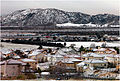 Snowfall in San Bernardino
 -
 San Bernardino, Amtrak station, Santa Fe Depot
 -
SR 210 Freeway in San Bernardino
-
San Bernardino sky line
Popular Culture References
This article contains a list of miscellaneous information. (October 2007) |
- President LB Johnson worked here as an elevator operator.
- Site of first McDonald's restaurant
- Famed British disc jockey John Peel worked at local radio station KMEN in the mid-1960s
- Burial place of guitarist Randy Rhoads in Mountain View Cemetery at Waterman and Highland Avenues.
- Site of Mick Jones' last performance with British punk band The Clash
- Mentioned in Bobby Troup's song "(Get Your Kicks On) Route 66"
- Sammy Davis Jr was involved in a car accident where he lost his eye in 1954. He was treated at San Bernardino Community Hospital.
- Will Rogers final public appearance was at the California Theatre in 1935. Two large murals of Rogers appear on the California Theater today.
- The Rolling Stones made their U.S. Concert Debut (though they had other, promotional dates first [15] at the Swing Auditorium on June 5, 1964.
- The first line of the Mark Knopfler song "Boom Like That" is 'I'm going to San Bernardino, ring-a-ding ding,' a reference to Ray Kroc's visit to the first McDonald's.
- Mentioned in a Bugs Bunny cartoon; and in the Simpsons, in the episode titled "Take My Wife, Sleaze" (Can we at least keep her till the orgy at San Berdoo?).
- "San Ber'dino" is the title of a song written by Frank Zappa and appeared on the album "One Size Fits All".
- San Bernardino is also mentioned in the Eagles Of Death Metal song "San Berdoo Sunburn" on their debut album "Peace, Love And Death Metal".
- Mentioned in the film Cars
- According to the B-Movie Cannibal Women in the Avocado Jungle of Death, it is the westernmost outpost of civilization.
- Joan Didion, in her essay Some Dreamers of the Golden Dream, described October in San Bernardino as the "season of suicide, divorce, and prickly dread, wherever the wind blows."
- The Twilight Zone episode "The Last Flight", and parts of the films The Hanoi Hilton, Terminator 3, The Fast and The Furious, Volcano, and Bad Boys were filmed at Norton Air Force Base.
- Referenced in the Creedence Clearwater Revival song Tombstone Shadow "Saw the Gypsy man way down in San Berdoo"
- Industrial punk band Mindless Self Indulgence referenced to San Bernardino in their song, "Planet of the Apes".
- Swing Auditorium in San Bernardino was the site of a "sickter" Grateful Dead performance on February 26, 1977 which featured the debut live performance of two soon-to-be dead classics, "Terrapin Station" and "Estimated Prophet".
- The city was noted in a popular rap lyric by Bay Area rap artist, Law. "Rollin down the 10 towards San Bernadino. My nigga Arick Rangwalla, half Pakistani and Chino."
- The Mountain Goats released a song titled "San Bernadino" on their 2008 album "Heretic Pride."
Nicknames, pronunciation, and abbreviations
San Bernardino has received many informal nicknames in its history. Of these, San B'dino, San Berdoo, and Berdoo [19][20] are the most common but are sometimes considered derogatory or undignified. Other, more official nicknames include: Gate City[21] (to reflect its proximity to Los Angeles, and the fact that it is at the southern/western end of the Cajon Pass, leading to the High Desert and Las Vegas, Nevada); "The Friendly City"[22];City on the Move[23]; and, most recently, The Heartbeat of Route 66[24].
The name of the city is sometimes misspelled as "San Bernadino"[25], without the second "r", based on a common mispronunciation.
Newspapers, particularly the San Bernardino County Sun, will sometimes abbreviate San Bernardino (the city but not the county) to "S.B." Doing so can cause some confusion, though, in that other places in the state, including the South Bay of Los Angeles County and Santa Barbara, California are often both abbreviated to "S.B.", as well. The name "San Bernardino" refers both to the incorporated City of San Bernardino, as well as to other associated, unincorporated areas.
Two common abbreviations are "San Bdno." and "San Bdo."; a Google search today for either abbreviation returns over 700 hits.
Notes
References
- ^ State of California, Department of Finance, E-5 Population and Housing Estimates for Cities, Counties and the State, 2001-2007, with 2000 Benchmark. Sacramento, California, May 2006[1]
- ^ "Table 1: Annual Estimates of the Population for Incorporated Places Over 100,000, Ranked by July 1, 2006 Population: April 1, 2000 to July 1, 2006" (CSV). 2005 Population Estimates. United States Census Bureau, Population Division. 2007-06-28. Retrieved 2007-06-28.
{{cite web}}: Check date values in:|date=(help)See also: List of United States cities by population - ^ San Bernardino Zip Codes: [2]
- ^ State of California, Department of Finance, E-5 Population and Housing Estimates for Cities, Counties and the State, 2001-2006, with 2000 Benchmark. Sacramento, California, May 2006[3]
- ^ City of San Bernardino, Charter section 186, San Bernardino Municipal Code section 1.28.020
- ^ Brown, Hardy, San Bernardino Black Voice News, "Brinker, Derry, Kelley & McCammack 'Wrapped Up, Tied Up, Tangled Up' . . . Ethics Gone" March 15, 2007 [4]
- ^ November 2006 Part 1 Crime in San Bernardino
- ^ Juvenile and adult arrests in San Bernardino
- ^ Sister Cities International, Inc. (SCI)
- ^ Mayor's Office - Sister Cities
- ^ "Will Gerrymandered Districts Stem the Wave of Voter Unrest?". Campaign Legal Center Blog. Retrieved 2008-02-10.
- ^ a b Advisory Services Panel (June 24–29, 2007), San Bernardino, California: Crossroads of the Southwest, Washington, D.C.: Urban Land Institute, retrieved 2007-12-26
{{citation}}: CS1 maint: date format (link) - ^ Brown, Josh (2007-07-25). "San Bernardino's base redevelopment efforts take circuitous path". Press Enterprise. Retrieved 2007-12-26.
- ^ Welcome to the Historic Site Of The First McDonalds
- ^ Summons, Trevor, San Bernardino County Sun, March 31, 2006 [5]
- ^ 19th Annual Stater Bros. Route 66 Rendezvous
- ^ NOS Festival
- ^ Pitchford, Phil, Riverside Press-Enterprise, October 17, 2006 [6]
- ^ Used since the 1870s [7]
- ^ Practical Presbyterian, Time Magazine, April 23, 1951 [8]
- ^ See The San Bernardino Daily Sun, July 1918 quoted at Santa Fe Depot and the Railroads[9]
- ^ Interview of Edward Thomann on January 9, 2003 by Professor Joyce Hanson, for the San Bernardino Oral History Project, January 9, 2003 [10][11], [12],
- ^ Interview of Edward Thomann on January 9, 2003 by Professor Joyce Hanson, for the San Bernardino Oral History Project, January 9, 2003 [13]
- ^ The Convention and Visitor's Bureau created this slogan, but no longer uses it
- ^ [14]
Further reading
- Edward Leo Lyman, San Bernardino: The Rise and Fall of a California Community, Signature Books, 1996.
- Walter C. Schuiling, San Bernardino County: Land of Contrasts, Windsor Publications, 1984
- Nick Cataldo, Images of America: San Bernardino, California, Arcadia Publishing, 2002
See also
External links
- City of San Bernardino
- California State University, San Bernardino
- San Bernardino Valley College
- San Bernardino County Fire Insurance Claims Contractors
- California Welcome Center in San Bernardino
34°07′46″N 117°17′35″W / 34.12951°N 117.29315°W
