Albefeuille-Lagarde
| Albefeuille-Lagarde | ||
|---|---|---|
|
|
||
| region | Occitania | |
| Department | Tarn-et-Garonne | |
| Arrondissement | Castelsarrasin | |
| Canton | Montech | |
| Community association | Grand Montauban | |
| Coordinates | 44 ° 4 ′ N , 1 ° 17 ′ E | |
| height | 73-102 m | |
| surface | 8.03 km 2 | |
| Residents | 633 (January 1, 2017) | |
| Population density | 79 inhabitants / km 2 | |
| Post Code | 82290 | |
| INSEE code | 82001 | |
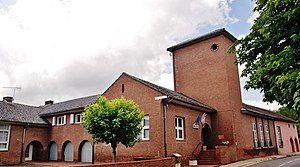
 Town hall (Mairie) of Albefeuille-Lagarde |
||
Albefeuille-Lagarde is a commune in southwest France in the Tarn-et-Garonne department in the Occitania region (before 2016 Midi-Pyrénées ). It has 633 inhabitants (as of January 1, 2017), belongs to the Arrondissement Castelsarrasin and is part of the canton of Montech (until 2015 Castelsarrasin-2 ). The inhabitants are called Algardois .
geography
Albefeuille-Lagarde is on the Tarn , which borders the municipality to the east. Albefeuille-Lagarde is surrounded by the neighboring communities Barry-d'Islemade in the north, Villemade in the north-east, Montauban in the east and south-east, Montbeton in the south and La Ville-Dieu-du-Temple in the west.
Population development
| 1962 | 1968 | 1975 | 1982 | 1990 | 1999 | 2006 | 2017 |
| 505 | 549 | 578 | 601 | 632 | 644 | 631 | 633 |
| Sources: Cassini and INSEE | |||||||
Attractions
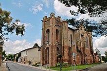
- Saint-Pierre-ès-Liens church in Lagarde, rebuilt in 1930
- Le Tap Chapel in Albefeuille
Web links
Commons : Albefeuille-Lagarde - Collection of images, videos and audio files

