Antweiler (Mechernich)
|
Antweiler
City of Mechernich
Coordinates: 50 ° 36 ′ 23 " N , 6 ° 44 ′ 49" E
|
||
|---|---|---|
| Height : | 239 m above sea level NHN | |
| Area : | 4.92 km² | |
| Residents : | 784 (June 30, 2017) | |
| Population density : | 159 inhabitants / km² | |
| Incorporation : | 1st July 1969 | |
| Incorporated into: | Veytal | |
| Postal code : | 53894 | |
| Area code : | 02256 | |
|
Location of Antweiler in North Rhine-Westphalia |
||
Antweiler is a district of the city of Mechernich in the Euskirchen district in North Rhine-Westphalia .
geography
The village is located in the "Antweiler Senke", in which there are clay and kaolin deposits and clay pits . It is the easternmost district of Mechernich, which borders the city of Euskirchen in the north and east . To the west is the Lessenich district , to the south the Wachendorf district .
history
On July 1, 1969, Antweiler was incorporated into Veytal .
On January 1, 1972, the municipality of Veytal (with the exception of the district Schwerfen, which came to the city of Zülpich ) was incorporated into the municipality (now the city) of Mechernich .
Culture and sights
Upper castle
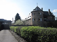
This is the remains of a moated castle. The square complex consisted of a two-wing residential building, of which only an archway and a tower of the outer bailey have been preserved.
Lower castle
The complex, also known as the Antweiler Lower Castle, is a 16th century moated castle.
Parish Church of St. Johann Baptist
Of the original church from the 13th century, only the tower remains today; the current building was added to it in 1852.
See also St. Johann Baptist (Antweiler)
Kalkarer Moor
To the east of the place - but no longer in the Mechernich area - lies the Kalkarer Moor / Toni clay pit nature reserve . This is a calcareous moorland west and south-west of the small town of Kalkar and an abandoned clay pit with a quarry pond.
House Maria Rast
The house is located east of the village in the Euskirchen area. In the former monastery there is a Catholic educational establishment run by the Secular Institute of the Schoenstatt Sisters of Mary .
traffic
District road 24 and state road 11 meet on the outskirts .
Web links
- Antweiler on the website of the city of Mechernich
Individual evidence
- ↑ Life in Mechernich. City of Mechernich, accessed January 5, 2018 .
- ↑ Martin Bünermann: The communities of the first reorganization program in North Rhine-Westphalia . Deutscher Gemeindeverlag, Cologne 1970, p. 87 .
- ^ Federal Statistical Office (ed.): Historical municipality directory for the Federal Republic of Germany. Name, border and key number changes in municipalities, counties and administrative districts from May 27, 1970 to December 31, 1982 . W. Kohlhammer, Stuttgart / Mainz 1983, ISBN 3-17-003263-1 , p. 309 .
- ↑ Entry by Alexandra Zingler on Antweiler Oberburg in the scientific database " EBIDAT " of the European Castle Institute, accessed on July 11, 2017.
- ↑ St. Johann Baptist - The Church. Catholic pastoral care area Veytal, accessed on July 11, 2017 .
- ↑ Nature reserve "Kalkarer Moor / Tongrube Toni" in the specialist information system of the State Office for Nature, Environment and Consumer Protection in North Rhine-Westphalia , accessed on July 11, 2017.


