Bělušice
| Bělušice | ||||
|---|---|---|---|---|
|
||||
| Basic data | ||||
| State : |
|
|||
| Region : | Ústecký kraj | |||
| District : | Must | |||
| Area : | 1081.7166 ha | |||
| Geographic location : | 50 ° 27 ' N , 13 ° 46' E | |||
| Height: | 333 m nm | |||
| Residents : | 219 (Jan 1, 2019) | |||
| Postal code : | 434 01 | |||
| License plate : | U | |||
| traffic | ||||
| Street: | Most - Louny | |||
| Railway connection: | Čížkovice – Obrnice | |||
| structure | ||||
| Status: | local community | |||
| Districts: | 3 | |||
| administration | ||||
| Mayor : | Veronika Pochobradská (as of 2013) | |||
| Address: | Bělušice 64 434 01 Most |
|||
| Municipality number: | 567051 | |||
| Website : | www.belusice.cz | |||
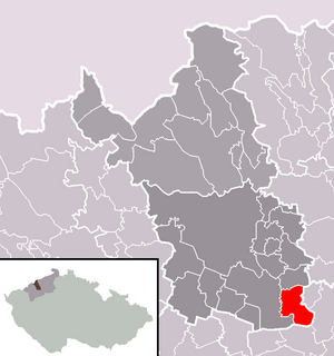
| Location of Bělušice in the Most district | ||||

|
||||
Bělušice [ ˈbjɛlʊʃɪtsɛ ] (German Bieloschitz ) is a municipality in the Czech Republic . It is located twelve kilometers southeast of Most and belongs to the Okres Most .
geography
Bělušice is located in the southwest of the Bohemian Uplands on the northeast slope of the hill Bělouš ( Bielausch , 399 m) in the area of the protected landscape area CHKO České středohoří . The village is on the left side of the Bělušický creek opposite its confluence with the Zaječický creek. The Skršínský vrch (389 m), the Jílový (346 m) and the Chrámecký vrch (392 m) rise to the north, the Tobiášův vrch (354 m) to the northeast, the Dlouhá (483 m) to the east, the Skála (386 m) to the south m) and the Milá (510 m), southwest of the Bělouš (399 m), the Světecký vrch (416 m) and the Dlouhý vrch (413 m) and to the west of the Ovčí vrch (332 m). The I / 28 road between Most and Louny and the Čížkovice – Obrnice railway line run north of the village ; the Bělušice railway station is 500 meters outside the village.
Neighboring towns are Skršín , Dobrčice, Chrámce and Žichov in the north, Měrunice , Kozly and Hořenec in the north-east, Jablonec and Libčeves in the east, Sinutec and Odolice in the south-east, Raná and Milá in the south, Počerady and Volevčice in the south-west, Bečov in the west and Bedřecův Světřichův in the north-west.
history
The first written mention of the place was in 1231 as the seat of the Vít von Bělušice. The village emerged around the festivals of the Vladiks from Bělušice. The place name is derived from the hill Bělouš (Czech for mold ). In 1240 Boleslav von Bělušice was named as the owner, in 1377 the estate belonged to Jindřich and Bozděch von Bělušice. Jan von Bělušice, mentioned in 1404, was the last landlord of this family. Between 1408 and 1421 the Vladiken Wchinsky owned the fortress. From 1465 Jiří von Truzenice, from 1523 Johann Charwat von Bärnstein, and from 1566 the lords of Bila belonged to the following owners . In 1570 the Charwat von Bärnstein gentlemen bought the estate back. Adam Charwat von Bärnstein was lynched in a tavern fight in Kozly in 1616 after he had forcibly forced the peasant women to dance while they were dancing. After the class uprising of 1618 , Johann Charwat von Bärnstein bought the Kozly estate, which had been confiscated from the Prague cathedral chapter, in 1620 . Charwat, who had participated in the uprising, was spared from a confiscation of his property after the battle of the White Mountain , only the Kozly estate was withdrawn from him in 1623 and returned to the cathedral chapter. With the death of Johann Charwat von Bärnstein, the Charwat von Bärnstein family became extinct in the male line. His daughter Elisabeth, who was married to Karl Chotek von Choczkow and brought her inheritance through heraldic association in 1625, became the sole heir to the Chotek family , who held and expanded the Bieloschitz estate for over 300 years. Wenzel Chotek von Chotkow bought the Skirschin estate in 1707 for 30,500 . In 1750 he acquired the Kosel estate for 11,000 guilders from the Prague cathedral chapter and combined both with the Bieloschitz allodial estate . He was born in 1754 in the new family vault of Counts Chotek in the Church of St. Martin is buried in Kosel. The following owners were his son Johann Karl Chotek von Chotkow , from 1787 his son Johann Rudolph Chotek von Chotkow and from 1824 his grandson Heinrich Chotek von Chotkow.
In 1831 the allodial property Bieloschitz with Kosel comprised a usable area of 2105 yoke 1296 square fathoms; Of this, 1377 yokes were 344 square fathoms on the Bieloschitz estate and 728 yokes 952 square fathoms were on the Kosel estate. The main source of income was agriculture, the authorities managed the three Meierhöfe in Bieloschitz, Milay and Skirschina on their own. The only forest area was the Zwinkenbusch (Svinky) near Kosel. The Allodialgut Bieloschitz formed the most south-westerly tip of the Leitmeritz district , it bordered on the north, west and south of the Saatzer district. The villages Bieloschitz, Milay (Milá) , Skirschina and Kosel belonged to the estate ; 717 German-speaking people lived on the rulership, of whom only the oldest were able to speak the Czech language. The village Bieloschitz / Bělossice consisted of 43 houses with 260 inhabitants. In the village there was a public chapel, an official farm and a sheep farm. The grinding mill Grundmühle (Pozemkový mlýn) was on the side . 38 houses were parish off to Hochpetsch , the remaining five to Kosel. Until the middle of the 19th century Bieloschitz was the official village of the allodial estate Bieloschitz with Kosel.
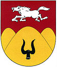
After the abolition of patrimonial formed Bieloschitz / Bělušice 1850 a district of the municipality Kosel / Kozly in Leitmeritzer county and judicial district Bilin . From 1868 the village belonged to the Teplitz district and from 1896 to the Dux district . In 1869 Bieloschitz had 297 inhabitants, in 1910 there were 305. In the 1920s, the larger community of Kosel disintegrated, one of the newly created communities was Bieloschitz / Bělušice . In the course of the land reform, the Bieloschitz estate, which belonged to Count Chotek, was parceled out in 1925 and the Banek family became the new owners. In 1930 there were 263 people living in Bieloschitz. As a result of the Munich Agreement , Bieloschitz was added to the German Reich in 1938 and initially belonged to the Dux district . From May 1, 1939, the village was part of the newly formed district of Bilin . In the census of May 17, 1939, the community had 244 inhabitants. After the end of the Second World War, Bělušice came back to Czechoslovakia and the German-Bohemian population was expelled . In 1948 the Banek family was expropriated. A labor camp was established on the southern outskirts in 1958, and a new prison was later built in its place. In the course of the abolition of the Okres Bílina, the community was assigned to the Okres Most in 1961, while Bedřichův Světec and Odolice were incorporated. In the second half of the 20th century, the population of Bělušice steadily decreased. In 1950 the village had 169 inhabitants; In 1961 there were 126 and in 1970 only 117. Since 2003 the community has had a coat of arms and a banner.
Bělušice Prison
Up until 1989, prisoners from the I Corrector Group (minor criminal first offenders) and, to a lesser extent, from the II Corrector group (repeat offenders and serious criminal first offenders) were housed in Bělušice. Since the political turning point, it has served as a maximum security prison for seriously criminal men with prison terms of up to 15 years.
Community structure
The municipality Bělušice consists of the districts Bedřichův Světec (Schwetz) , Bělušice (Bieloschitz) and Odolice (Wodolitz) . The municipality is divided into the cadastral districts of Bedřichův Světec, Bělušice u Mostu and Odolice.
Attractions
- Late Romanesque church of St. Jacob in Bedřichův Světec, built in the 14th century
- Bělušice Gothic fortress, first mentioned in 1408, but probably originated in the 13th century. In 1815 parts of the fortress were canceled. A part of the medieval walls has probably been preserved in the house of the courtyard (house no. 1). The most important building in the ensemble is the Salla terrena (house number 56), built around 1700 , which was restored in the 2000s. After the Velvet Revolution, the farm was returned to the Banek family.
- Wayside shrine
- Baroque statue of St. John of Nepomuk on the southwestern part of the village square, created in 1725
- Milá Mountain , nature reserve that has retained its steppe and forest steppe character.
Web links
Individual evidence
- ↑ http://www.uir.cz/obec/567051/Belusice
- ↑ Český statistický úřad - The population of the Czech municipalities as of January 1, 2019 (PDF; 7.4 MiB)
- ^ Johann Gottfried Sommer: The Kingdom of Bohemia, Vol. 1: Leitmeritzer circle. 1833, pp. 61-63.
- ^ Michael Rademacher: German administrative history from the unification of the empire in 1871 to the reunification in 1990. Bilin district. (Online material for the dissertation, Osnabrück 2006).
- ↑ http://www.uir.cz/casti-obce-obec/567051/Obec-Belusice
- ↑ http://www.uir.cz/katastralni-uzemi-obec/567051/Obec-Belusice


