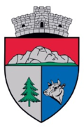
Ciuruleasa
|
Ciuruleasa Csurulyásza |
||||
|
||||
| Basic data | ||||
|---|---|---|---|---|
| State : |
|
|||
| Historical region : | Transylvania | |||
| Circle : | Alba | |||
| Coordinates : | 46 ° 15 ' N , 23 ° 2' E | |||
| Time zone : | EET ( UTC +2) | |||
| Height : | 615 m | |||
| Area : | 55.85 km² | |||
| Residents : | 1,197 (October 20, 2011) | |||
| Population density : | 21 inhabitants per km² | |||
| Postal code : | RO-517250 | |||
| Telephone code : | (+40) 02 58 | |||
| License plate : | FROM | |||
| Structure and administration (as of 2016) | ||||
| Community type : | local community | |||
| Structure : | Ciuruleasa, Bidigeşti , Bodreşti , Bogleşti , Buninginea , Gheduleşti , Mătişeşti , Morăreşti , Vulcan | |||
| Mayor : | Radu-Marcel Tuhuț ( PSD ) | |||
| Postal address : | Str. Principală, no. 1 loc. Ciuruleasa, jud. Alba, RO-517250 |
|||
| Website : | ||||
Ciuruleasa ( Hungarian Csurulyásza ) is a Romanian municipality in the Alba district in Transylvania .
Geographical location
Ciuruleasa with the eight incorporated villages is located in the valley of the Cernița river in the Apuseni Mountains , in the south-western part of the historic Motzenland . The southeastern half of the municipality is in the Transylvanian Ore Mountains (Munții Metaliferi) and the northwestern in the southern valleys of the Bihor Mountains . Located at Drum național 74 ( Abrud - Brad ), it is 6 kilometers to the next town of Abrud; the district capital Alba Iulia is 71 kilometers southeast of Ciuruleasa. In the landscape dominated by meadows and mountains, 1335 hectares of the 5585 hectares are used for agriculture. 4085 hectares are forests, 117 hectares are unproductive areas and the rest is assigned to courtyards, buildings, waterways and roads.
history
Due to the nearby mining region around today's city of Abrud , which has been known since ancient times , there has been no independent historical research for Ciuruleasa. The region was given to a Hungarian nobleman named Gyula by the Hungarian King Emmerich in 1201 ; In 1276 she came to the Catholic diocese in Weißenburg .
The current district of Buninginea is first mentioned in 1589. In 1727 the inhabitants of the Cernița valley rose and occupied the town hall of Abrud. In 1784 the rebels around Horea ( Vasile Ursu Nicola ), Cloşca ( Ion Oargă ) and Crişan ( Marcu Giurgiu ) held camp here before attacking Abrud. During the Romanian Revolution of 1848 there was fighting between the troops of Avram Iancu and units of the Hungarian Revolutionary Army .
Ciuruleasa is only recorded in 1850 under Csiurul Karcza and in 1854 under Csuruliasa . Until 1950 Ciuruleasa was administered by Abrud-Sat ( Abruden ) - today a village in the small town of Abrud - and has been a municipality since then.
population
In the census of 1850, 1838 inhabitants were registered in the area of today's municipality, almost exclusively Romanians . Of these, 1103 lived in Ciuruleasa and 735 in the incorporated village of Buninginea (including 3 Roma ). In 1941 the population reached its highest level of 2685 in total. In 1956, 2332 people lived in the community; in Ciuruleasa itself there were 614, in Bidigeşti 113, in Bodreşti 117, in Bogleşti 309, in Buninginea (Hungarian Buninzsina ) 593, in Gheduleşti 166, in Mătişeşti 152, in Morăreşti 119 and in Vulcan 149. After 1956 the number of the Residents steadily. In the 2002 census, 1368 people (exclusively Romanians) were registered.
Attractions
- The Romanian Orthodox Church Sf. Gheorghe , built in 1777.
- In the center of Ciuruleasa, the monument in honor of Avram Iancu and in memory of the fighting that took place here during the revolution of 1848 .
Web links
Individual evidence
- ↑ 2011 census in Romania ( MS Excel ; 1.3 MB)
- ↑ Mayoral elections 2016 in Romania ( MS Excel ; 256 kB)
- ↑ Information on the independent administration of Ciuruleasa at cjalba.ro accessed on February 16, 2016 (Romanian; PDF; 3.5 MB)
- ↑ Census, last updated October 30, 2008, p. 76 (Hungarian; PDF file; 1.1 MB)
- ↑ The church in Ciuruleasa at biserici.org accessed on November 6, 2012 (Romanian)
- ↑ Information on the construction of the church from basilica.ro accessed on February 16, 2016 (Romanian)


