
Bucium (Alba)
|
Bucium tree village Bucsony |
|||||
|
|||||
| Basic data | |||||
|---|---|---|---|---|---|
| State : |
|
||||
| Historical region : | Transylvania | ||||
| Circle : | Alba | ||||
| Coordinates : | 46 ° 16 ' N , 23 ° 11' E | ||||
| Time zone : | EET ( UTC +2) | ||||
| Height : | 737 m | ||||
| Area : | 85.70 km² | ||||
| Residents : | 1,454 (October 20, 2011) | ||||
| Population density : | 17 inhabitants per km² | ||||
| Postal code : | 517165 | ||||
| Telephone code : | (+40) 02 58 | ||||
| License plate : | FROM | ||||
| Structure and administration (as of 2016) | |||||
| Community type : | local community | ||||
| Structure : | Bucium, Angheleşti , Bisericani , Bucium-Sat , Cerbu , Ciuculeşti , Coleşeni , Dogăreşti , Fereşti , Floreşti , Gura Izbitei , Heleşti , Izbicioara , Izbita , Jurcuieşti , Lupuleşti , Magura , Muntari , Petreni , Poiana , Poieni , Stâlnişoara , Valcea , Valea Abruzel , Valea Albă , Valea Cerbului , Valea Negrilesii , Valea Poienii , Valea Șesii , Văleni | ||||
| Mayor : | Cornel Napau ( PSD ) | ||||
| Postal address : | Str. Principală, no. 25 loc. Bucium, jud. Alba, RO-517165 |
||||
| Website : | |||||


Bucium (outdated Bucium-Șasa ; German Baumdorf , Hungarian Bucsony ) is a Romanian municipality in the Alba district in Transylvania .
Bucium is also known under the Hungarian name Bucsum .
location

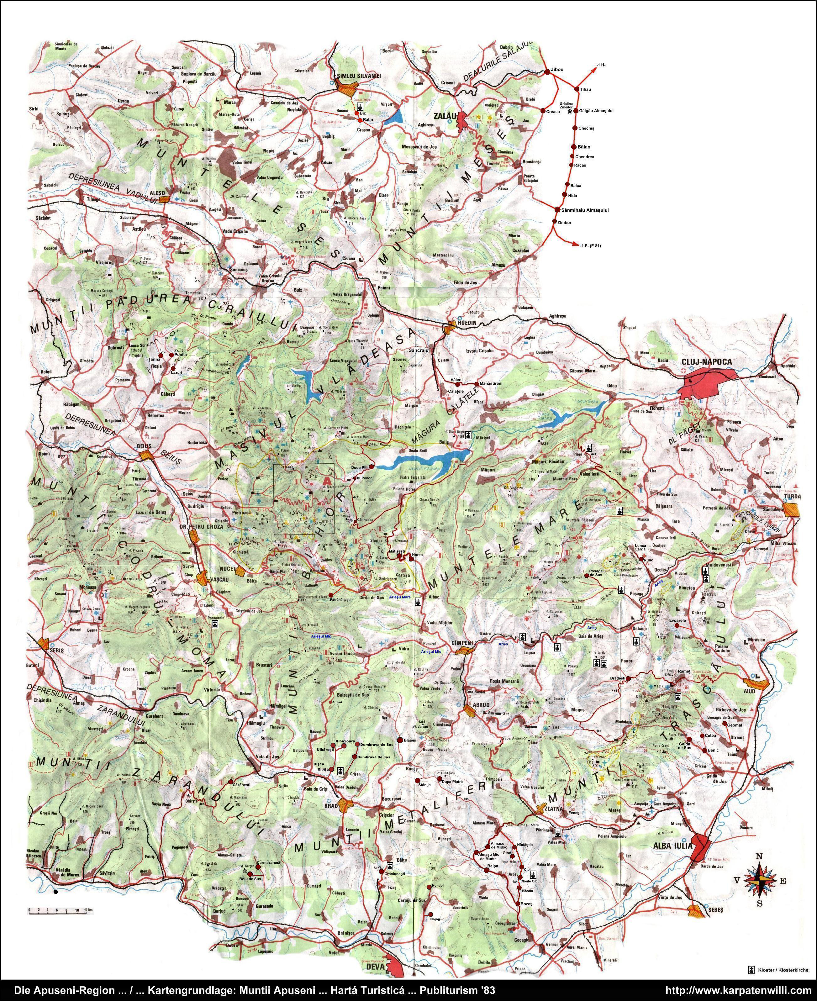
Bucium is located in the valley of the Abrud River in the Transylvanian Ore Mountains ( Munții Metaliferi , part of the Apuseni Mountains ), in western Transylvania . The next city Abrud is about 12 kilometers to the west, and the district capital Alba Iulia is about 73 kilometers southeast of Bucium. It consists of about 30, mostly small settlements.
history
The place was first mentioned in 1595 under the name Buchin . Since then, it has been mainly characterized by pasture farming. Numerous residents also worked in gold mines and gold panning.
population
In 2002, all of the 1792 inhabitants of the municipality, with the exception of one Hungarian, referred to themselves as Romanians . The population has decreased significantly since the Second World War (4119 in 1941). The highest number of Germans (64) was registered in 1850, almost all of them in the incorporated village of Poieni (ung. Bucsumpojén ).
In 2002, 115 people lived in Bucium itself.
traffic
Bucium is about six kilometers east of Drum național 74 ( Abrud - Zlatna ), on the partially paved county road ( Drum județean ) DJ 107I from Abrud to Aiud .
Attractions

- East of Bucium are the basalt rocks Detunata Goală (1169 m) and Detunata Flocoasă (1258 m).
- In the municipality there is an approximately 300 hectare daffodil meadow near the Valea Negrilesii settlement .
Born in Bucium
- Ion I. Agârbiceanu (1907–1971), physicist, was a corresponding member of the Romanian Academy in 1963 .
Web links
Individual evidence
- ↑ 2011 census in Romania ( MS Excel ; 1.3 MB)
- ↑ Mayoral elections 2016 in Romania ( MS Excel ; 256 kB)
- ^ Dictionary of the localities in Transylvania
- ↑ Bucium at sate-comune.ro ( Memento from April 13, 2010 in the Internet Archive ) (Romanian)
- ↑ Heinz Heltmann, Gustav Servatius (Ed.): Travel Guide Siebenbürgen. Kraft-Verlag, Würzburg 1993, ISBN 3-8083-2019-2 .
- ↑ Census, last updated October 30, 2008, p. 60 (PDF file; 1.14 MB)
- ↑ Map on www.karpatenwilli.com
- ↑ Ion I. Agârbiceanu at Crispedia.ro, accessed on August 23, 2012 ( Memento of 12 December 2015, Internet Archive ) (Romanian)
- ↑ Information on Ion I. Agârbiceanu at Academia Română, accessed on August 23, 2012
Albac | Almașu Mare | Arieșeni | Avram Iancu | Berghin | Bistra | Blandiana | Bucerdea Grânoasă | Bucium | Câlnic | Cenade | Cergău | Ceru-Băcăinți | Cetatea de Baltă | Ciugud | Ciuruleasa | Crăciunelu de Jos | Cricău | Cut | Daia Română | Doștat | Fărău | Galda de Jos | Gârbova | Gârda de Sus | Hopârta | Horea | Ighiu | Întregalde | Jidvei | Livezile | Lopadea Nouă | Lunca Mureșului | Lupșa | Meteș | Mihalț | Mirăslău | Mogoș | Noșlac | Ocoliș | Ohaba | Pianu | Poiana Vadului | Ponor | Poșaga | Rădeşti | Râmeț | Rimetea | Roșia de Secaș | Roșia Montană | Sălciua | Săliştea | Sâncel | Sântimbru | Săsciori | Scărișoara | Șibot | Sohodol | Șona | Șpring | Stremț | Șugag | Unirea | Vadu Moților | Valea Lunga | Vidra | Vințu de Jos