Breña district
| Breña district | ||
|---|---|---|
 Location of the district in the province of Lima |
||
| Symbols | ||
|
||
| Basic data | ||
| Country | Peru | |
| region | region free | |
| province | Lima | |
| surface | 3.2 km² | |
| Residents | 85,309 (2017) | |
| density | 26,493 inhabitants per km² | |
| founding | July 15, 1949 | |
| ISO 3166-2 | PE | |
| Website | www.munibrena.gob.pe (Spanish) | |
| politics | ||
| Alcalde District | José Dalton Li Bravo (2019-2022) |
|
| Political party | Acción Popular | |
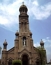
| Basílica María Auxiliadora | ||
Coordinates: 12 ° 3 ′ 26 ″ S , 77 ° 3 ′ 6 ″ W
The Breña District is one of the 43 urban districts of the Lima Metropolitana Region in Peru . It has an area of 3.22 km² and is therefore the second smallest in Lima. The 2017 census counted 85,309 inhabitants. In 1993 the population was 89,973, in 2007 81,909. The district was established on July 15, 1949.
Geographical location
The Breña district is centrally located in Lima. It is located 2.5 km southwest of the Plaza des Armas de Lima. The almost square district area measures around 1.8 by 1.9 km. The main streets Avenida Arica and Avenida Aguarico meet in the center of the district.
The Breña district borders in the west, north and east on the Lima district (Cercado de Lima), in the southeast on the Jesús María district and in the southwest on the Pueblo Libre district .
Web links
- Municipalidad de Breña
- Peru: Region Lima (provinces and districts) at www.citypopulation.de

