Frasses
| Frasses | ||
|---|---|---|
| State : |
|
|
| Canton : |
|
|
| District : | Broye | |
| Municipality : | Les Montets | |
| Postal code : | 1483 | |
| former BFS no. : | XXXX | |
| Coordinates : | 556 363 / 187070 | |
| Height : | 482 m above sea level M. | |
| Residents: | 162 (2002) | |
|
Frasses |
||
| map | ||
|
|
||
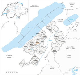
Frasses ( Freiburger Patois ) is a village and formerly an independent political municipality in the Broye district of the canton of Friborg in Switzerland . On January 1, 2004, Frasses merged with Granges-de-Vesin , Montet (Broye) and Aumont to form the new municipality of Les Montets .
Frasses is also the former French name of the municipality of Fräschels in the lake district of the canton of Friborg.
geography
Frasses lies at 482 m above sea level. M. , three kilometers south-southeast of the district capital Estavayer-le-Lac (linear distance ). The small farming village extends on a hill around which the Arignon brook flows (left side brook of the Petite Glâne ), on the northeastern edge of the Molasse hill country between Lake Neuchâtel and the Broyetal , in the north-western Freiburg Central Plateau . The former municipality area was around 2.0 km². The little relief area comprised the broad valley basin of the Arignon, reached in the northeast to the height of Haut de Croix ( 507 m above sea level ) and in the east to the edge of the Broye plain.
population
With 162 inhabitants (2002), Frasses was one of the small communities in the canton of Friborg before the merger. In 1850 the village had 123 inhabitants, in 1970 only 95 inhabitants. A few individual farms belong to Frasses.
economy
Up until the second half of the 20th century, Frasses was a predominantly agricultural village. Even today, arable farming , fruit growing and animal husbandry have an important place in the income structure of the population. Some other jobs are available in local small businesses and in the service sector. In the last few decades the village has also developed into a residential community. Many employed people are therefore commuters who mainly work in the Estavayer-le-Lac and Payerne regions.
traffic
The village has good transport links. It is located on the old main road from Payerne to Estavayer-le-Lac . The nearest connection to the A1 motorway (Lausanne – Bern), which opened in 2001 and crosses the northern municipality, is around 1 km from the town center. Frasses is connected to the public transport network by a bus line operated by Transports publics Fribourgeois , which serves the hinterland on a circular route from Estavayer-le-Lac.
history
The area of Frasses was settled very early. Traces of settlement from the Bronze Age , the Iron Age and the Roman Age have been discovered near the village . In addition, graves from the La Tène period and the Roman era were found.
The place was first mentioned in 1142 under the name Fraces , derived from the Latin word fraxinus (ash). Since the Middle Ages Frasses was under the rule of Estavayer. After Bern had conquered the Vaud in 1536, the village came under the rule of Friborg and was assigned to the Estavayer Bailiwick. After the collapse of the Ancien Régime (1798), Frasses was part of the Estavayer district during the Helvetic and subsequent periods before being incorporated into the Broye district in 1848. Frasses does not have its own church, it belongs to the parish of Montet (Broye) .
As part of the community mergers promoted by the canton of Friborg since 2000, the residents of Frasses, Montet (Broye) , Granges-de-Vesin and Aumont spoke out in favor of a merger. With effect from January 1st, 2004 the new municipality of Les Montets was created .
Attractions
Web links
- Marianne Rolle: Frasses. In: Historical Lexicon of Switzerland .
- Aerial views of the village


