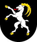
Forel FR
| FR is the abbreviation for the canton of Friborg in Switzerland and is used to avoid confusion with other entries of the name Forel . |
| Forel | ||
|---|---|---|
| State : |
|
|
| Canton : |
|
|
| District : | Broye | |
| Municipality : | Estavayer | |
| Postal code : | 1475 | |
| former BFS no. : | 2018 | |
| Coordinates : | 558.05 thousand / 191813 | |
| Height : | 465 m above sea level M. | |
| Area : | 5.03 km² | |
| Residents: | 368 (December 31, 2005) | |
| Population density : | 73 inhabitants per km² | |
|
Forel FR |
||
| map | ||
|
|
||
Forel (FR) ( Freiburger Patois ) is a town and formerly an independent political municipality in the Broye district of the canton of Friborg in Switzerland . With effect from January 1, 2006, Forel merged with Autavaux and Montbrelloz to form the new municipality of Vernay . The village has been part of the Estavayer municipality since 2017 .
geography
Forel lies at 465 m above sea level. M. , four kilometers northeast of the district capital Estavayer-le-Lac (air line). The village extends on a plateau above the south bank of Lake Neuchâtel , on the ridge between the lake and the Broye plain , in the northwestern Freiburg Central Plateau .
The area of the 5.0 km² former municipal area comprised a section on the south bank of Lake Neuchâtel (around 2.2 km of the lakeshore line). The community soil extended southwards from the lake shore over a flat edge of the bank, which is partly made of reeds, partly with forest, and over a 30 m high steep slope onto the Forel plateau. This plateau is divided by two short erosion valleys , with the valley of the village stream of Autavaux forming the south-western border. To the east, the municipal area extended over the forest area Bois des Esserts to the plateau of Les Planches and reached Belmont at 505 m above sea level on the corridor . M. the highest point of Forel. In 1997, 5% of the former municipal area was in settlements, 24% in forests and woodland, 69% in agriculture and a little more than 2% was unproductive land.
Forel includes the hamlet of Les Planches ( 494 m above sea level ) on the ridge between Lake Neuchâtel and the Broye plain, as well as some individual farms. Neighboring communities of Forel were Autavaux and Rueyres-les-Prés in the canton of Friborg and Grandcour and Chevroux in the canton of Vaud .
population
With 368 inhabitants (end of 2005) Forel was one of the small communities in the canton of Friborg. 92.0% of the residents are French-speaking, 5.9% German-speaking and 1.8% speak Italian (as of 2000). The population of Forel was 155 people in 1850 and 183 people in 1900. During the 20th century, the population fluctuated between 170 and 220 people. Only since 1980 (195 inhabitants) has there been significant population growth.
economy
Forel was a predominantly agricultural village until the second half of the 20th century . Even today, agriculture , fruit growing and animal husbandry have an important place in the income structure of the population. Some other jobs are available in local small businesses and in the service sector. In the past few decades, Forel has also developed into a residential community thanks to its attractive location. Many employed people are therefore commuters who work mainly in Estavayer-le-Lac and in the Payerne region.
traffic
The village is off the main thoroughfares, but is easily accessible from Estavayer-le-Lac . Forel is connected to the public transport network by a bus from the Transports publics Fribourgeois , which runs as a circular route from Estavayer-le-Lac.
history
The Forel area was settled very early. The remains of two Neolithic and Bronze Age settlements have been found near the lake shore . The first written mention of the place took place in 1239 under the name Forest . The place name goes back to the late Latin forestum , which means forest , which was reserved as a hunting area for noble families in the Middle Ages. The hamlets and farms outside a closed place were also mentioned in the old French forest .
Since the Middle Ages Forel has been under the lords of Estavayer. After Bern had conquered the Vaud in 1536, the village came under the rule of Friborg and was assigned to the Estavayer Bailiwick. After the collapse of the Ancien Régime (1798), Forel was part of the Estavayer district during the Helvetic and subsequent periods before being incorporated into the Broye district in 1848.
As part of the amalgamation of municipalities promoted by the canton of Friborg since 2000, Forel merged with effect from January 1, 2006 with the previously independent municipalities of Autavaux and Montbrelloz to form the new municipality of Vernay .
Attractions
The Saint-Gorgon-et-Garin chapel dates from 1687 and was enlarged in 1923 to become today's parish church. Forel has only been an independent parish since then, before it belonged to the parish of Rueyres-les-Prés. Some stately farmhouses from the 17th to 19th centuries have been preserved in the town center.
Web links
- Marianne Rolle: Forel (FR). In: Historical Lexicon of Switzerland .
- Aerial views of the village


