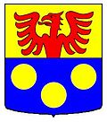
Cheiry
| Cheiry | |
|---|---|
| State : |
|
| Canton : |
|
| District : | Broye |
| BFS no. : | 2009 |
| Postal code : | 1529 |
| Coordinates : | 553 748 / 177733 |
| Height : | 563 m above sea level M. |
| Height range : | 504–710 m above sea level M. |
| Area : | 6.45 km² |
| Residents: | 416 (December 31, 2018) |
| Population density : | 64 inhabitants per km² |
| Website: | www.cheiry.ch |
|
Cheiry |
|
| Location of the municipality | |
Cheiry ( Freiburger Patois ) is a municipality in the Broye district in the canton of Friborg in Switzerland . With effect from January 1, 2005, the previously independent community Chapelle (Broye) was incorporated into Cheiry.
geography
Cheiry lies at 563 m above sea level. M. , 12 km southwest of Payerne ( linear distance ) in the Freiburg exclave Surpierre . The farming village extends in the Lembe Valley , above the mouth of a side stream that rises on the Combremont plateau, in the hill country west of the Broyetal , in the western Freiburg Central Plateau .
The 6.5 km² municipal area covers a section of the Molasse hill country between Lake Neuchâtel and the middle Broyetal. The Lembe flows through the area from southwest to northeast, which has a 200 to 500 m wide flat valley floor. The valley is accompanied on its north-western side by the heights of La Maule ( 679 m above sea level ) and Bois d'Aclex , and in the south-east by the forest heights of Bois d'Amont and Grand Bois (ridge between the valleys of Lembe and Broye). The highest point of Cheiry is 711 m above sea level. M. on the north slope of the Bois d'Amont. In 1997, 7% of the municipal area was accounted for by settlements, 25% for forests and woodlands and 68% for agriculture.
Cheiry includes the hamlets of Chapelle (Broye) ( 622 m above sea level ) on the Fin de la Golâ terrace to the left of the Lembetal, Coumin-Dessous ( 520 m above sea level ) on the Lembe and Coumin-Dessus ( 558 m above sea level) . M. ) on a terrace on the right valley slope of the Lembe and some individual farms. Neighboring municipalities of Cheiry are Prévondavaux and Surpierre in the canton of Friborg and Forel-sur-Lucens , Granges-près-Marnand , Sassel , Combremont-le-Grand and Combremont-le-Petit in the canton of Vaud .
population
With 416 inhabitants (as of December 31, 2018), Cheiry is one of the small communities in the canton of Friborg. 89.1% of the residents are French-speaking, 7.0% German-speaking and 1.5% speak English (as of 2000). The population of Cheiry was 418 in 1850 and 379 in 1900 (including the Chapelle, which is now incorporated). In the course of the 20th century, the population continued to decrease to 258 people by 1980 due to strong emigration. Only since then has there been significant population growth again.
economy
Cheiry was a predominantly agricultural village until the second half of the 20th century . Even today, have agriculture , the cultivation of tobacco , the dairy industry and animal husbandry an important role in the employment structure of the population. Further jobs are available in local small businesses and in the service sector. In the last few decades the village has also developed into a residential community. Many workers are therefore commuters who mainly work in the Payerne region.
traffic
The community is located off the main thoroughfares on a connecting road from Granges-près-Marnand to Thierrens . The village is connected to the public transport network through a post bus course that runs from Granges-près-Marnand to Cheiry.
history
The municipality of Cheiry was settled very early, which has been confirmed by various finds of devices that were used in the La Tène period . The first written mention of the place took place in 1185 under the name Chirie . The spellings Zeiry (1295) and Cheirier (1668) also appeared later . The place name goes back to the Roman personal name Carius .
Since the Middle Ages Cheiry has been under the rule of Surpierre. With this, the village came on February 21, 1536 to Bern and on March 1, 1536 under the rule of Freiburg, where it was assigned to the Bailiwick of Surpierre. In 1624, almost all the houses in the village fell victim to a fire. After the collapse of the Ancien Régime (1798), Cheiry belonged to the Estavayer district until 1803 and then to the Surpierre district during the Helvetic Republic, before being incorporated into the Broye district in 1848. Cheiry hit the headlines in 1994 when 23 Sun Temple members committed mass suicide in a house .
As part of the community mergers promoted by the canton of Friborg since 2000, the previously politically independent community of Chapelle (Broye) was incorporated into Cheiry with effect from January 1, 2005.
Attractions
Cheiry had a parish church since 1228. The current modern building dates from 1967. In the center of the village there are still some characteristic farmhouses from the 17th to 19th centuries.
Web links
- Official website of the municipality of Cheiry (French)
- Marianne Rolle: Cheiry. In: Historical Lexicon of Switzerland .
- Aerial views of the village
Individual evidence
- ↑ Permanent and non-permanent resident population by year, canton, district, municipality, population type and gender (permanent resident population). In: bfs. admin.ch . Federal Statistical Office (FSO), August 31, 2019, accessed on December 22, 2019 .


