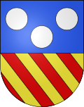
Villeneuve FR
| FR is the abbreviation for the canton of Friborg in Switzerland and is used to avoid confusion with other entries of the name Villeneuve . |
| Villeneuve | ||
|---|---|---|
| State : |
|
|
| Canton : |
|
|
| District : | Broye | |
| Municipality : | Surpierre | |
| Postal code : | 1527 | |
| former BFS no. : | 2047 | |
| Coordinates : | 556 441 / 177 341 | |
| Height : | 481 m above sea level M. | |
| Area : | 3.54 km² | |
| Residents: | 374 (December 31, 2015) | |
| Population density : | 106 inhabitants per km² | |
| Website: | www.surpierre-fr.ch | |
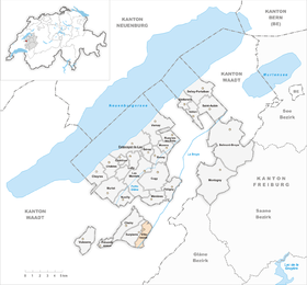
| map | ||
|
|
||
Until December 31, 2016, Villeneuve was a municipality in the Broye district of the canton of Friborg in Switzerland . On January 1, 2017, it merged with Surpierre .
geography
Villeneuve is 481 m above sea level. M. , ten kilometers southwest of Payerne (straight line) in the Freiburg exclave Surpierre . The former street line village extends on the western edge of the Broye valley , at the foot of the adjacent molasse heights , partly criss-crossed by sandstone cliffs , on both sides of the village stream of Surpierre, in the northwestern Freiburg Central Plateau .
The area of the 3.5 km² municipal area comprises a section of the central Broye valley. The canalized river course of the Broye forms the eastern border for long stretches; a small part of the area lies across the river in the area of the mouth of the Ruisseau de Seigneux . From the Broye, the communal soil extends westward over the flat valley floor, which is up to 1 km wide here, and over the steep slope of the Côte des Baumes to the edge of the Surpierre plateau above. At the height of Les Vignettes is 650 m above sea level. M. reached the highest point of Villeneuve. In 1997, 6% of the municipal area was in settlements, 34% in forests and woodlands, 58% in agriculture and a little less than 2% was unproductive land.
Various farm settlements and individual farms belong to Villeneuve. Villeneuve's neighboring municipalities are Surpierre in the canton of Friborg and Granges-près-Marnand , Henniez , Seigneux and Lucens in the canton of Vaud .
population
With 374 inhabitants (as of December 31, 2015) Villeneuve was one of the small communities in the canton of Friborg. 91.5% of the residents are French-speaking, 5.8% German-speaking and 1.2% speak Italian (as of 2000). The population of Villeneuve was 288 in 1900. During the 20th century, the population decreased by more than 30% to 194 people by 1980. Only since then has there been slight population growth again.
economy
Until the second half of the 20th century, Villeneuve was predominantly an agricultural village. Even today, arable farming , fruit growing and animal husbandry have an important place in the income structure of the population. Further jobs are available in local small businesses and in the service sector. In the last few decades the village has also developed into a residential community. Many employed people are therefore commuters who work mainly in the larger towns of the Broye Valley and in Payerne .
traffic
The community is located off the main thoroughfares on a connecting road from Granges-près-Marnand to Lucens . Villeneuve is connected to the public transport network by a postbus course that runs from Granges-près-Marnand to Cheiry .
history
Villeneuve has been part of the Surpierre estate since the Middle Ages . The village developed at the foot of Surpierre Castle, especially after the Confederates destroyed the town of Surpierre during the Burgundian Wars in 1475. After Bern had conquered Vaud, the village came under the rule of Friborg on February 21, 1536, and then under the rule of Friborg on March 1, 1536, and was assigned to the Bailiwick of Surpierre. After the collapse of the Ancien Régime (1798), Villeneuve belonged to the Estavayer district during the Helvetic Republic until 1803 and then to the Surpierre district, before being incorporated into the Broye district in 1848.
Attractions
The village chapel of Villeneuve dates from 1740; the village belongs to the parish of Surpierre. Some characteristic farmhouses from the 17th to 19th centuries have been preserved in the town center.


