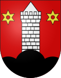
Murist
| Murist | ||
|---|---|---|
| State : |
|
|
| Canton : |
|
|
| District : | Broye | |
| Municipality : | Estavayer | |
| Postal code : | 1489 | |
| former BFS no. : | 2034 | |
| Coordinates : | 551 768 / 182 257 | |
| Height : | 662 m above sea level M. | |
| Area : | 8.20 km² | |
| Residents: | 631 (December 31, 2016) | |
| Population density : | 77 inhabitants per km² | |
| Website: | www.estavayer.ch | |
|
Murist |
||
| map | ||
|
|
||
Murist ( Freiburger Patois ) was a municipality in the Broye district of the canton of Friborg in Switzerland until December 31, 2016 . On January 1, 2017, Murist merged with the former municipalities of Bussy , Estavayer-le-Lac , Morens , Rueyres-les-Prés , Vernay and Vuissens to form the new municipality of Estavayer .
geography
Murist is 662 m above sea level. M. , ten kilometers west-southwest of Payerne (straight line) in the Friborg exclave Estavayer-le-Lac . The clustered village extends on the ridge between the valleys of Bainoz in the northwest and Petite Glâne in the southeast, in the Molasse hill country of the northwestern Freiburg Central Plateau .
The 8.2 km² municipal area covers a section of the Molasse hill country between Lake Neuchâtel and the central Broyetal . The central part of the area occupied by the plateau of Murist, which at the height Vursy with 694 m above sea level. M. reaches its highest point. To the northwest, the plateau descends relatively gently to the valley of the Bainoz. Beyond the stream, the communal soil extends into the forest area of Les Bruyères and to the height of La Frête ( 683 m above sea level ), which is crossed under the Tunnel d'Arrissoules of the A1 motorway , which opened in 2001 . In the southeast, the Murist plateau slopes down to the valley of the Petite Glâne with a wooded 100 m high steep slope. A small area east of the stream also belongs to Murist. In 1997, 6% of the municipal area was accounted for by settlements, 18% for forests and woodlands and 76% for agriculture.
Murist includes the villages and formerly independent communities Franex ( 582 m above sea level ) in the Petite Glâne valley below the Tour de la Molière, La Vounaise ( 588 m above sea level ) on the Bainoz and Montborget ( 650 m above sea level) . ) in a hollow west of the Bainoz, the hamlet Fontanalla ( 607 m above sea level ) in the valley of the Bainoz and some individual farms. Neighboring municipalities of Murist are Cheyres , Châbles , Lully (FR) , Les Montets and Nuvilly in the canton of Friborg and Treytorrens (Payerne) , Chavannes-le-Chêne and Rovray in the canton of Vaud .
population
With 631 inhabitants (as of December 31, 2016) Murist was one of the small communities in the canton of Friborg. 91.9% of the residents speak French, 7.2% speak German and 0.7% speak Italian (as of 2000). The population of Murist was 678 in 1900. After a peak in 1910 with 713 inhabitants, a population decline of almost 50% to 375 inhabitants was registered by 1980 due to strong emigration. Since then a slight population growth has been recorded again.
economy
Until the second half of the 20th century, Murist was a predominantly agricultural village. Even today, agriculture and fruit growing, as well as dairy farming and cattle breeding, have an important place in the income structure of the population. Further jobs are available in local small businesses and in the service sector, including in construction and metal construction companies. At Murist is the quarry where the shell sandstone from La Molière used to be extracted. In the last few decades the village has also developed into a residential community. Many employed people are therefore commuters who mainly work in the Estavayer-le-Lac and Payerne regions.
traffic
The community is located off the main thoroughfares on a connecting road from Estavayer-le-Lac to Treytorrens (Payerne) . Murist is connected to the public transport network by a bus from the Transports publics Fribourgeois , which serves the hinterland from Estavayer-le-Lac on a circular route.
history
The first written mention of the place took place in 1229 under the name Muris , derived from the Gallo-Roman personal name Mauricius . From that time Murist belonged to the La Molière lordship, which at the beginning of the 14th century went to a branch of the lords of Font, who were now called Font-La Molière.
After Bern had conquered Vaud in 1536, Murist came under the rule of Friborg and was assigned to the Bailiwick of Font. After the collapse of the Ancien Régime (1798), the village was part of the Estavayer district during the Helvetic and subsequent periods before being incorporated into the Broye district in 1848.
At the end of the 20th century, three surrounding small farming villages were incorporated into Murist. La Vounaise and Montborget made the start and merged with Murist on January 1, 1981. With effect from January 1, 1992, Franex was also incorporated.
Attractions
- The parish church of Murist dates from the 17th century. Some characteristic farmhouses from the 17th to 19th centuries have been preserved in the village.
- At the height northeast of the village is the Tour de la Molière. This imposing square keep from the 12th century is the only remaining remnant of the former castle of La Molière, which was destroyed in the 16th century.
Web links
- Official website of the municipality of Murist (French)
- Aerial photos of Murist and its surroundings
- Marianne Rolle: Murist. In: Historical Lexicon of Switzerland .
- Hubert Foerster: La Molière. In: Historical Lexicon of Switzerland .
- Castle world: Château de la Molière


