Gerlachov (Bardejov)
| Gerlachov | ||
|---|---|---|
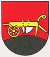
| coat of arms | map | |

|
|
|
| Basic data | ||
| State : | Slovakia | |
| Kraj : | Prešovský kraj | |
| Okres : | Bardejov | |
| Region : | Šariš | |
| Area : | 8.864 km² | |
| Residents : | 1,069 (Dec. 31, 2019) | |
| Population density : | 121 inhabitants per km² | |
| Height : | 360 m nm | |
| Postal code : | 086 04 ( Kružlov post office ) | |
| Telephone code : | 0 54 | |
| Geographic location : | 49 ° 19 ' N , 21 ° 7' E | |
| License plate : | BJ | |
| Kód obce : | 519189 | |
| structure | ||
| Community type : | local community | |
| Administration (as of November 2018) | ||
| Mayor : | Ondrej Ševcov | |
| Address: | Obecný úrad Gerlachov Gerlachov č. 56 086 04 Kružlov |
|
| Website: | www.gerlachov.ocu.sk | |
| Statistics information on statistics.sk | ||
Gerlachov (until 1927 Slovak "Gerlachov"; German Gerlachau , Hungarian Gerla - until 1907 Gerlachó , Rusyn Ґерлахів / Gerlachiw ) is a municipality and a town in the east of Slovakia , with a population of 1,069 (as of December 31, 2019). It belongs to the Okres Bardejov ( Prešovský kraj ).
geography
Gerlachov is located in the upper valley of the Topľa in the western part of the Low Beskids , 15 kilometers west of Bardejov .
history
The place was founded in the early 14th century by a mayor named Gerlach and appears in writing for the first time in 1344 as Gerlachwagasa . Gerlachov was owned by various landowners. In 1828 there were 76 houses and 588 residents. To this day the community has an agricultural character.
Attractions
- Classicist Greek Catholic Church from 1844–1856, consecrated to the Archangel Michael
- orthodox church from 1993
- about 20 preserved wooden houses, on the one hand still permanently inhabited, on the other hand used as weekend houses
Web links
Commons : Gerlachov (Bardejov) - collection of images, videos and audio files

