
Hausermühle (Kranenbach)
| House grinder
|
||
|---|---|---|
 Tranchot map from 1806 |
||
| Location and history | ||
|
||
| Coordinates | 51 ° 12 '47 " N , 6 ° 16' 9" E | |
| Location | Germany | |
| Waters | Kranenbach | |
| Built | 13th Century | |
| Shut down | 1956 Demolition of the mill building | |
| technology | ||
| use | Grain mill | |
| Grinder | 1 grind | |
| drive | Watermill | |
| water wheel | overshot | |

The house mill in the municipality of Schwalmtal was a water mill with an overshot water wheel .
geography
The Hausermühle was located at Kranenbach , An der Hausermühle, in the Waldniel district , in the Schwalmtal municipality, in the Viersen district. The water level of the Kranenbach in this area was 52 m above sea level. There was a pond in front of the mill . The care and maintenance of the Kranenbach is the responsibility of the Schwalm Association , which is based in Brüggen .
history
The lords of Bocholtz , whose ancestral seat was near Lobberich , had owned a manor with a small fort on the western outskirts of Waldniel since the 13th century . It was called Brockerhof or Haus Bocholtz. Three mills belonged to them: the Lüttelforster mill , the Schierer or Vossen mill and the Hausermühle here right next to the “house”, hence their name. Everything speaks for the fact that it is as old as the manor.
The house mill was always a grinding mill and was driven by an overshot water wheel. The fort burned down in 1708 and was not rebuilt. What remains are some farm buildings and the mill , which soon showed all signs of decay. The dilapidated mill house was demolished in 1956 and the pond was filled. Only the street name is a reminder of what used to be here. In the course of the renaturation of the Kranenbach, a pond was created at this point, which also serves as a retention basin .
gallery
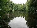
Pond as a retention basin

literature
- Hans Vogt: Lower Rhine water mill guide. Krefeld 1998, pages 451-453.
Web links
Individual evidence
At the Schwalm :
Borner Mühle |
Brempter mill |
Brüggener Mill |
Dilborn Mill |
Frankenmühle |
Jennekes Mill |
Lüttelforster Mühle |
Mühlrath mill |
Breakdown mill |
Papelter mill |
Radermühle |
Vennmühle
An der Niers :
Clörather Mühle |
Gibber mill |
Holtzmühle |
Langendonker Mill |
Mülhausen mill |
Neersdommer Mill |
Oedter Mill |
Schlossmühle Neersen
An der Nette :
Flootsmühle |
Henkenmühle |
Kothmühle |
Leuther Mill |
Lüthemühle |
Mill House Baerlo |
Nelsenmühle |
Neumühle |
Tüschenmühle |
Weuthenmühle
Am Hammer Bach :
Bongartzmühle |
Hammer mill |
Hüstermühle |
Plinzenmühle |
Schnockesmühle |
Sgoedenmühle
Am Dorfer Bach :
Biestenmühle |
Goetersmühle |
Kaisermühle |
Kimmelmühle |
Schricksmühle
Am Kranenbach :
Hausermühle |
Hüttermühle |
Pletschmühle |
Schierer Mühle
Am Mühlenbach :
Weiher Mühle |
Specker Mühle
Am Pletschbach :
Pletschmühle
Am Rintger Bach :
Klostermühle