
Kirberg
|
Kirberg
Municipality of Hünstelden
Coordinates: 50 ° 18 ′ 36 ″ N , 8 ° 9 ′ 48 ″ E
|
|
|---|---|
| Height : | 214 (180-370) m above sea level NHN |
| Residents : | 2295 (Jan. 1, 2019) |
| Incorporation : | 1st October 1971 |
| Postal code : | 65597 |
| Area code : | 06438 |
Kirberg is a district of the municipality of Hünstelden and its administrative seat in the central Hessian district of Limburg-Weilburg .
geography
The Kirberg district borders from west to south-east in a clockwise direction on the districts of Heringen , Neesbach , Dauborn and Ohr , to the south on Ketternschwalbach , a district of Hünstetten and thus on the Rheingau-Taunus district .
The district is slightly elongated in a north-south direction. The northern two thirds are made up of agricultural land, while the southern third is part of a large mixed forest area. The terrain slopes down from the south to the northeast. The highest point at 370 meters is on the southern edge of the district. The place itself lies at an altitude of 210 to 240 meters in a depression running in an east-west direction and is traversed by the Hainbach.
The federal highway 417 runs through Kirberg .
history
middle Ages

The history of the place is closely linked to that of Kirberg Castle , which rises on a scarf stone spur on the edge of the old town center. The settlement itself is older than the castle built around 1355. In front of the fortress there was probably a church on the rock from 790 onwards. The location on Hünerstrasse , an important old street , was probably important for the founding of the city . Gerhard von Diez and Johann von Nassau-Merenberg had Kirberg Castle built together. As part of the castle construction, Kirberg was granted city rights and a circular wall was built around the settlement. The document belonging to this act also represents the first recorded mention of Kirberg. Customs stations for the traffic coming through on Hünerstrasse were set up on the upper and lower towers of the wall. The castle itself was only used for a short time and soon began to fall apart. Many of the surrounding houses are built with stones that were broken from the ruins.
After the Diezer Count House died out in 1386, rule over both parts of the city was usually a line of the House of Nassau. By inheritance, pledging or sale, Kurtrier, Eppstein and the lords of Reifenberg were also lords of part of the city for a short time.
Early modern age


Due to the resettlement of residents of the later deserted places Bubenheim and Sindersbach , the city experienced considerable growth. The basic structure of the town center with three parallel streets, which still exists today, goes back to the time when the city was founded. Some of the Burgmann families settled at that time stayed in the village for centuries and were builders of some of the half-timbered properties that are still in existence today. The most impressive building of this type today is the "Stein'sche Haus": it was built in 1481 by the von Reifenberg family, who are important in the region . In 1556 the noble family vom Stein inherited the property. Karl Freiherr vom Stein had it converted into a widow's residence for his mother in 1784. The system was significantly changed and received its current form, which came out again after extensive renovation from 1974 to 1981.
The name Flecken for Kirberg is guaranteed for the year 1594 . By this time at the latest, the place no longer had city rights, but was the seat of the Kirberg Office , which, in addition to the new city, also included Bubenheim , Sindersbach , Niederheringen (all three today desolate ), ears, Nauheim, Neesbach and Oberheringen, today's Heringen. Originally, the two gentlemen of the city seem to have appointed a common bailiff. After repeated disputes, there were two bailiffs, each appointed by one of the two gentlemen. In the 16th century, the function of bailiff was transferred from lower nobility to commoners. The bailiffs exercised the lower jurisdiction for the district in Kirberg . On four days a year in Kirberg, blood justice was also exercised by the bailiffs and a college of aldermen. The office was located in a border region between principalities of the various branches of the House of Nassau (Dauborn, Oberneisen, Bechtheim) and Kurtrier (Werschau, Lindenholzhausen). This repeatedly led to border disputes. In 1610, today's old town hall was built as an aristocratic court. It is also called the Heckenhaus after a previous owner . The bailiff lived and worked there from 1731 to 1769. Ludwig Yorck von Wartenburg had his quarters there in 1813 . The building was later used as the town hall of the Kirberg community until 1970. Today there is a local history museum , rooms for various associations and a savings bank branch.
During the Thirty Years' War and several times in the following decades, fires affected parts of the place. After the last of these fires, which destroyed almost the entire settlement, Kirberg was largely rebuilt in 1711. Many of the representative half-timbered buildings that characterize the town center date from this time. Other large fires followed in 1796 and 1850. Shortly after the formation of the Duchy of Nassau in 1806, Kirberg lost the official residence to Limburg .
Recent and Recent History
The old curtain wall protected Kirberg from attacks during the Thirty Years War and was repaired in 1697. The two towers were demolished in 1818, as was the western section of the wall in the middle of the 19th century. The settlement grew by a fourth parallel street, the Neugasse. In 1904 a hospital was opened.
52 Kirbergers died in World War I and 43 in World War II. In 1955 the kindergarten, the outdoor swimming pool and the village community center (today the town hall of the municipality of Hünstelden) were handed over to their destination. On October 1, 1971, Kirberg merged with six neighboring communities as part of the regional reform in Hesse to form the new community of Hünstelden.
Economic history
Economically, Kirberg was almost exclusively geared towards agriculture, at the latest with the loss of importance of the castle. Gardens extend directly around the site. Wine was grown until the beginning of the 18th century. The increasing fragmentation of the fields due to the real division was remedied in 1906 with a comprehensive land consolidation . For 1800 there were 66 horses, 278 cows and cattle, 664 sheep and 170 pigs in the village. There were no mills in the Kirberg area, the ban mill was probably located in the Gnadenthal monastery .
Together with the other places of the office, Kirberg formed a brand cooperative that owned an extensive forest area. A “Holzweiser” as a march official was handed down for Heringen as early as 1373, for Kirberg not until 1477. A detailed order of forest use and organs of the marrow cooperative was first handed down from 1661.
What is unusual for a city is the lack of a fair. In 1732 and 1765 there were unsuccessful efforts by the citizens to set up one.
At the end of the 19th century, the place experienced a strong emigration of residents, as there were hardly any other employment opportunities in Kirberg than agriculture. A trade association was founded in 1860.
History of religion

In 1355, at the same time as the castle was built, the place received a new church. Kirberg had already been the seat of one of six dean's offices on the right bank of the Rhine of the Trier diocese under the archdeaconate of the St. Lubentius monastery in Dietkirchen . By 1217 at the latest, the deanery had its own land chapter, a spiritual community, analogous to cathedral or collegiate chapters at higher ecclesiastical levels. Later the parish was attached to the Diez Monastery, founded in 1289 . In 1525 the last Catholic pastor resigned from office. In 1530 Kirberg was completely reformed . The place remained the location of a deanery, which with the establishment of the Duchy of Nassau in 1806 included the parishes of Nauheim , Mensfelden , Staffel , Dauborn and Hadamar and was divided up in 1933. It was not until 1946 that a Catholic community emerged again as a result of the settlement of Catholic expellees . In 1949 there were again 1300 Catholics in the village, who were initially looked after by the parish of Werschau. The groundbreaking ceremony for a Catholic church took place on September 7, 1949, and was consecrated on December 18. In 1950 the neighboring rectory was built.
In 1555 the first school was opened. Around 1858 she moved to a new building.
Jews probably first settled in Kirberg in the 17th century. In 1769 there were 14 Jewish families with 43 members. A small synagogue was located in Wassergasse by 1720 at the latest. The Jewish community also included Dauborn, Heringen and Mensfelden. When the number of Jews in Heringen and Mensfelden exceeded those in the other two towns, a branch synagogue was set up in Heringen. Kirberg remained the seat of the community. The Kirberg Synagogue was closed in 1933, and in 1939 the cult objects and religious documents were handed over to the State Police in Frankfurt and then probably destroyed. The Jewish cemetery was initially located in the "Hünergraben" district, later on the road between Kirberg and Dauborn. 17 tombstones are still preserved.
Territorial history and administration
The following list gives an overview of the territories in which Kirberg was located and the administrative units to which it was subordinate:
- before 1806: Holy Roman Empire , Office Kirberg (half principality Nassau-Diez , half principality Nassau-Usingen )
- from 1806: Duchy of Nassau , Amt Kirberg (joint property of Nassau-Usingen and Nassau-Orange )
- from 1816: German Confederation , Duchy of Nassau, Limburg Office
- from 1849: German Confederation, Duchy of Nassau, Limburg District Office
- from 1854: German Confederation, Duchy of Nassau, Limburg Office
- from 1867: North German Confederation , Kingdom of Prussia , Province of Hessen-Nassau , Administrative Region of Wiesbaden , Unterlahnkreis
- from 1871: German Empire , Kingdom of Prussia, Province of Hessen-Nassau, administrative district of Wiesbaden, Unterlahnkreis
- from 1886: German Empire, Kingdom of Prussia, Province of Hesse-Nassau, District of Wiesbaden, District of Limburg
- from 1918: German Empire, Free State of Prussia , Province of Hesse-Nassau, District of Wiesbaden, District of Limburg
- from 1944: German Empire, Free State of Prussia, Nassau Province , Limburg District
- from 1945: American zone of occupation , Greater Hesse , Wiesbaden district, Limburg district
- from 1949: Federal Republic of Germany , State of Hesse , Wiesbaden district, Limburg district
- from 1968: Federal Republic of Germany, State of Hesse, administrative district Darmstadt , district Limburg
- On October 1, 1971, Kirberg was incorporated as a district of the newly formed municipality of Hünstelden and became the seat of the municipal administration.
- from 1974: Federal Republic of Germany, State of Hesse, administrative district Darmstadt, district Limburg-Weilburg
- from 1981: Federal Republic of Germany, State of Hesse, Gießen district, Limburg-Weilburg district
Population development
In 1594, 67 families were counted in Kirberg.
| Kirberg: Population from 1834 to 2019 | ||||
|---|---|---|---|---|
| year | Residents | |||
| 1834 | 1,205 | |||
| 1840 | 1,226 | |||
| 1846 | 1,253 | |||
| 1852 | 1,223 | |||
| 1858 | 1,239 | |||
| 1864 | 1,229 | |||
| 1871 | 1,115 | |||
| 1875 | 1,050 | |||
| 1885 | 1,127 | |||
| 1895 | 1,062 | |||
| 1905 | 1,000 | |||
| 1910 | 990 | |||
| 1925 | 936 | |||
| 1939 | 913 | |||
| 1946 | 1,482 | |||
| 1950 | 1,448 | |||
| 1956 | 1,293 | |||
| 1961 | 1,378 | |||
| 1967 | 1,478 | |||
| 1970 | 1,691 | |||
| 2011 | 2,279 | |||
| 2019 | 2,295 | |||
| Data source: Historical municipality register for Hesse: The population of the municipalities from 1834 to 1967. Wiesbaden: Hessisches Statistisches Landesamt, 1968. Further sources:; after 1970: municipality of Hünstelden | ||||
Religious affiliation
Source: Historical local dictionary
- 1885: 1087 Protestant (= 96.45%), 23 Catholic (= 2.04%), 17 Jewish (= 1.51%) residents
- 1961: 1032 Protestant (= 74.89%), 341 Catholic (= 24.75%) inhabitants
Culture and sights
societies
In 1844 the singing and gymnastics clubs were founded. Shortly after the First World War, a gymnastics home was built. On April 30, 1905, the Kirberg volunteer fire brigade was founded, to which its youth fire brigade was added on October 25, 1970 and the children's fire brigade on August 15, 2010 . She has been using the fire station in Heringer Fahrweg since 1984 , after a small shelter at the town hall had previously served as a syringe house. On September 9, 1967, the model flying group Goldener Grund was founded in Kirberg, which was registered in the association register in 1968.
Buildings
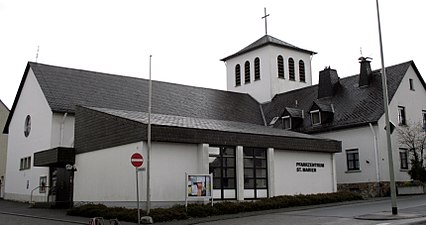
Catholic Church

Stein's house

War memorial
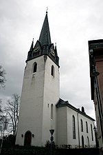
Evangelical Church, tower side

Old syringe house


Infrastructure
Since April 30, 1905, the Kirberg volunteer fire brigade (from October 25, 1970 with a youth fire brigade and from August 15, 2010 with a children's fire brigade) has been providing fire protection and general help in this area.
Personalities
Sons and daughters of the place
- Karl Bücher (1847–1930), political economist
- Hermann Bücher (1882–1951), foreign politician and industrialist
- Oskar Knapp (1898–1967), farmer and politician
- Wilhelm Bender (* 1944), former CEO of Fraport AG
- Christel Hoffmann (1949–2018), politician (SPD) and member of the Hessian state parliament
- Karlheinz Weimar (* 1950), Hessian Finance Minister (CDU) from 1999 to 2010
- Hildegard Pfaff (* 1952), politician, 1991–2009 member of the Hessian state parliament (SPD)
- Ralph Stengler (* 1956), physicist, university professor and university president
Personalities who worked in Kirberg
- Christian Daniel Vogel (1789–1852) worked as a Protestant pastor in Kirberg from 1831. He was one of the region's first local historians. His standard work, Description of the Duchy of Nassau , published in 1843, was largely developed in Kirberg.
literature
- Hugo Grün: Kirberg 1355–1955. Festschrift for the local festival of today's Fleckens, the former town of Kirberg. 1955.
- Georg Ulrich Großmann : Central and South Hesse: Lahntal, Taunus, Rheingau, Wetterau, Frankfurt and Maintal, Kinzig, Vogelsberg, Rhön, Bergstrasse and Odenwald. DuMont, Cologne 1995, ISBN 3-7701-2957-1 (= DuMont art travel guide ), p. 74 f.
- Literature about Kirberg in the Hessian Bibliography
Web links
- Kirberg district. In: Internet presence. Municipality of Hünstelden
- Kirberg, Limburg-Weilburg district. Historical local dictionary for Hessen. In: Landesgeschichtliches Informationssystem Hessen (LAGIS).
Individual evidence
- ↑ a b Statistics - residents of the districts. In: website. Municipality of Hünstelden, archived from the original ; accessed in February 2019 .
- ^ Federal Statistical Office (ed.): Historical municipality directory for the Federal Republic of Germany. Name, border and key number changes in municipalities, counties and administrative districts from May 27, 1970 to December 31, 1982 . W. Kohlhammer, Stuttgart / Mainz 1983, ISBN 3-17-003263-1 , p. 369 .
- ↑ a b c Kirberg, Limburg-Weilburg district. Historical local dictionary for Hessen. (As of May 8, 2018). In: Landesgeschichtliches Informationssystem Hessen (LAGIS).
- ^ Michael Rademacher: German administrative history from the unification of the empire in 1871 to the reunification in 1990. State of Hesse. (Online material for the dissertation, Osnabrück 2006).
- ↑ Citizens Brochure. (PDF; 15.7 MB) In: Website. Municipality of Hünstelden, 2012, p. 23 , archived from the original ; accessed in February 2019 .
- ↑ Model flying group Goldener Grund