
Hünstelden
| coat of arms | Germany map | |
|---|---|---|

|
Coordinates: 50 ° 19 ′ N , 8 ° 8 ′ E |
|
| Basic data | ||
| State : | Hesse | |
| Administrative region : | to water | |
| County : | Limburg-Weilburg | |
| Height : | 238 m above sea level NHN | |
| Area : | 62.7 km 2 | |
| Residents: | 9661 (Dec. 31, 2019) | |
| Population density : | 154 inhabitants per km 2 | |
| Postal code : | 65597 | |
| Primaries : | 06438, 06431 | |
| License plate : | LM, WEL | |
| Community key : | 06 5 33 008 | |
| LOCODE : | DE HFN | |
| Community structure: | 7 districts | |
| Address of the municipal administration: |
Le-Thillay-Platz 65597 Hünstelden |
|
| Website : | ||
| Mayoress : | Silvia Scheu-Menzer ( independent ) | |
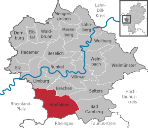
| Location of the municipality of Hünstelden in the Limburg-Weilburg district | ||
  |
||

Hünfelden is a community in central Hesse Limburg-Weilburg in Hesse .
geography
Hünstelden is located in the Taunus north of the Hessian state capital Wiesbaden on the Hühnerstrasse ( Bundesstrasse 417 ).
Hünstetten borders the city of Limburg and the municipality of Brechen in the north, the municipality of Selters and the city of Bad Camberg in the east (all in the Limburg-Weilburg district), and in the south on the municipalities of Hünstetten and Aarbergen (both in the Rheingau-Taunus district ) and in the west to the municipalities of Aar-Einrich and Diez (both in the Rhein-Lahn district in Rhineland-Palatinate ).
history
The municipality of Hünstelden was created as part of the regional reform in Hesse on October 1st, 1971 through the voluntary amalgamation of the previously independent municipalities of Dauborn, Heringen, Kirberg, Mensfelden, Nauheim, Neesbach and Ohr. The name "Hünstelden" was chosen because of the numerous megalithic tombs from the Hallstatt period around the Heringen and Ohr districts. The community had 6952 inhabitants when it was founded.
Mensfelden can refer to the earliest documented mention of the year 775. Dauborn, Heringen and the meanwhile submerged village of Bubenheim in the area of today's Kirberg followed in 790 in the Golden Book of the Prüm Abbey . Via Publica and Hühnerstraße (today's federal highway 417) ran through what is now the Hündener area . In 1355 a castle was built in Kirberg .
The Cistercian convent Gnadenthal was founded in 1235 , and in 1590 it was equipped with a large abbess house. After the Reformation, the complex became a state domain in Nassau . The Christian community of Jesus Brotherhood has existed there since 1969 .
Community structure
The community consists of the following seven districts that were formerly independent:
| Districts | Residents | |
| Dauborn | 2714 | |
| Kirberg | 2295 | |
| Mensfelden | 1297 | |
| Herrings | 983 | |
| Nauheim | 882 | |
| Ears | 774 | |
| Neesbach | 761 | |
| total | 9706 | |
As of January 1, 2019

Dauborn Church

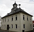
Stein's house in Kirberg

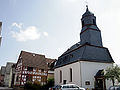
Mensfelden church tower

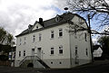
Former town hall and former post office in Heringen
Old school in Nauheim
Neesbacher Church
Old school in ears


Community representation
The local elections on March 6, 2016 produced the following results, compared to previous local elections:
| Parties and constituencies | % 2016 |
Seats 2016 |
% 2011 |
Seats 2011 |
% 2006 |
Seats 2006 |
% 2001 |
Seats 2001 |
||
|---|---|---|---|---|---|---|---|---|---|---|
| SPD | Social Democratic Party of Germany | 38.3 | 12 | 42.4 | 13 | 40.8 | 15th | 39.5 | 15th | |
| CDU | Christian Democratic Union of Germany | 36.3 | 11 | 34.5 | 11 | 40.5 | 15th | 35.9 | 13 | |
| FBH | Free citizen list Hünstelden | 25.4 | 8th | 17.1 | 5 | 16.1 | 6th | 19.9 | 7th | |
| ALH | Alternative list for Hünstelden | - | - | 5.4 | 2 | - | - | - | - | |
| LEFT | The left | - | - | 0.5 | 0 | - | - | - | - | |
| FDP | Free Democratic Party | - | - | - | - | 2.5 | 1 | 1.6 | 1 | |
| GREEN | Alliance 90 / The Greens | - | - | - | - | - | - | 3.1 | 1 | |
| total | 100.0 | 31 | 100.0 | 31 | 100.0 | 37 | 100.0 | 37 | ||
| Voter turnout in% | 49.9 | 48.5 | 45.6 | 51.4 | ||||||

mayor
After the Hessian municipal constitution is the Mayor Chairman of the Municipal Executive Board , the next to the mayor seven volunteer in the community Huenfelden Associate members. The mayor has been Silvia Scheu-Menzer, who is not party to any party, since March 1, 2011. She is re-elected until 2023. Your directly elected predecessors were:
- 1999 to 2011 Norbert Besier
Culture and sights
Buildings


- Kirberg Castle ruins
- restored half-timbered buildings and the former town hall in the Kirberg district
- Stein's house in Kirberg
- former Gnadenthal monastery
Museums
- The local museum in Kirberg.
Economy and Infrastructure
Hünstelden has developed into a popular residential community with a rural character. With the federal highway 417 to Wiesbaden and Limburg it has good transport connections. The two junction points Limburg-Süd and Bad Camberg of the federal motorway 3 , via which the Rhine-Main area can be reached quickly, are also located a short distance away . The closest long-distance train station is Limburg Süd train station .
education
The Freiherr-vom-Stein-Schule is a primary , secondary and secondary school with a grammar school branch.
Public facilities
- Kirberg Kindergarten
- Dauborn Kindergarten
- Kindergarten pegs
- Kindergarten in Mensfelden
- Kindergarten Nauheim
- Kindergarten Neesbach
- Nursery ears
- Voluntary fire brigade Kirberg, founded in 1905 (since October 25, 1970 with youth fire brigade and from August 15, 2010 with children's fire brigade )
- Dauborn volunteer fire brigade, founded in 1906 (with youth fire brigade since August 10, 1975)
- Heringen volunteer fire brigade, founded in 1909 (since January 12, 1974 with youth fire brigade and from April 5, 2008 with children's fire brigade)
- Mensfelden volunteer fire brigade, founded in 1935 (with youth fire brigade since March 16, 1993)
- Nauheim volunteer fire brigade, founded in 1934 (since March 1, 1973 with youth fire brigade)
- Voluntary fire brigade Neesbach, founded in 1934 (since April 1, 1972 with youth fire brigade and since October 30, 2009 with children's fire brigade)
- Volunteer fire brigade ears, founded in 1934 (since April 1, 1972 with youth fire brigade)
Personalities
- Wilhelm Bender (* 1944), manager, former CEO of Fraport AG
- Frank Gerhardt (* 1967), composer
- Andreas Felger (* 1935), painter
- Hildegard Pfaff (* 1952), politician, 1991–2009 member of the Hessian state parliament (SPD)
- Jan-Luca Rumpf (* 1999), soccer player
- Karlheinz Weimar (* 1950), Hessian Finance Minister (CDU) from 1999 to 2010
Individual evidence
- ↑ Hessian State Statistical Office: Population status on December 31, 2019 (districts and urban districts as well as municipalities, population figures based on the 2011 census) ( help ).
- ^ Federal Statistical Office (ed.): Historical municipality directory for the Federal Republic of Germany. Name, border and key number changes in municipalities, counties and administrative districts from May 27, 1970 to December 31, 1982 . W. Kohlhammer GmbH, Stuttgart / Mainz 1983, ISBN 3-17-003263-1 , p. 369 .
- ↑ Municipality of Hünstelden: Statistics - Inhabitants of the districts of the municipality of Hünstelden , accessed on February 8, 2019
- ^ Result of the municipal election on March 6, 2016. Hessian State Statistical Office, accessed in April 2016 .
- ^ Hessian State Statistical Office: Result of the municipal elections on March 27, 2011
- ^ Hessian State Statistical Office: Result of the municipal elections on March 26, 2006
- ^ Hessian State Statistical Office: direct elections in Hünstelden
- ↑ Municipality of Hünstelden: Mayor elections 2016 - election day and runoff day ( memento of December 13, 2016 in the Internet Archive ), accessed on December 13, 2016.
Web links
- Internet presence of the municipality of Hünstelden
- Hünstelden, Limburg-Weilburg district. Historical local dictionary for Hessen. In: Landesgeschichtliches Informationssystem Hessen (LAGIS).
- Information on the community of Hünstelden. In: Hessisches Gemeindelexikon. HA Hessen Agentur GmbH , 2016.
- Info brochure from the municipality of Hünstelden (PDF; 15.9 MB).
- Literature about Hünstelden in the Hessian Bibliography

Bad Camberg | Beselich | Breaking | Dornburg | Elbe Valley | Elz | Hadamar | Hünfelden | Limburg a. d. Lahn | Löhnberg | Mengerskirchen | Merenberg | Runkel | Selters (Taunus) | Villmar | Waldbrunn (Westerwald) | Weilburg | Weilmünster | Weinbach