
Lengronne
| Lengronne | ||
|---|---|---|
|
||
| region | Normandy | |
| Department | Some | |
| Arrondissement | Coutances | |
| Canton | Quettreville-sur-Sienne | |
| Community association | Communauté de communes Coutances Mer et Bocage | |
| Coordinates | 48 ° 56 ′ N , 1 ° 23 ′ W | |
| height | 35-119 m | |
| surface | 12.07 km 2 | |
| Residents | 423 (January 1, 2017) | |
| Population density | 35 inhabitants / km 2 | |
| Post Code | 50450 | |
| INSEE code | 50266 | |

Lengronne is a French municipality with 423 inhabitants (at January 1, 2017) in the department of Manche in the region of Normandy . It belongs to the Arrondissement of Coutances and the canton of Quettreville-sur-Sienne .
It borders in the north-west on Le Mesnil-Aubert , in the north on Quettreville-sur-Sienne with Guéhébert , in the north-east on Grimesnil , in the east on Saint-Denis-le-Gast , in the south-east on Gavray-sur-Sienne in the south on Ver and to the south-west with Cérences .
Population development
| year | 1968 | 1975 | 1982 | 1990 | 1999 | 2010 | 2015 |
|---|---|---|---|---|---|---|---|
| Residents | 555 | 512 | 464 | 429 | 429 | 449 | 438 |
Attractions
- Notre-Dame du Voeu chapel
- Saint-Ouen church

Notre-Dame du Voeu chapel

Saint-Ouen church
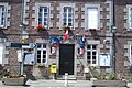
Mairie Lengronne


Web links
Commons : Lengronne - collection of images, videos and audio files